Onomea Bay Trail
A short, steep hike down to spectacular coastal views at Onomea Bay.
Hiking Moderate
- Distance
- 634 m
- Ascent
- 50 m
- Descent
- 50 m
- Duration
- 0-1 hrs
- Low Point
- 0 m
- High Point
- 50 m
- Gradient
- 18˚
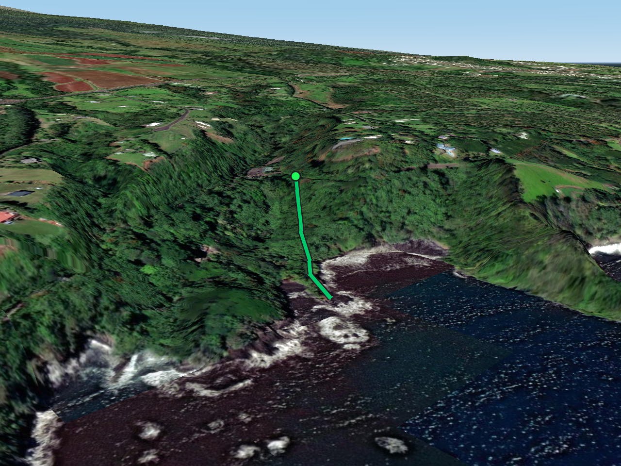
The Onomea Bay Trail is a short, steep hike down off the highway to reach Onomea Bay on the shoreline below. Dropping 164 vertical feet in just 0.2 miles, this is a short, steep hoof down to the bay. As such, it can actually be a bit trickier to negotiate than its short length would indicate.
Description
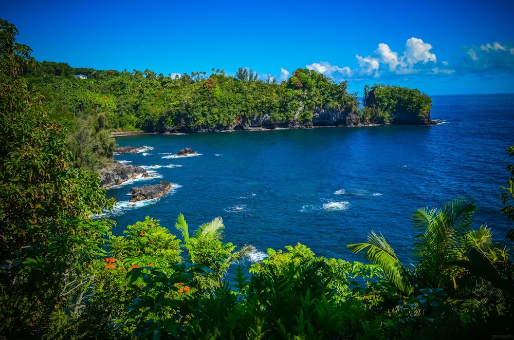
This area is a dense, beautiful rainforest, and this hike provides incredible rainforest views. There's also a beautiful waterfaull just upstream from the bay that's worth checking out.
The coastal scenery from the bay is absolutely stunning, and widely regarded as some of the best on the Big Island. You'll enjoy dramatic cliffs, lush vegetation, and crystal-clear waters—and so will the hundreds of photographers flocking to the bay as well.
Sources: https://bigislandhikes.com/onomea-bay/ https://thatadventurelife.com/2019/10/29/onomea-bay-trail-big-island-hi/ https://hawaiianislands.com/big-island/things-to-do/onomea-bay-trail
Difficulty
Moderate
Hiking along trails with some uneven terrain and small hills. Small rocks and roots may be present.
Medium Exposure

The trail contains some obstacles such as outcroppings and rock which could cause injury.
Remoteness

Close to help in case of emergency.
Best time to visit
Features
- Picturesque
- Water features
- Forestry or heavy vegetation