7 routes · Hiking
A challenging hike with some of the most famous valley views on Hawai'i.
Hiking Difficult

The Waipio Valley Hike is a must-do on the Big Island. You'll be rewarded with lush valley views, roaring waterfalls, sweeping ocean vistas, a long stretch of black sand beach, and amazing cliffside climbs — not to mention the valley's rich cultural and historical significance.
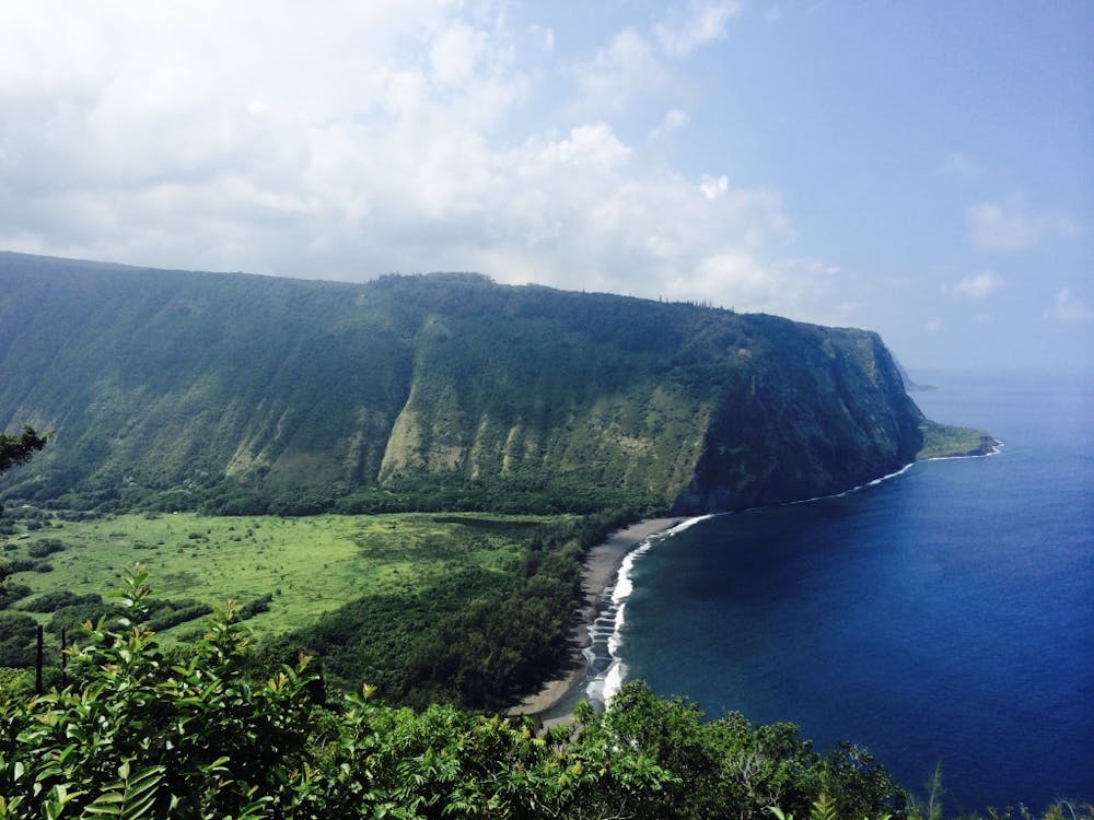
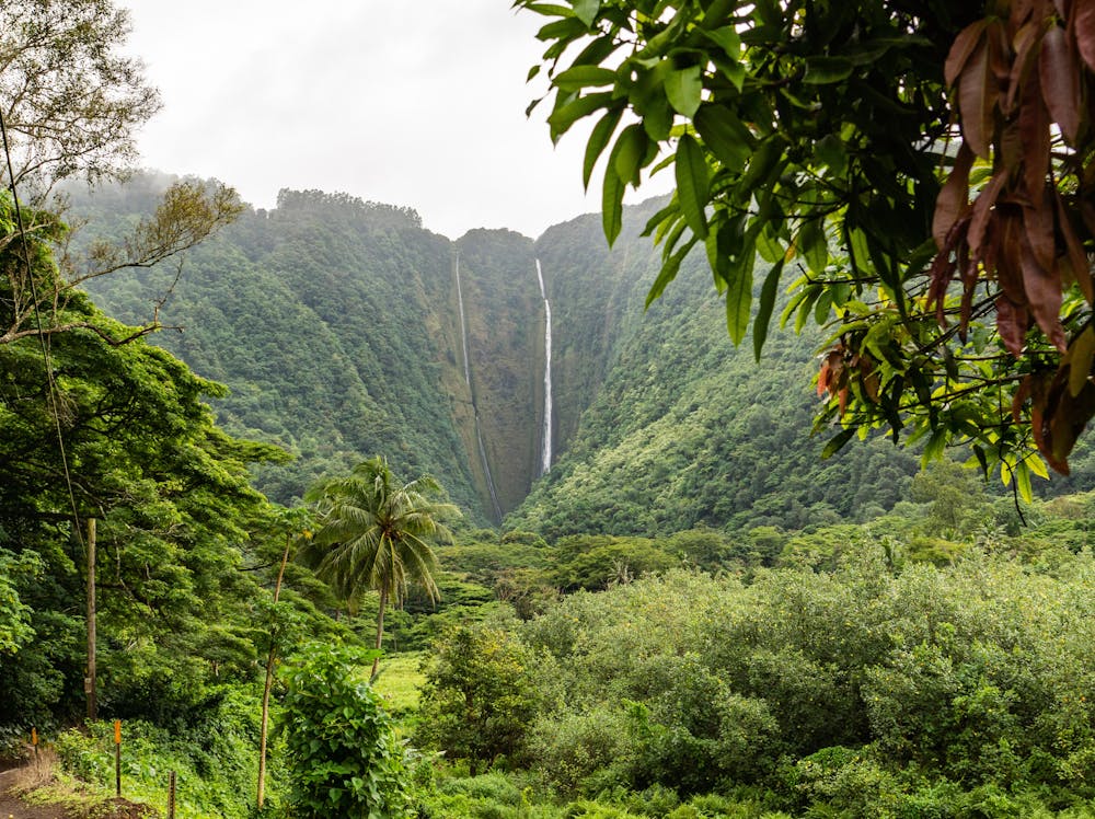
Known as “The Valley of the Kings,” this sacred valley has an important cultural and historical meaning, as it was the home to King Kamehameha I. It also boasts some of the most awe-inspiring views on Hawai'i. Home to the island's tallest waterfall, Hi’ilawe, that drops down 1,300 feet, the valley offers dramatic 3,000-foot-tall cliff views, a long black sand beach, lush tropical nature, wild ponies, and some incredible hiking. It’s also a favourite local surfing spot on the Hāmākua Coast.
To reach the trailhead, drive to the end of the Heritage Corridor drive and park your car in the parking lot or on the side of the road. Get a sneak peek of the deep valley from the high vantage point of the lookout, before making your way down the very steep paved road, and keeping an eye out for the 4WD cars that come up and down the road. The further down you walk, the more the valley opens up to your left while the ocean goes on to meet the horizon to your right.
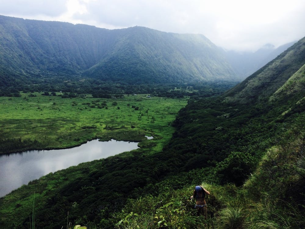
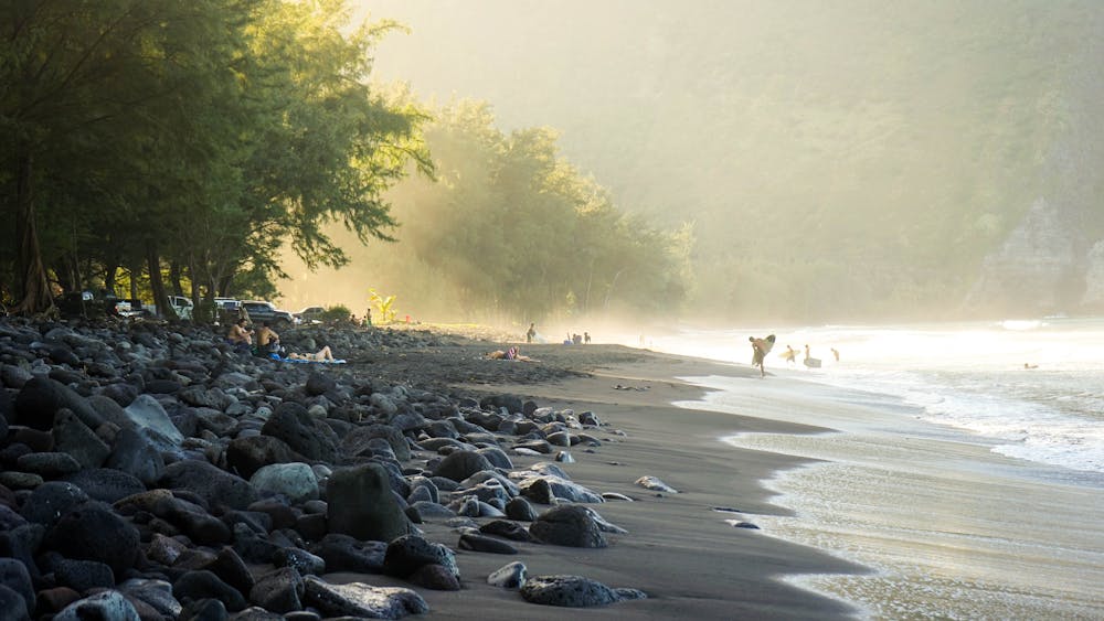
Follow the direction of the ocean once you’re at the bottom and wiggle your toes in the sand or hop into the water for a swim. If you’re keen for an added challenge, walk through the stream that crosses the beach, and head to the end of the valley. Here, hike up the other side of the valley’s cliff, on the Muliwai Trail over to the top of Waimanu Valley. The steep, uphill, zig-zagging trail, locally known as Z Trail due to its shape, offers little respite from the beating Hawaiian sun, but it’s well worth the effort as the views into Waipi’o, and then Waimanu Valley on the other side, are stunning.
Once at the top, continue walking along the flat and shaded earth trail. You can turn around whenever you feel like it. If you continue down into Waimanu Valley, you’re heading along one of the most difficult, and beautiful, hikes on the island. The best way to experience Waimanu is on an overnight camping trip. For the sake of this route, it’s just as great to see the valley from above, before heading back down into Waipi’o and back up to the Lookout.
Top your day out with a stopover at the famous Tex Drive-In in the sweet and sleepy town of Honoka’a for a well-deserved malasada, a delicious local fried type of doughnut.
Disclaimer: Much of the back of Waipi’o Valley, its homes, roads, and land, including the trail to Hi’ilawe Waterfall, is private property. The road down into Waipi’o Valley and the path to the beach have public access, so it’s best to stick to this route.
Sources:
Difficult
Hiking trails where obstacles such as rocks or roots are prevalent. Some obstacles can require care to step over or around. At times, the trail can be worn and eroded. The grade of the trail is generally quite steep, and can often lead to strenuous hiking.

Some trail sections have exposed ledges or steep ascents/descents where falling could cause serious injury.
Little chance of being seen or helped in case of an accident.
7 routes · Hiking