Pupukea Trail System
Oahu's most famous mountain bike trail system.
Mountain Biking Difficult
- Distance
- 17 km
- Ascent
- 478 m
- Descent
- 478 m
- Duration
- 1-2 hrs
- Low Point
- 103 m
- High Point
- 259 m
- Gradient
- 6˚
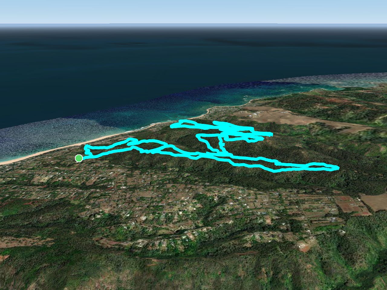
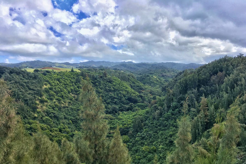
The hand-built network of singletrack located in Pupukea-Paumalu Forest Reserve has become the most well-known mountain bike trail system on the island of Oahu, and arguably in the entire state of Hawaii! Tireless volunteers have scratched a network of superb singletrack into the floor of the Hawaiian jungle, creating a network of over 35 miles of trails that can be combined in countless ways! The route shown here is a relatively complex tour through the trail system that hits most of the highlights… yet still leaves a few gems to be discovered.

- •
- •
- •
- •
- •
- •
- •
Description
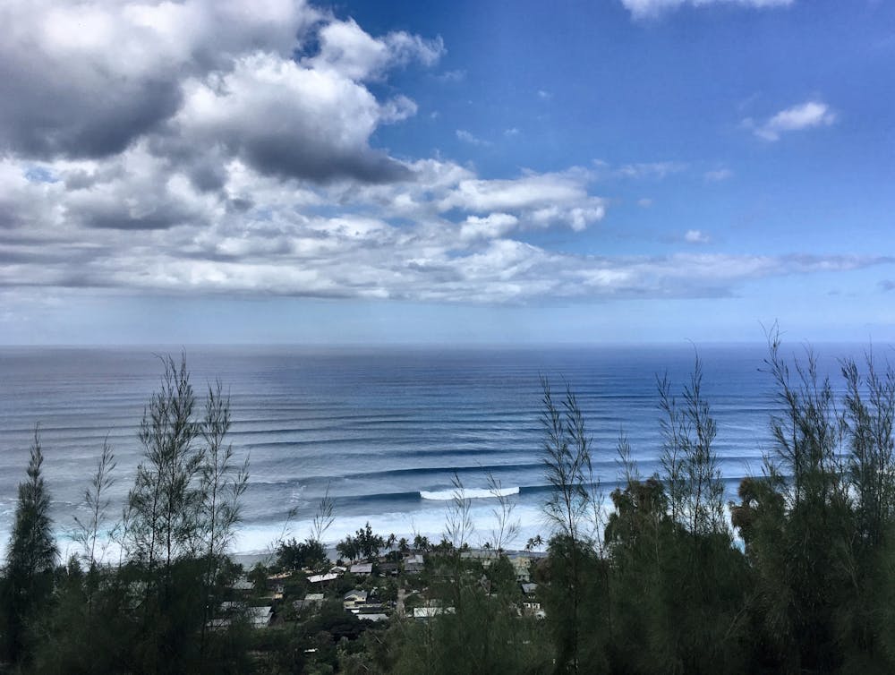
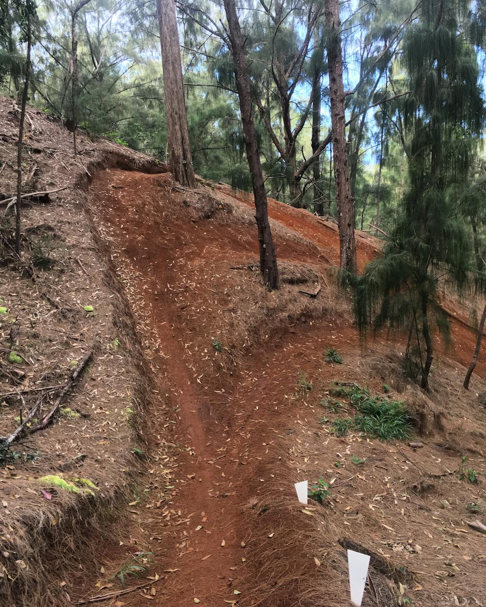
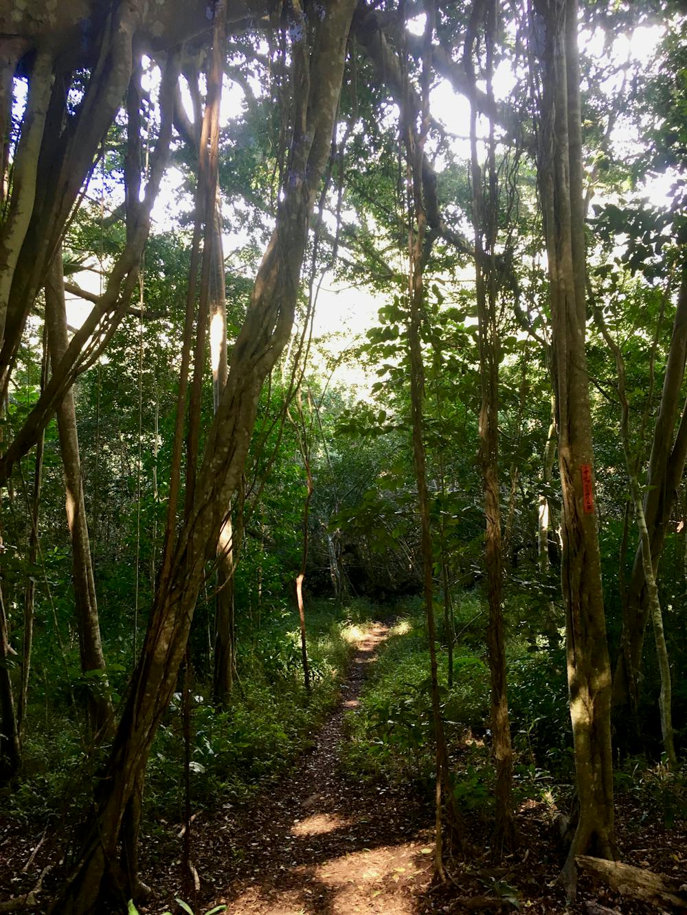
The vast majority of the the trails consist of rooty singletrack twisting and turning beneath the tall canopy of the rainforest. Root webs spider out from the surrounding trees, overlaying a base of rock-hard red clay. The entire system is located deep in the forest, and while a few tall cliff sides provide gorgeous views of the massive waves on the North Shore, most of your time pedaling will be spent deep in the forest.
The cross country-oriented trails here serve primarily as a means to the end of getting to the top of the descents, than anything else. But of course, if you want to get on your cross country whip and bang out miles, you can most certainly do so! The constant up-and-downs of the trails quickly add up to some respectable elevation gain, but most of the individual climbs aren’t taller than 500 feet or so.
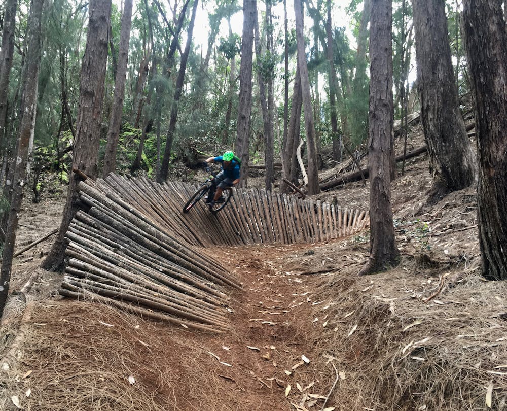
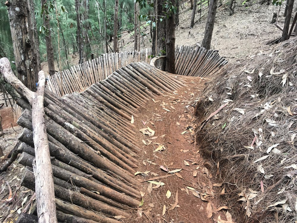
It's easy to tell that almost all of the trail building effort has been invested in the descending trails. When the singletrack points down, you’ll find superb bench cut, rolling grade reversals, jumps of all shapes and sizes, drops, wooden features, and much more! Party Line opens with a superb hand built wall ride, funneling into steep sweeping turns and entertaining kickers. Hula Girl is another renowned descent, with some big jumps near the bottom.
The wooden features aren’t solely reserved for the downhill trails, either. A few elevated boardwalks keep some of the flatter trails entertaining, and optional log ride skinnies and ladder drops provide alt lines for the more advanced riders.
As the jungle attempts to overtake the singletrack, the lines and routes continue to morph and evolve over time, generally leading to improvement. New trails continue to be built in this network, so keep your eyes peeled for entertaining lines that may have been built more recently, and may not be included on this map.
Difficulty
Difficult
Mostly stable trail tread with some variability featuring larger and more unavoidable obstacles that may include, but not be limited to: bigger stones, roots, steps, and narrow curves. Compared to lower intermediate, technical difficulty is more advanced and grades of slopes are steeper. Ideal for upper intermediate riders.
Low Exposure

The path is on completely flat land and potential injury is limited to falling over.
Remoteness

Away from help but easily accessed.
Best time to visit
Features
- Flow
- Technical
- Singletrack
- In the forest
- Drops
- Jumps
- Roots
- Wooden Feature