Borah Peak
Sun Valley
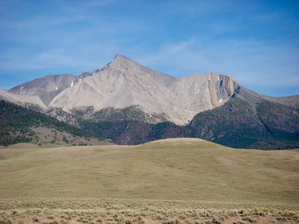
At 12,662 feet ASL, Borah Peak reigns as Idaho's high point
Hiking Extreme
- Distance
- 12 km
- Ascent
- 1.6 km
- Descent
- 1.6 km
- Duration
- 5-6 hrs
- Low Point
- 2.3 km
- High Point
- 3.8 km
- Gradient
- 25˚

Borah Peak soars to a height of 12,662 feet above sea level, claiming for itself the crown as Idaho’s highest point. As the tallest peak in the state, Borah attracts 3,000 to 5,000 climbers per year looking to bag the high point.
Description
Also known as Mount Borah, the climb mapped here covers almost 5,300 feet of elevation gain (and loss) in the 7.6-mile round-trip climb. With over 5,000 feet of vertical prominence over the surrounding landscape, Borah is also ranked as one of the continent's ultra-prominent peaks.
The climb begins with a steep but manageable access trail that climbs "up the chaparral and under a stand of skeletal fir, then switchbacks over an arched back of earth that eventually rolls out onto a high alpine plateau at 10,600’,” according to Steve Graepel on VisitIdaho.com.
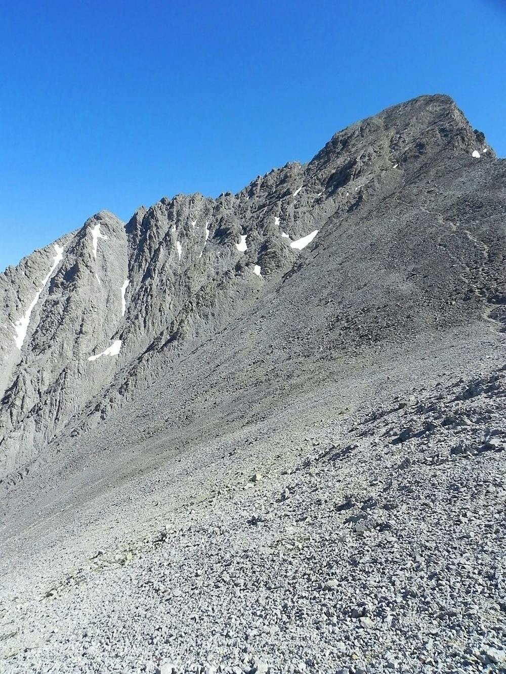
After another 1,000 feet of climbing on a good trail, you’ll reach Chicken Out Ridge, "the most famous route feature in all of Idaho,” according to Gimpilator on SummitPost.org.
"You might see a faint trail tucking to the left below Chicken Out Ridge. Avoid it,” cautions Graepel.
Instead, stick to the obvious rocky spine for some hand-over-hand scrambling. This is the crux of the route, but the truth is that "it's not as difficult or exposed as all the hype makes it out to be,” according to Gimpilator.
Trust your gut and make smart decisions, but after passing the crux, you’ll reach the final push to the summit. You can either choose a faint gravelly trail, or take a direct route up a rocky shoulder.
Congratulations, you’ve reached the highest point in the state of Idaho!
Sources: SummitPost.org VisitIdaho.com
Difficulty
Extreme
Scrambling up mountains and along technical trails with moderate fall exposure. Handholds are necessary to navigate the trail in its entirety, although they are not necessary at all times. Some obstacles can be very large and difficult to navigate, and the grades can often be near-vertical. The challenge of the trail and the steepness of the grade results in very strenuous hiking. Hikes of this difficulty blur the lines between "hiking" and "climbing".
High Exposure

Some trail sections have exposed ledges or steep ascents/descents where falling could cause serious injury.
Remoteness

In the high mountains or remote conditions, all individuals must be completely autonomous in every situation.
Best time to visit
Features
- Alpine
- Summit Hike