5 m away
Alpine Lake and Baron Lakes
Popular hike from Redfish Lake, over a high pass, into an alpine basin with dramatic views and excellent backcountry campsites.
Difficult Hiking
- Distance
- 26 km
- Ascent
- 1.2 km
- Descent
- 1.2 km
Backcountry camping at serene alpine lakes, and an extension to a high pass in the heart of the range.
Hiking Difficult

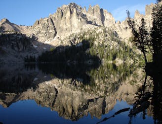
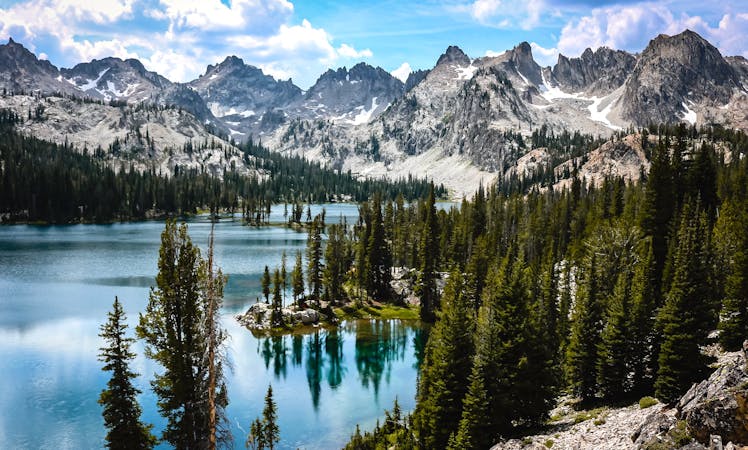
The Cramer Lakes are a string of three alpine lakes in an especially remote reach of the Sawtooth Mountains. If you trek beyond the upper lake and to the alpine pass above, you’ll find the view that author Michael Lanza calls, “a turbulent sea of razor peaks stretching to every horizon.”
The trail is not terribly strenuous, but the mileage almost necessitates a backpacking trip of at least two days. Campsites are numerous around the Cramer Lakes, and you can likely find a span of lakeshore all to yourself. The only permit necessary in the Sawtooths is free and self-issued at the trailhead.
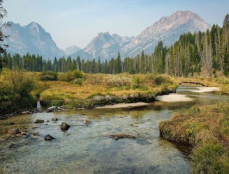
You’ll start with the boat ride across Redfish Lake (unless you’re up for the extra hike), then follow the Inlet Trail toward the heart of the range. When this trail splits, most hikers turn right for Alpine and Baron Lakes. For Cramer Lakes, you’ll instead stay straight and find greater solitude after wading across the creek.
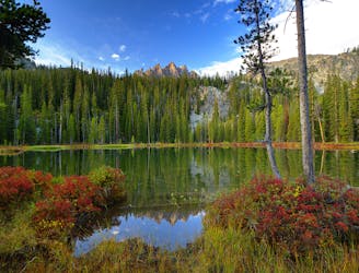
The trail continues gradually uphill, through spacious forest that gives unending views of the peaks that surround. You’ll eventually glimpse a pair of unnamed lakes below, but the trio of Cramer Lakes comes next. After passing the marshy shore of Lower Cramer, you’ll find a stunning view of Middle Cramer Lake and the waterfall streaming into it. Lug your gear just a bit farther if you want to camp near the upper lake. Keep in mind that campsites in this wilderness are informal and at-large, so if you arrive too late, you might not get your choice of spot. You must select a site that’s clearly been used before, and you must take care to minimize your impact.
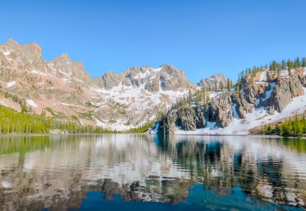
If you still have energy and daylight after setting up camp, you can extend the hike to the divide. Or relax and save it for the morning. The trail continues past the upper lake, then past some smaller tarns along increasingly steep and rocky slopes. It then proceeds upward through a barren boulder field, toward a row of jagged spires overhead. There may even be snow to cross in early summer.
Once at the divide, 10,700-foot Mount Cramer and a formation called The Temple dominate the view. If you walk through the stand of wind-gnarled trees atop the pass, you can peer over into the basin of Hidden Lake, and the headwaters of the South Fork Payette. On a longer itinerary you might move camp and spend a night on that side as well, but the route mapped here turns around at the divide.
Sources: https://redfishlake.com/blog/best-hikes-in-idaho/ https://thebigoutside.com/americas-newest-long-trail-the-idaho-wilderness-trail/ https://www.fs.usda.gov/recarea/sawtooth/recarea/?recid=5969
Difficult
Hiking trails where obstacles such as rocks or roots are prevalent. Some obstacles can require care to step over or around. At times, the trail can be worn and eroded. The grade of the trail is generally quite steep, and can often lead to strenuous hiking.

The trail contains some obstacles such as outcroppings and rock which could cause injury.

Little chance of being seen or helped in case of an accident.
5 m away
Popular hike from Redfish Lake, over a high pass, into an alpine basin with dramatic views and excellent backcountry campsites.
Difficult Hiking
5.9 km away
With a boat shuttle, you can hike the length of Redfish Lake and see smaller, higher alpine lakes along the way.
Moderate Hiking
5.9 km away
Family-friendly stoll along a mountain creek, ending at an incredible view of the Sawtooths.
Moderate Hiking
8 routes · Hiking