Malad Gorge
Stroll on the edge of a basalt canyon with streaming waterfalls, with just a short side trip from the interstate.
Hiking Easy
- Distance
- 3 km
- Ascent
- 112 m
- Descent
- 112 m
- Duration
- 0-1 hrs
- Low Point
- 972 m
- High Point
- 996 m
- Gradient
- 5˚

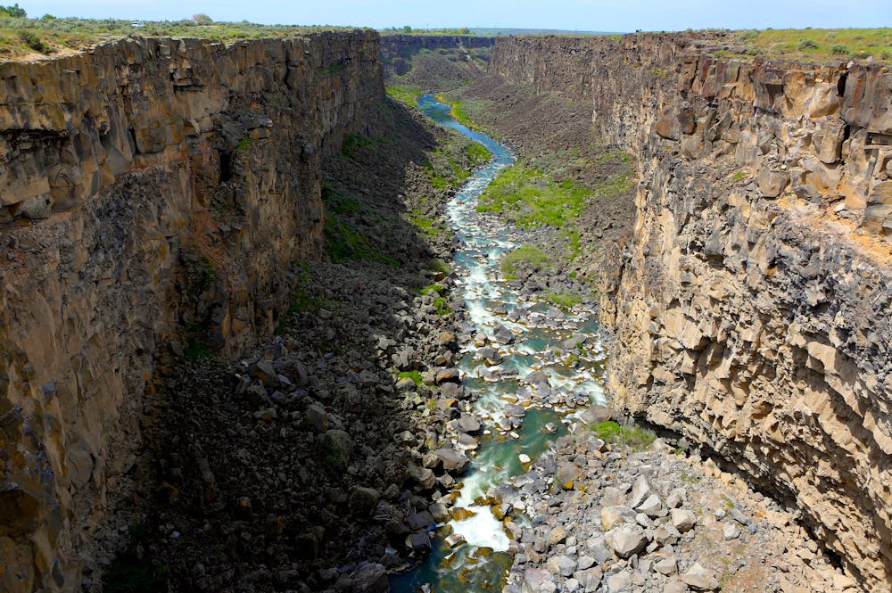
In a short detour from Interstate 84, you can see a dramatic canyon that tumbles with waterfalls. In this small unit of Thousand Springs State Park (entrance fee required) the Malad River tumbles through a tight gorge and meets a gushing spring on its way to the Snake River, which awaits out of sight downstream.
Description
From the parking lot beside the freeway, take an easy but sun and wind-exposed stroll along the rim of the gorge. You'll first cross a footbridge that parallels the interstate, overlooking a stair-step waterfall within a corridor of vertical basalt. Continue along a paved path to find interpretive signs at another viewpoint, and go beyond that for a dirt trail with unprotected access to the edge.
You can continue along the rim, then cross a narrowing peninsula of rock to find a view over the voluminous natural spring––a pool of clear blue amid an amphitheater of stone. Just a little farther on, you'll see a hydroelectric dam at the confluence of canyons. From that point you can go no further, so you'll turn around and enjoy a different angle on the views heading back to the start.
Difficulty
Easy
Walking along a well-kept trail that’s mostly flat. No obstacles are present.
Medium Exposure

The trail contains some obstacles such as outcroppings and rock which could cause injury.
Remoteness

Close to help in case of emergency.
Best time to visit
Features
- Picturesque
- Dog friendly
- Wild flowers
- Water features
- Family friendly