1 m away
Trail Creek Lakes
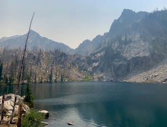
Overnight or day trip to a picturesque alpine lake, with the option to scramble to higher and more secluded lakes.
Difficult Hiking
- Distance
- 18 km
- Ascent
- 860 m
- Descent
- 860 m
A stunning multi-day loop, reaching a popular lake via lesser-traveled trails in the Sawtooths.
Hiking Difficult
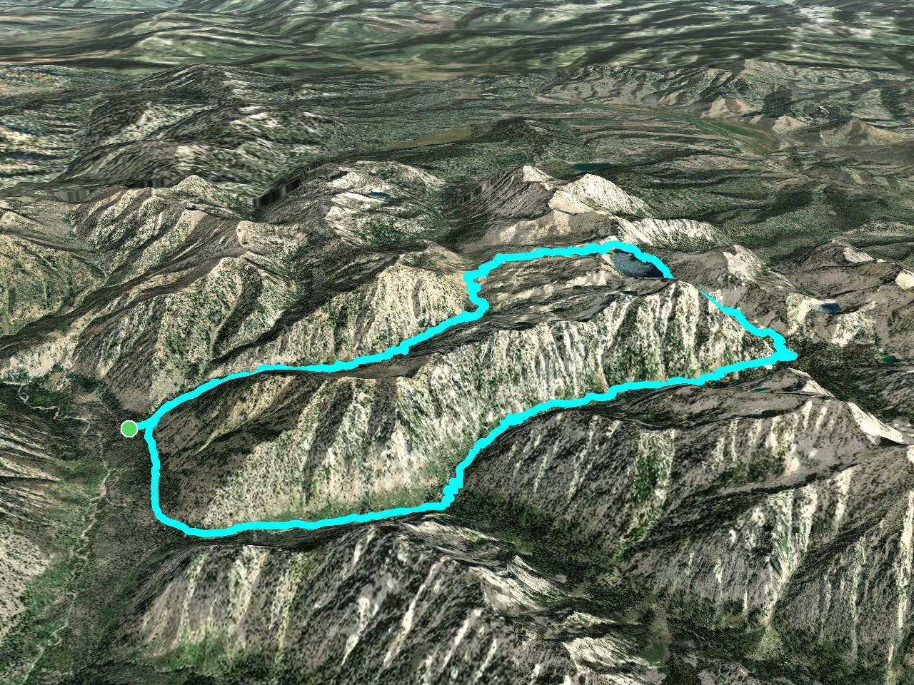
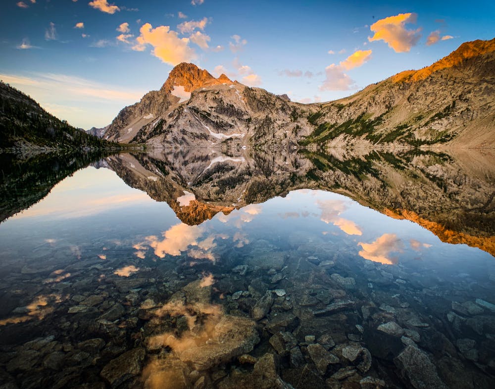
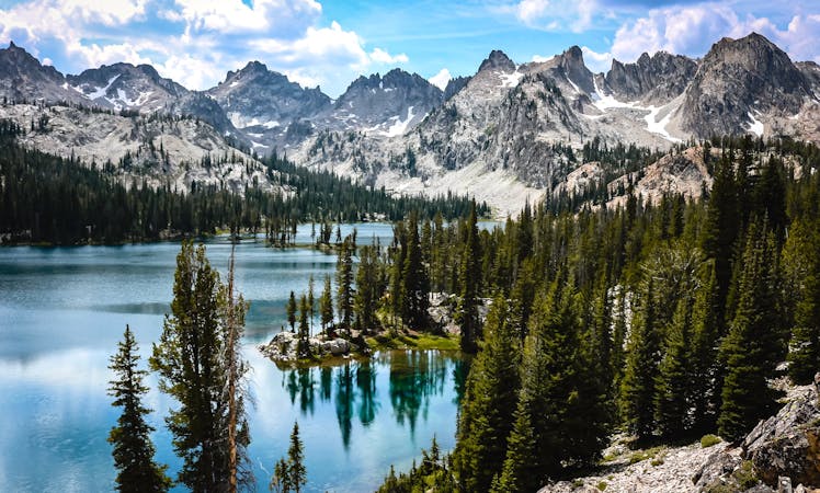
Sawtooth Lake, a mile-long pool of blue in a crater-like alpine basin, is a top hiking destination in the Sawtooth Mountains. Most people do it as a day hike from Iron Creek trailhead near Stanley. But this alternate, longer route starts on the other side of the range at Grandjean trailhead, and utilizes under-traveled terrain to reach the popular lake.
It’s possible to do this loop in one big day, but better as a backpacking trip in order to enjoy remote campsites and allow for side excursions. On a one-night itinerary, it might be best going counter-clockwise, ascending with ample shade in the Baron Creek drainage and camping near Sawtooth Lake, then descending through the burn area past McGown Lakes. With two nights, however, it could be better to go clockwise, camping first at Trail Creek Lake or McGown Lakes then again near Sawtooth Lake. Trail Creek Lake is actually on a spur from the loop mapped here, but is a worthy sight and makes an excellent place to camp. Another side trip you might take is Observation Peak––one of the rare Sawtooth summits with a trail that reaches the top.
No matter the direction of travel on the loop, you can expect some steep and rugged sections of trail with no one else around. Water sources are generally plentiful, mostly in the form of unbridged creeks which flow high in early season. Even by the end of summer when the forest has dried out, most water sources remain reliable. Creeks flow in little waterfalls through shaded gulches and rocky ravines, amid deep forest and in sunny fire clearings. Granite walls stretch nearly vertically overhead, with jagged peaks craning out of sight.
The most scenic part is of course the main attraction: Sawtooth Lake. It can be a bit crowded on a weekend, however. Where the Iron Creek trail meets the lake there is a cluster of popular campsites, and a smaller cluster on the rocky knoll to the southeast. Past there, the views are divine as the trail traverses above the lakeshore, but campsites are nonexistent. More sites can be found past the upper end of the lake, in a meadow and also in a clump of trees.
Keep in mind that Sawtooth Lake is a high-use area. It’s important to use only sites which are previously established, with a dirt or rock clearing rather than vegetation. Please do not impact new sites or expand existing ones, and be sure to follow other Leave No Trace principles. Permits are required for camping all along this route, but they are free and self-issued at trailheads.
More information: https://www.fs.usda.gov/recarea/sawtooth/recarea/?recid=5969
Difficult
Hiking trails where obstacles such as rocks or roots are prevalent. Some obstacles can require care to step over or around. At times, the trail can be worn and eroded. The grade of the trail is generally quite steep, and can often lead to strenuous hiking.

The trail contains some obstacles such as outcroppings and rock which could cause injury.

Little chance of being seen or helped in case of an accident.
1 m away
Overnight or day trip to a picturesque alpine lake, with the option to scramble to higher and more secluded lakes.
Difficult Hiking
2 m away
The longer and lonelier way to reach Baron Lakes, a popular overnight destination.
Difficult Hiking
8 routes · Hiking