5 km away
West Fork to Elk Meadows and Birthday

One variation on a local favorite loop, with gradual climbing to a smooth and fast descent.
Moderate Mountain Biking
- Distance
- 18 km
- Ascent
- 536 m
- Descent
- 536 m
High-elevation circuit on a Pocatello local mountain, with fast track and epic views.
Mountain Biking Difficult
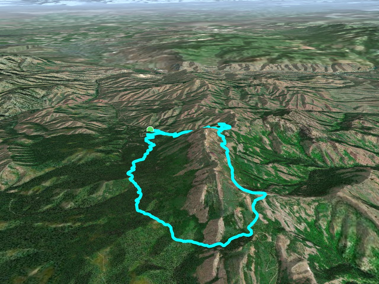
This loop on Scout Mountain has to be one of the best rides near Pocatello. It rises through dense forest and emerges among rock formations high on the mountain. What follows is a long traverse of the mountainside with huge views and a twisting descent to finish it off.
The ride begins from a trailhead off of East Fork Mink Creek Road, starting on Crestline Trail. To go in the recommended counter-clockwise direction you’ll take a connector over to the paved road and ride a little higher on this. Leave the road at the signed trailhead for East Fork, and hit the dirt once more. On the rest of this long climb, you can expect some rocky and loose sections, but for the most part, it’s straightforward climbing on doubletrack trail. You’ll enjoy the shade of Douglas-fir and aspen groves, and bask in views from open sagebrush meadows. From the clearings you’ll see the craggy spine of Scout Mountain looming overhead.
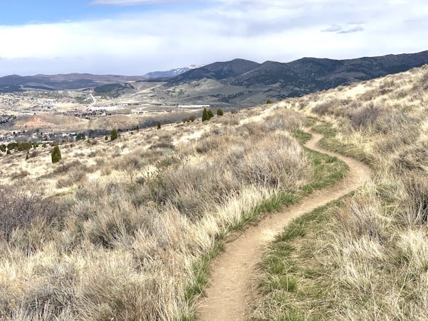
You’ll pass a marshy pond then enjoy a brief downhill, but then tackle a steeper climb to top out East Fork Mink trail near a stone buttress. Then, a stretch of dirt road with big vistas and more uphill leads to the turnoff for Crestline. That’s where the real fun begins. It’s a tight singletrack carving along the side of the mountain, through lush meadows and scattered trees with views over sprawling foothills.
There’s a bit of everything from flow to technical, loose rock to firm dirt, and some sections come with unnerving exposure over steep slopes. It’s mostly downhill but with short stretches to pedal as well. The scenery plus the grade make it a thrill for any type of rider, depending on how fast you want to go. Eventually, the trail crosses over a shoulder of the mountain, then drops down broad switchbacks among alternating swaths of trees and sage. The home stretch rolls through leafy woodland to end up back at the starting point.
Sources: https://www.visitpocatello.com/trails-routes/crestline-trail/ https://www.idahostatejournal.com/outdoors/xtreme/the-top-mountain-biking-trails-in-pocatello/article73d65605-f2a0-5c36-9e69-e37712df3428.html
Difficult
Mostly stable trail tread with some variability featuring larger and more unavoidable obstacles that may include, but not be limited to: bigger stones, roots, steps, and narrow curves. Compared to lower intermediate, technical difficulty is more advanced and grades of slopes are steeper. Ideal for upper intermediate riders.

Some trail sections have exposed ledges or steep ascents/descents where falling could cause serious injury.
Little chance of being seen or helped in case of an accident.
5 km away
One variation on a local favorite loop, with gradual climbing to a smooth and fast descent.
Moderate Mountain Biking
5 routes · Mountain Biking