9.1 km away
Route of the Hiawatha: Out-and-Back
The "crown jewel" of rails-to-trails adventures.
Easy Mountain Biking
- Distance
- 47 km
- Ascent
- 2.7 km
- Descent
- 2.7 km
The "crown jewel" of rails-to-trails adventures.
Mountain Biking Easy

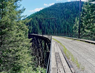
The Route of the Hiawatha is renowned as the "crown jewel" of rails-to-trails adventures. According to RideTheHiawatha.com, the trail "is 15 miles long with 10 train tunnels and 7 sky-high trestles." One of the highlights of the trip is the 1.66-mile-long St. Paul Pass Tunnel—be sure to bring your headlight or headlamp!
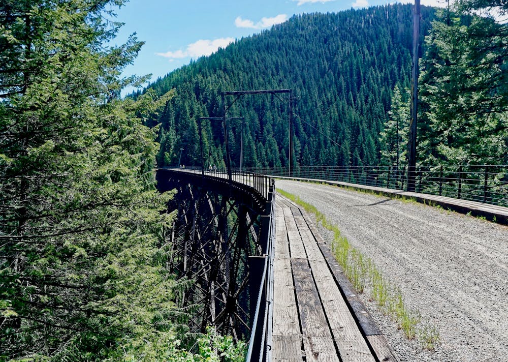
This stunning rails-to-trails route runs through the Bitterroot Range: some of the most formidable mountain ranges in the Western USA. Throughout the entire ride or hike, you'll be surrounded by towering mountain ridges covered in massive pine forests. This area of the country is truly a spectacular region to explore!
The route shown here is the point-to-point option running from east to west. In this direction, the trail runs 14.5 miles. However, it's mostly downhill, and with a shuttle available to take you back to the start, this is an easy yet absolutely beautiful outing in the mountains!
This trail is most popular with cyclists on mountain bikes and gravel bikes. While some cyclists on road bikes will complete this route, the rough gravel surface makes it ideal for fatter tire bikes.
Even though the trail is most popular with cyclists, you can choose to hike or run the Route of the Hiawatha, too.
You can purchase a trail pass and shuttle ticket—and even rent a mountain bike—at the Lookout Pass Ski Area. According to RideTheHiawatha.com, "The Lookout Pass Lodge and Bike Rental Shop opens at 8 AM (PDT). The trail is open 8:30 AM to 5 PM (PDT) daily starting May 27 through September 18, 2022."
Easy
Mostly smooth and non-technical singletrack with unavoidable obstacles 2in/5cm tall or less. Avoidable obstacles may be present. Ideal for beginner riders.

The path is on completely flat land and potential injury is limited to falling over.

Away from help but easily accessed.
9.1 km away
The "crown jewel" of rails-to-trails adventures.
Easy Mountain Biking