Whitecap Mountain - Maine 100 Mile Wilderness
7.7 mile summit hike on the AT in the middle of Maine's 100 Mile Wilderness
Hiking Difficult
- Distance
- 12 km
- Ascent
- 656 m
- Descent
- 656 m
- Duration
- 3-4 hrs
- Low Point
- 483 m
- High Point
- 1.1 km
- Gradient
- 14˚

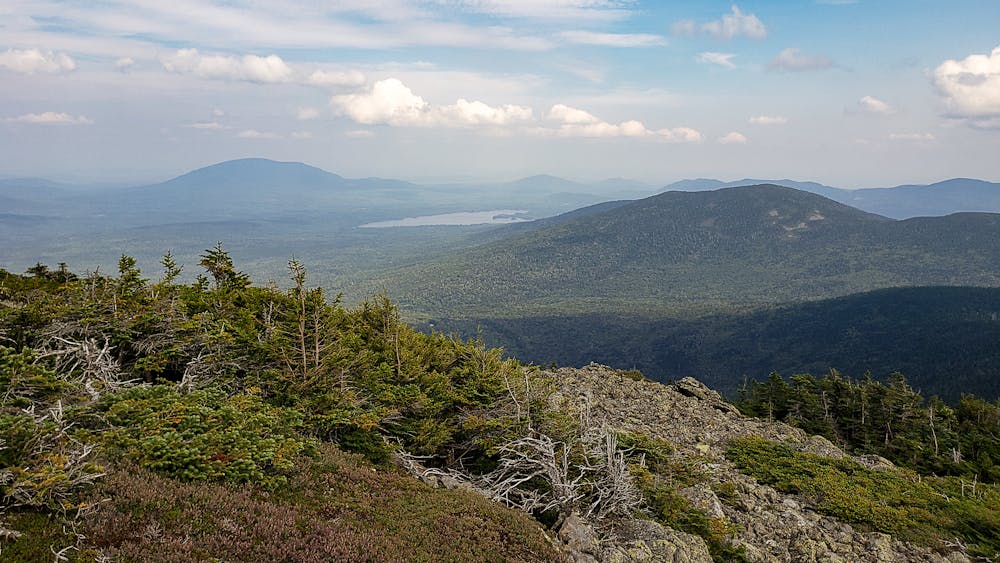
Whitecap Mountain is an excellent hike on the AT, right in the middle of Maine's 100 mile wilderness. The out-and-back hike is 7.7 miles with about 2,700 feet of elevation gain. At the summit you are rewarded with expansive views over Maine's north woods.
Description
Trail Head Directions: Directions: From the blinking light in the center of Greenville travel north 17.2 miles on Lily Bay Road and turn right onto the Frenchtown Road. Continue down Frenchtown Road without turning off any side roads, following the signs beyond West Branch Pond Camps. At 31.1 miles you will arrive at a gate and small parking area. The trailhead is 1/4 mile beyond the gate.
For more info and photos, please visit my blog: <a href="http://www.ericsturgeon.com/blog/white-cap-mountain-hike-maine-100-mile-wilderness/">Whitecap Mountain - Eric's Maine Life</a>
Difficulty
Difficult
Hiking trails where obstacles such as rocks or roots are prevalent. Some obstacles can require care to step over or around. At times, the trail can be worn and eroded. The grade of the trail is generally quite steep, and can often lead to strenuous hiking.
Medium Exposure

The trail contains some obstacles such as outcroppings and rock which could cause injury.
Remoteness

Little chance of being seen or helped in case of an accident.
Best time to visit
Features
- Picturesque
- Summit Hike