Chapel Loop
Hiking loop in Pictured Rocks National Lakeshore with cliffside and waterfall views.
Hiking Moderate
- Distance
- 16 km
- Ascent
- 314 m
- Descent
- 314 m
- Duration
- 3-4 hrs
- Low Point
- 181 m
- High Point
- 250 m
- Gradient
- 4˚

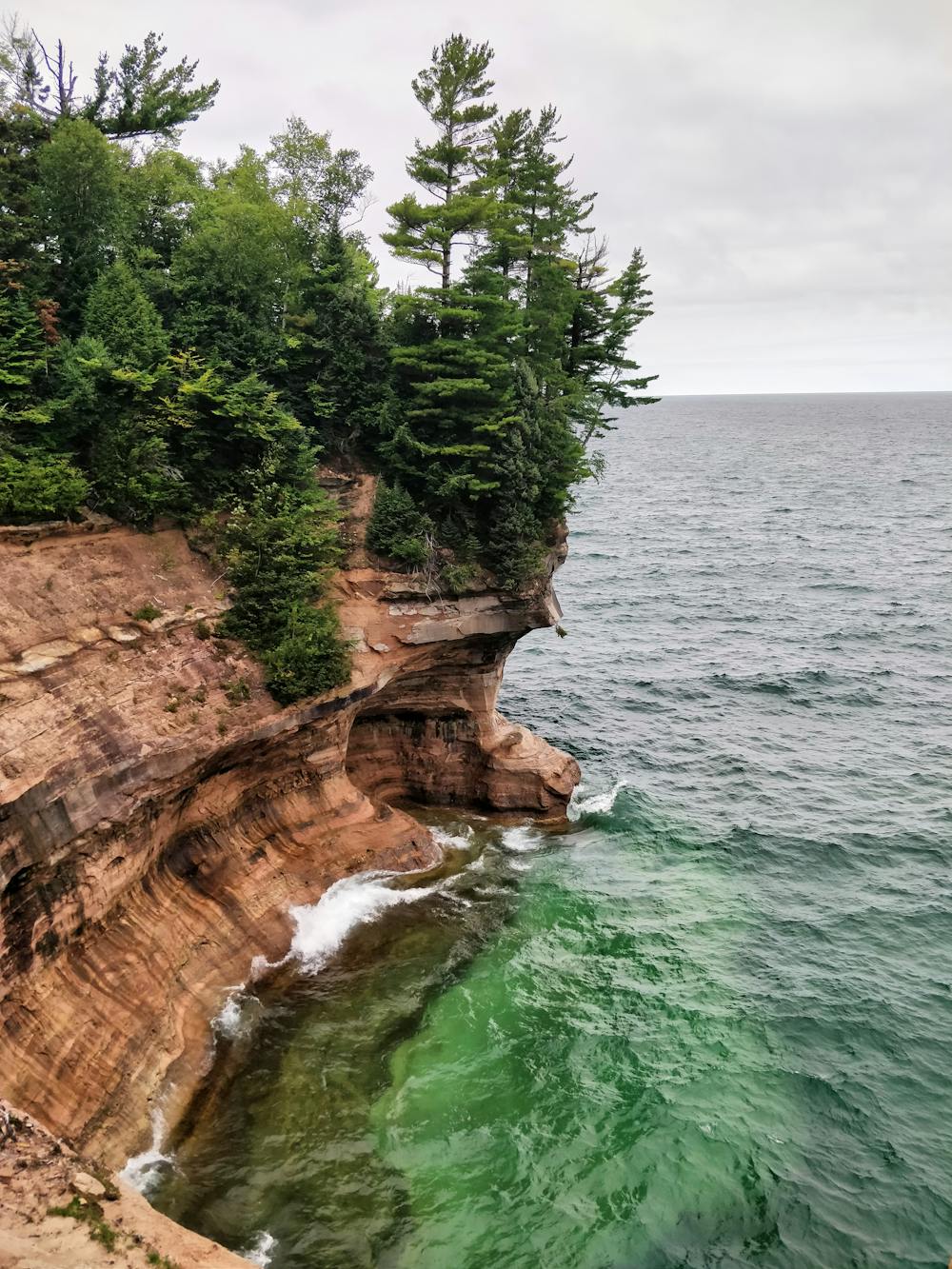
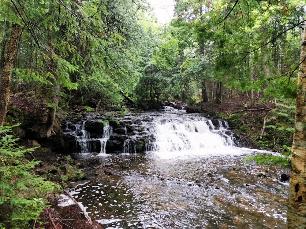
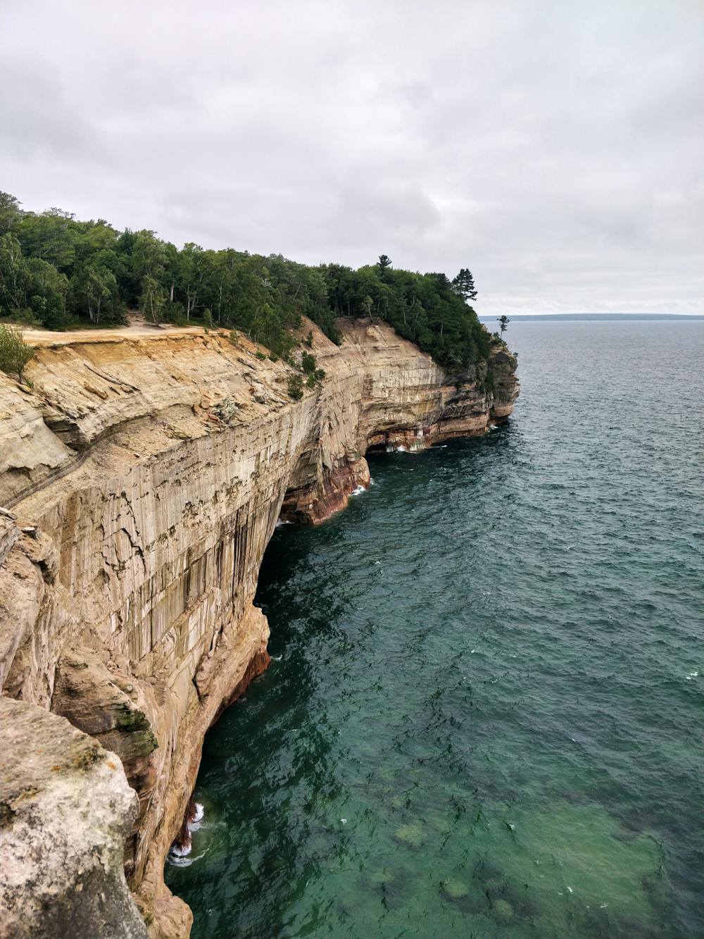
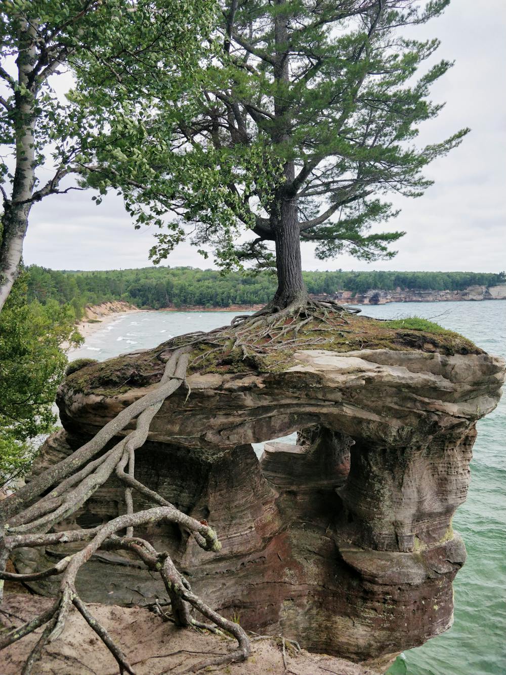
This hiking loop features two waterfalls and nearly five miles of cliffside views in Pictured Rocks National Lakeshore. There are two campgrounds accessible to backpackers for those looking to spend the night.
- •
- •
- •
- •
Description
The section along the cliffs offers views of arches, coves, and towering sandstone formations carved by Lake Superior. The sections through the forest offer views of Mosquito Falls and Chapel Falls, and are easily accessible as out-and-back style hikes if desired.
Difficulty
Moderate
Hiking along trails with some uneven terrain and small hills. Small rocks and roots may be present.
High Exposure

Some trail sections have exposed ledges or steep ascents/descents where falling could cause serious injury.
Remoteness

Away from help but easily accessed.
Best time to visit
Features
- Picturesque
- Water features
- Forestry or heavy vegetation