1.5 km away
The Anger Hair Piece, Comb-Over, Corn-Rows

Steep technical side country chutes.
Extreme Freeride Skiing
- Distance
- 807 m
- Ascent
- 0 m
- Descent
- 389 m
Hopefully the liftline for the Headwaters replacement.
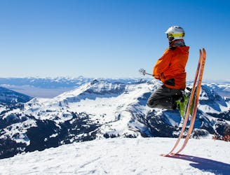
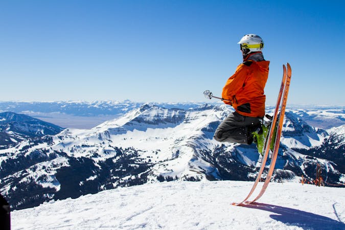
Freeride Skiing Severe

This is a popular freeride skiing route which is generally considered to be severe. It's not remote, it features medium exposure (e2) and is typically done between January and April. From a low point of 2.6 km to the maximum altitude of 3 km, the route covers 732 m, 380 vertical metres of ascent and 0 vertical metres of descent.
-
Severe
Steep skiing at 38-45 degrees. This requires very good technique and the risk of falling has serious consequences.

As well as the slope itself, there are some obstacles (such as rock outcrops) which could aggravate injury.

Close to help in case of emergency.
1.5 km away
Steep technical side country chutes.
Extreme Freeride Skiing
1.6 km away

A rarely open short steep chute on the east face.
Severe Freeride Skiing
1.8 km away

The classic of Lone Lake Cirque.
Severe Freeride Skiing
2.2 km away
A beautiful back country ski on the south side of Lone Mountain.
Difficult Freeride Skiing
2.2 km away

A popular descent in Cornrows section of the Lone Lake Cirque
Severe Freeride Skiing
2.3 km away

A steep ski line in Lone Lake Cirque
Severe Freeride Skiing
2.4 km away

Ridge line with multiple lines and cliffs.
Difficult Freeride Skiing
2.5 km away

The farthest and shortest line in Lone Lake is clean, steep, and fun
Severe Freeride Skiing
2.5 km away

A steep ski line above a no fall zone
Severe Freeride Skiing
15 routes · Freeride Skiing