Y chute
classic chute you can see right from the lake.
Freeride Skiing Severe
- Distance
- 1.2 km
- Ascent
- 0 m
- Descent
- 506 m
- Low Point
- 2.8 km
- High Point
- 3.3 km
- Gradient
- 51˚
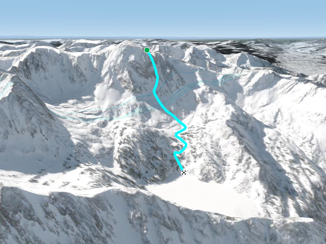
This is a popular freeride skiing route which is generally considered to be severe. It's extremely remote, it features high exposure (e3) and is typically done between January and May. From a low point of 2.8 km to the maximum altitude of 3.3 km, the route covers 1.2 km, 0 vertical metres of ascent and 506 vertical metres of descent.
Description
beautiful couloir that is easily visible from the lake
Difficulty
Severe
Steep skiing at 38-45 degrees. This requires very good technique and the risk of falling has serious consequences.
High Exposure (E3)

In case of a fall, death is highly likely.
Remoteness

In the high mountains or remote conditions, all individuals must be completely autonomous in every situation.
Best time to visit
Features
- Couloir