2.9 km away
Lone Peak
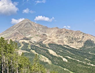
A classic peak climbing objective in Big Sky.
Severe Hiking
- Distance
- 9 km
- Ascent
- 1.1 km
- Descent
- 1.1 km
A heavily-trafficked trail leading into a beautiful basin below the Spanish Peaks.
Hiking Moderate

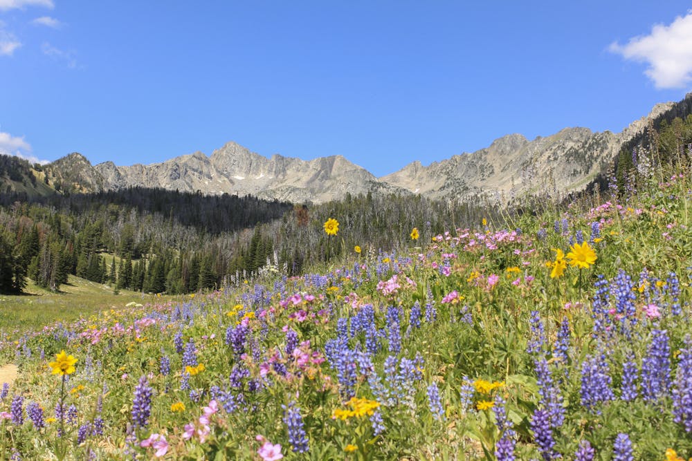
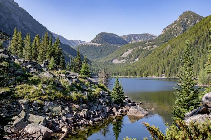
The Beehive Basin trail is one of the most famous hikes in Big Sky, and for good reason. This non-technical 3.4-mile trail leads to some of the most beautiful views in the region. The ultimate goal is a wildflower-filled basin with a crystal-clear lake framed by a U-shaped cirque of towering rock peaks, known as the Spanish Peaks.
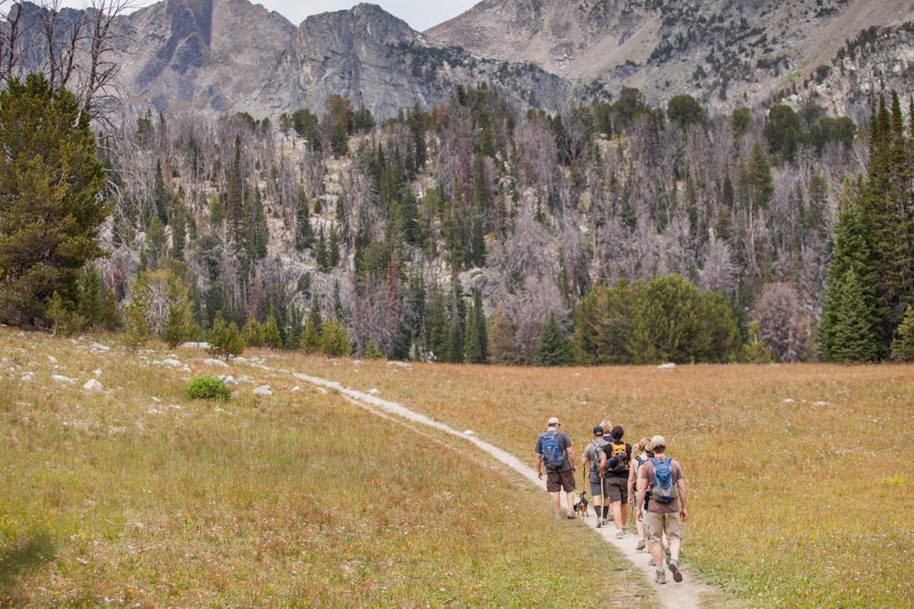
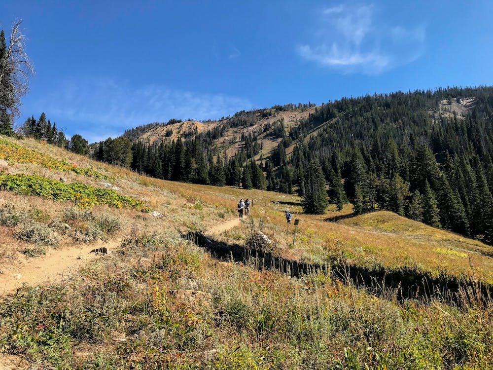
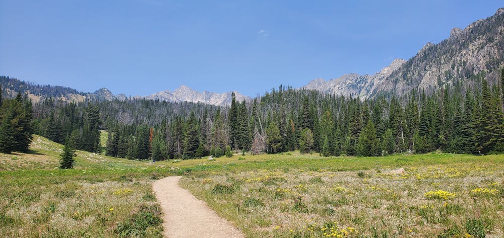
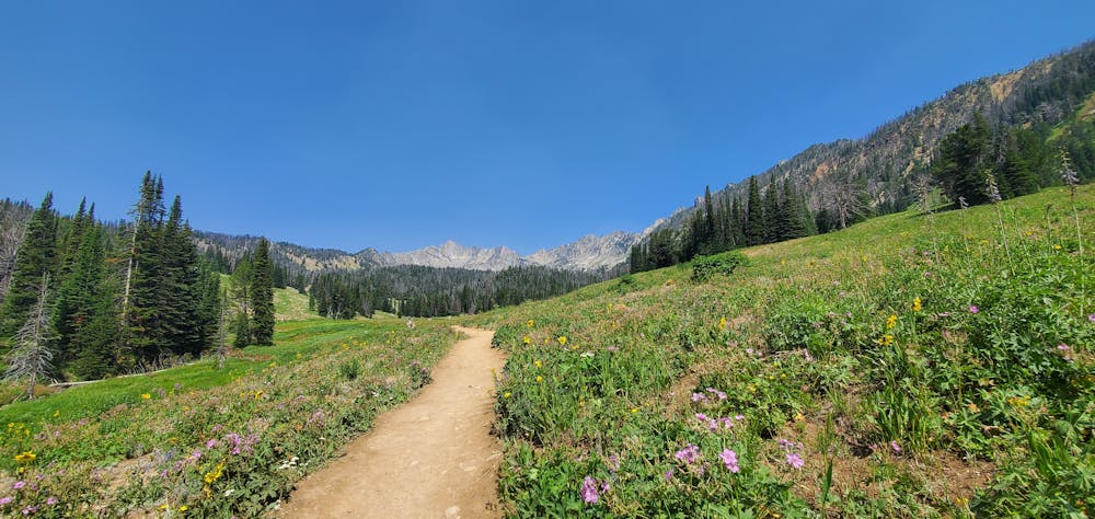
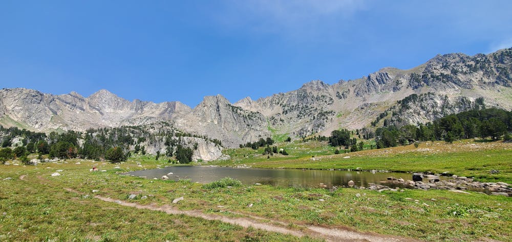
This moderate hike follows a smooth, wide, well-traveled trail on its way from the crowded parking lot to the stunning basin. According to FATMAP, the hike gains about 1,647 vertical feet on its ~3.4-mile one-way distance. While Beehive definitely isn't just a short sightseeing hike, many prospective hikers, ranging from young to old and everywhere in between, will be able to tackle the trail into the basin.
Even if you don't make it all the way to the basin, you'll still get to enjoy fantastic views along the entire hike. According to OutsideBozeman.com, the trail to the basin travels through expansive "alpine wildflower meadows, through tall forest, and past creeks." You'll even enjoy "an unnamed lake surrounded by streams and a grassy basin" along the way.
Note:
The Big Sky area is renowned as prime grizzly bear country. Signs at every trailhead warn that bears are highly active in the area. To mitigate the risk of bear encounters, make plenty of noise while hiking, try to hike with a group of people, and consider attaching a bear bell to your backpack. Also, make certain that you carry bear spray with you every time you hike, in case you do get into an encounter with a grizzly.
Sources: https://www.visitmt.com/listings/general/national-forest-trail/beehive-basin-trail https://outsidebozeman.com/trails-tours/hiking-trails/beehive-basin-trail https://www.visitbigsky.com/get-inspired/big-sky-stories/7-best-hikes-in-big-sky-montana
Moderate
Hiking along trails with some uneven terrain and small hills. Small rocks and roots may be present.

The path is on completely flat land and potential injury is limited to falling over.

Away from help but easily accessed.
2.9 km away
A classic peak climbing objective in Big Sky.
Severe Hiking
4.7 km away
Skip the crowds of Beehive Basin with this long hike to a remote high alpine lake.
Difficult Hiking
8.1 km away
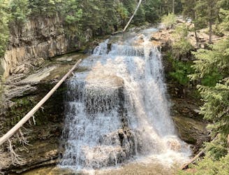
A beautiful 35-foot-tall waterfall with pools perfect for swimming.
Easy Hiking
7 routes · Hiking