8 routes · Hiking
A steep hike up Bridger Bowl ski area to a beautiful view from the top of the ridge.
Hiking Severe

The hike to the top of Bridger Bowl is steep and rugged, but the promise of stunning views from the top still attracts plenty of hikers.
The small parking lot shown here as the beginning of the hike is the most popular spot to start the ascent to the top of the ridge. While there are a few trails lower down the mountain from this point, this parking lot is the highest up the dirt road that you can normally drive. Here, a locked gate stops most traffic from proceeding further.
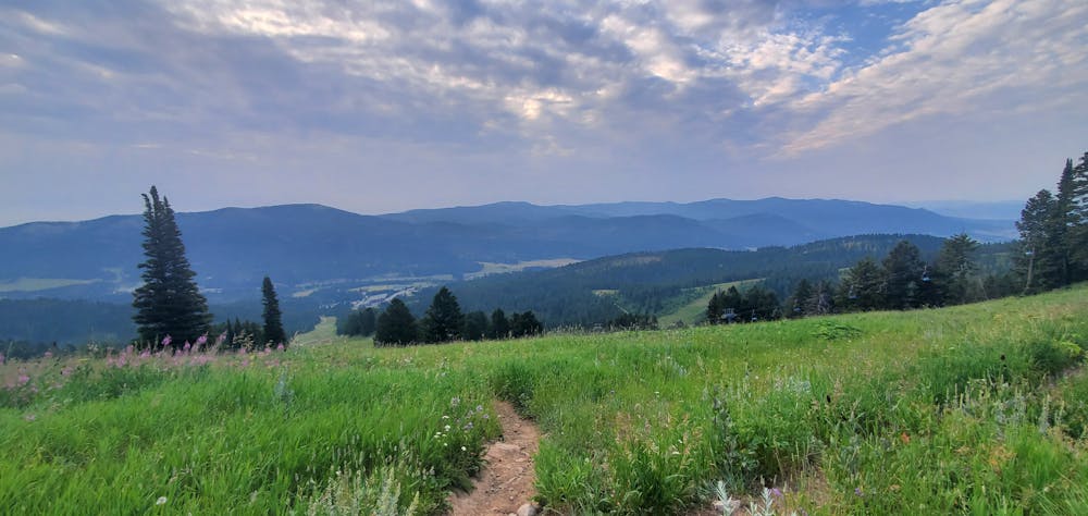
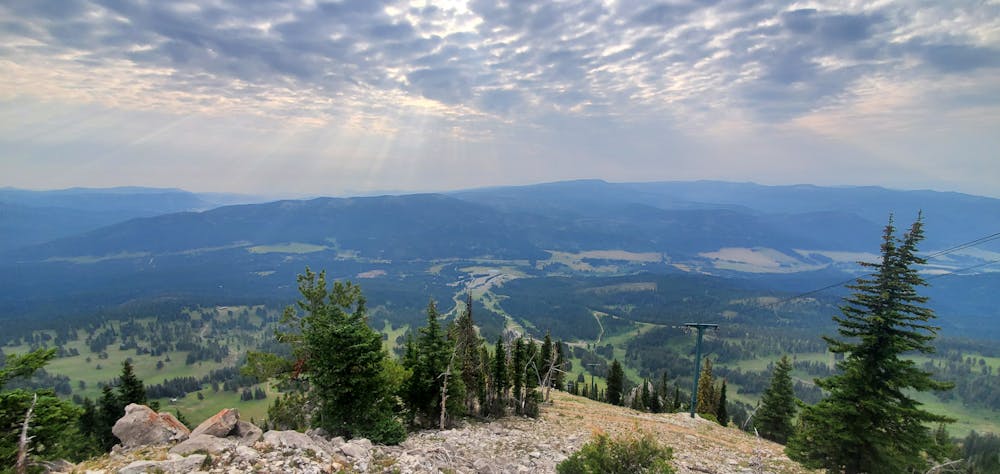
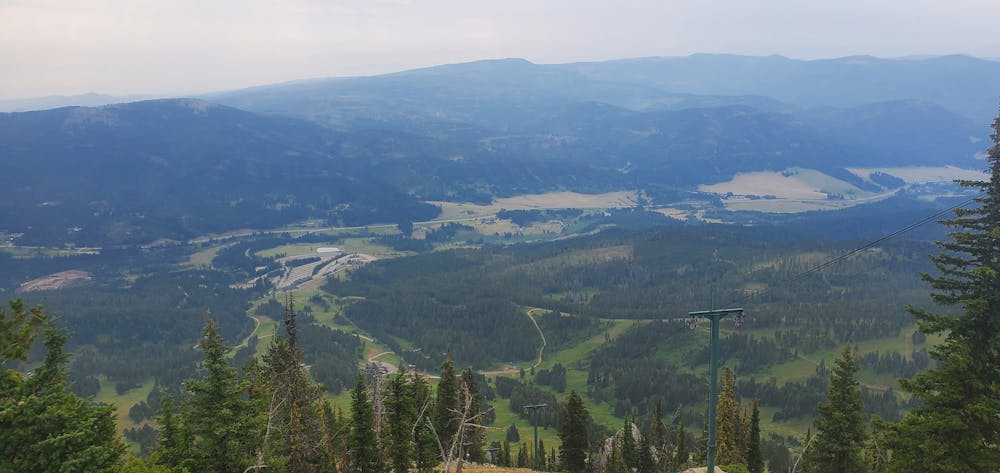
The trail more-or-less follows the chairlift to the top of the ridge. There are several different trails and roads crisscrossing the mountain, some of which are poorly signed, which can make navigation difficult at times. When in doubt, look for the chairlift and try to return to the lift line.
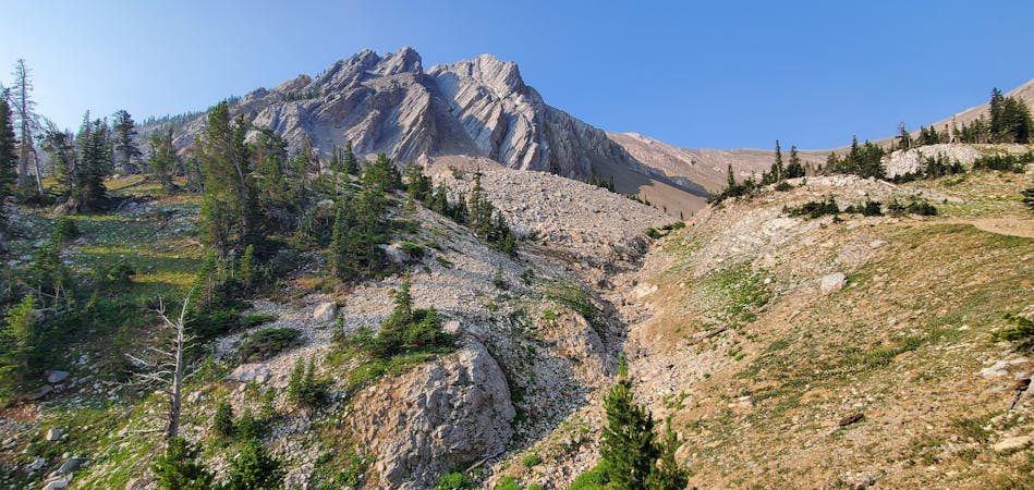
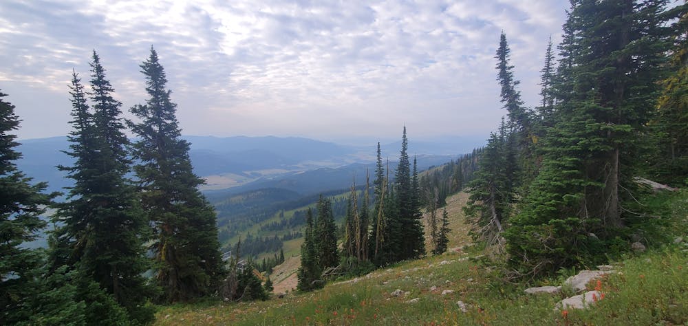
The trail tread itself is steep, eroded, and rocky. Come prepared for challenging hiking, and know that there is no respite from the harsh sun.
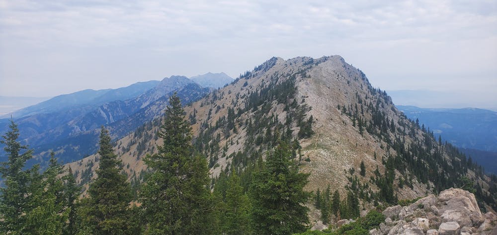
"Upon reaching the ridge you'll be rewarded with sweeping views of the Gallatin Valley and Bridger Canyon," writes MontanTrailBriefs.com. Take some time to enjoy the fantastic vistas—you've earned them!
The Bridger Ridge Trail traverses along the entire spine of the mountain range. If you're trying to tackle a longer objective, you can connect there from this point. Otherwise, return to your car the same way you came.
Note:
The Bozeman area is renowned as prime grizzly bear country. Signs at every trailhead warn that bears are highly active in the area. To mitigate the risk of bear encounters, make plenty of noise while hiking, try to hike with a group of people, and consider attaching a bear bell to your backpack. Also, make certain that you carry bear spray with you every time you hike, in case you do get into an encounter with a grizzly.
Severe
Hiking challenging trails where simple scrambling, with the occasional use of the hands, is a distinct possibility. The trails are often filled with all manner of obstacles both small and large, and the hills are very steep. Obstacles and challenges are often unexpected and can be unpredictable.

The trail contains some obstacles such as outcroppings and rock which could cause injury.
Away from help but easily accessed.
8 routes · Hiking