8 routes · Hiking
An aesthetic ascent leads to a beautiful view over the Gallatin range.
Hiking Difficult

The trailhead for Chestnut Mountain is easily accessible directly from an Interstate 90 exit, but the easy access is deceptive. This trail quickly becomes a surprisingly beautiful hike that leads to a stunning 360-degree panorama of the Gallatin Range.
The hike begins ascending directly from the trailhead and by the time you reach the summit, you'll have ascended a stiff 2,743 vertical feet in just 5.4 miles. Get your climbing boots on because it's up, up, up from here.
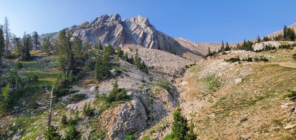
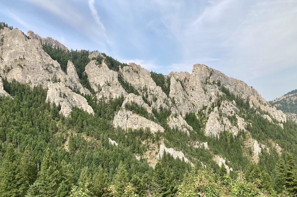
Thankfully, the singletrack climb is well-built, with artful switchbacks and fantastic benchcutting. The miles roll by quickly thanks to the high-quality trail construction and beautiful views combined. From some sections of the trail, you'll enjoy spectacular vistas of vaulted cliffs on the opposite side of a narrow valley.
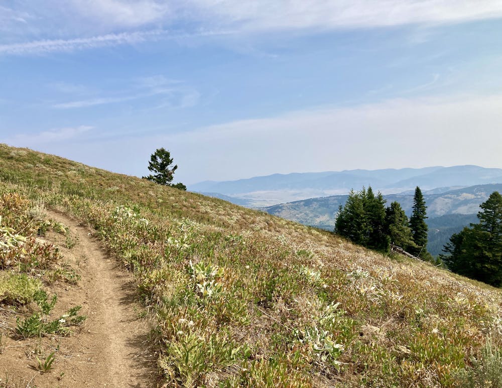
As you climb higher, the wildflowers will begin to burst forth, adding beautiful splashes of color to the sides of the trail. Higher still, the long-distance vistas begin to open up, and you'll enjoy expansive views across the surrounding mountains.
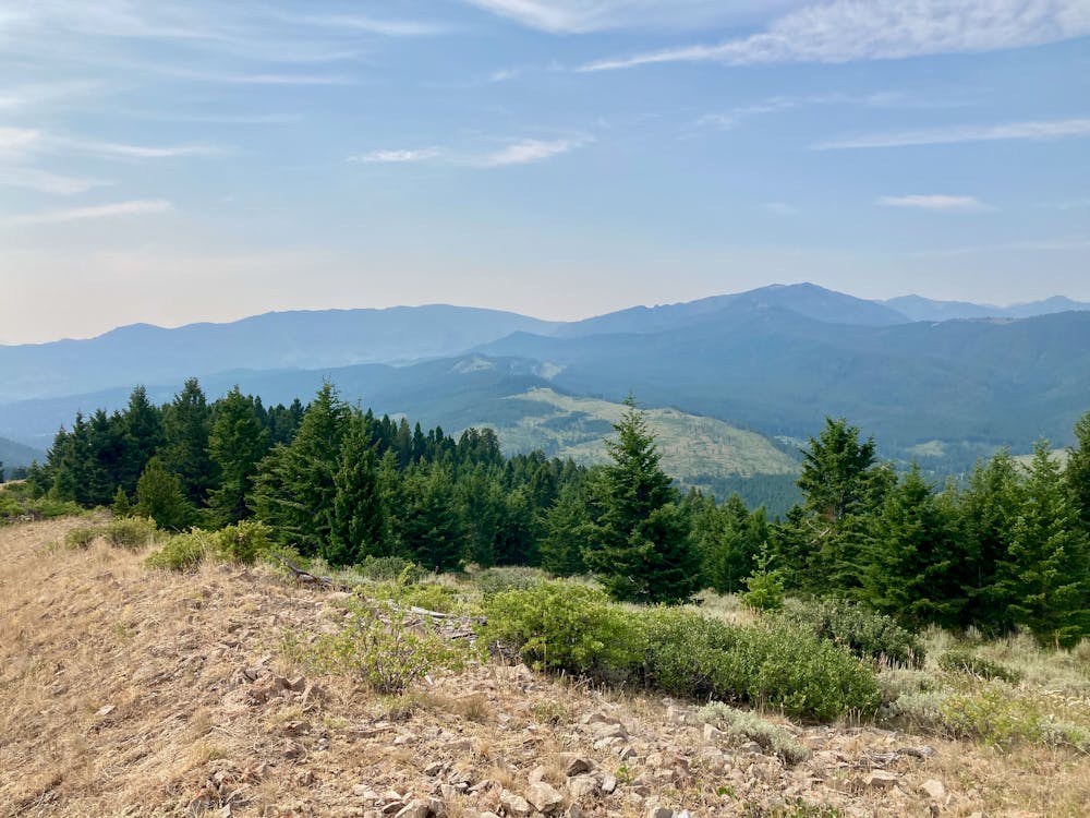
The main reward comes on top of the summit. Despite being a relatively low summit at just 7,681 feet above sea level, the bald top of Chestnut Mountain provides a spectacular 360-degree view of the surrounding Gallatin mountains! From this vantage point, the true majesty and expansive spread of the Gallatins become readily apparent. There truly is a lifetime of adventure here in Bozeman, Montana!
Note:
The Bozeman area is renowned as prime grizzly bear country. Signs at every trailhead warn that bears are highly active in the area. To mitigate the risk of bear encounters, make plenty of noise while hiking, try to hike with a group of people, and consider attaching a bear bell to your backpack. Also, make certain that you carry bear spray with you every time you hike, in case you do get into an encounter with a grizzly.
Difficult
Hiking trails where obstacles such as rocks or roots are prevalent. Some obstacles can require care to step over or around. At times, the trail can be worn and eroded. The grade of the trail is generally quite steep, and can often lead to strenuous hiking.

The trail contains some obstacles such as outcroppings and rock which could cause injury.
Away from help but easily accessed.
8 routes · Hiking