Granite Peak: Cooke City Route
One of the most technical state high points in the USA, approached via a lengthy overland route.
Hiking Extreme
- Distance
- 39 km
- Ascent
- 1.7 km
- Descent
- 1.7 km
- Duration
- 1 day +
- Low Point
- 2.7 km
- High Point
- 3.9 km
- Gradient
- 29˚

Note: this route receives a "Difficult" Mountaineering difficulty rating.
Description
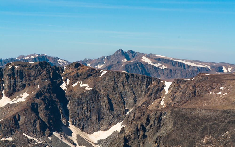
Soaring to a height of 12,807 feet, Granite Peak reigns as the highest point in the state of Montana, and it's also renowned as one of the most difficult of the state high points to climb. "Besides some talus-strewn class 3 and 4 climbing, Granite Peak is notorious for the brutal thunderstorms that lash its slopes with predictable monotony on summer afternoons," according to PeakBagger.com. You'll also have to brave a "dangerous ridge of snow" and some extreme exposure on one of the final pitches. All sources warn that this mountain is not recommended for novice climbers: Granite Peak has proved deadly several times over.
While most climbers approach Granite Peak from the north via the West Rosebud or East Rosebud trailhead, it is possible to gain the summit from the Cooke City side. This route requires a lengthy overland approach with minimal trails to reach the peak. And yet, it seems to be gaining in popularity with climbers making an attempt on the state's high point.
If you want to tackle this route, you'll need to be prepared for extensive overland navigation with few or non-existent trails. Even the approach will be challenging and lengthy. This 24-mile route will take even fit climbers several days to complete.
If you don't get lost in the wilderness and you reach the base of Granite Peak itself, this route as mapped takes a technical, direct approach to the summit, with steep rock climbing and extreme exposure required. It's beyond the scope of this description to detail the exact moves required, but being prepared with a rope and a trad kit may be a smart idea.
For a less-technical approach, consider crossing the low pass below the summit, descending the talus to Lowary Lake, and then scaling the talus fields toward the col between Granite Peak and Tempest Mountain. This dogleg will add considerable distance, and the talus field scrambling in and of itself is very dangerous and steep. But it could avoid the steep final pitch shown on this map.
If you've managed to overcome the challenge and conquer that final push, then congratulations: you've reached the highest point in Montana!
Sources: https://www.summitpost.org/granite-peak/150239 https://www.peakbagger.com/peak.aspx?pid=5258 https://www.theoutbound.com/montana/backpacking/backpack-granite-peak https://www.startribune.com/minnesota-man-dies-climbing-highest-peak-in-montana/558619292/#:~:text=A%20Minnesota%20man%20fell%20to,from%20reaching%20the%20area%20sooner.
Difficulty
Extreme
Scrambling up mountains and along technical trails with moderate fall exposure. Handholds are necessary to navigate the trail in its entirety, although they are not necessary at all times. Some obstacles can be very large and difficult to navigate, and the grades can often be near-vertical. The challenge of the trail and the steepness of the grade results in very strenuous hiking. Hikes of this difficulty blur the lines between "hiking" and "climbing".
Extreme Exposure

Some trail sections are extremely exposed where falling will almost certainly result in serious injury or death.
Remoteness
In the high mountains or remote conditions, all individuals must be completely autonomous in every situation.
Best time to visit
Features
- Alpine
- Summit Hike