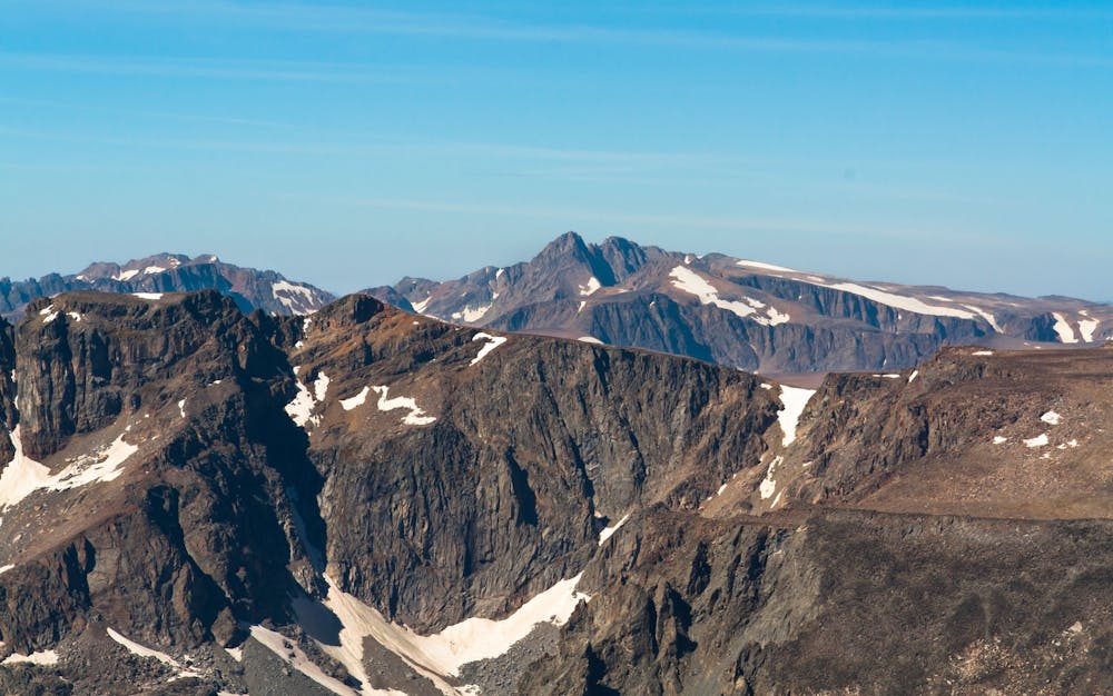
Granite Peak: Huckleberry Creek Route
One of the most technical state high points in the USA.
Hiking Extreme
- Distance
- 33 km
- Ascent
- 2.4 km
- Descent
- 2.4 km
- Duration
- 1 day +
- Low Point
- 2 km
- High Point
- 3.9 km
- Gradient
- 27˚

Note: this route gets a "Difficult" Mountaineering difficulty rating.
Description
Soaring to a height of 12,807 feet, Granite Peak reigns as the highest point in the state of Montana, and it's also renowned as one of the most difficult of the state high points to climb. "Besides some talus-strewn class 3 and 4 climbing, Granite Peak is notorious for the brutal thunderstorms that lash its slopes with predictable monotony on summer afternoons," according to PeakBagger.com. You'll also have to brave a "dangerous ridge of snow" and some extreme exposure on one of the final pitches. All sources warn that this mountain is not recommended for novice climbers: Granite Peak has proved deadly several times over.
The approach to Granite Peak is so lengthy that most climbers break it into a multi-day backpacking adventure, setting up a high camp before the final summit push. The most common ascent of Granite Peak begins at the West Rosebud trailhead and heads in past Mystic Lake. While there are a few different routes to choose from, the route mapped here climbs toward the upper col and the final summit push via Huckleberry Creek. While some sources note Huckleberry Creek as one of the more arduous routes, it still remains one of the most popular and easiest to navigate.
While Huckleberry Creek requires "navigation across massive boulder fields which rise steeply toward the base of Granite Peak," according to Matt Lemke on SummitPost.org, staying down in the valley means you're more protected from afternoon thunderstorms. In comparison, the other route on this side of the mountain crosses a completely-exposed high alpine plateau, which can prove dangerous if the weather turns sour.
While exceptional mountain athletes may be able to bag this peak in one day, most climbers will have to break this up into a multi-day excursion. If taking the Huckleberry Creek Route, Princess Lake offers a great camping option before the final push to the summit.
The final summit push requires a boulder scramble to the col between Tempest Mountain and Granite Peak. Once at the col, the route more or less follows the ridgeline to gain the summit, although some climbers will choose to swing lower down through the talus along the first section of the ascent. But eventually, you'll have to commit to the ridge and extreme exposure to gain the summit of Granite Peak.
The final 200 feet of the summit block are extremely exposed. Many climbers will choose to rope up for this section, and rappel back down from the top. While it can be climbed without a rope, that decision is up to you. A fall from this final ridge will likely prove deadly—and it did for the an experienced climber in 2019.
If you've managed to overcome the challenge and conquer that final 200 feet, then congratulations: you've reached the highest point in Montana!
Sources: https://www.summitpost.org/granite-peak/150239 https://www.peakbagger.com/peak.aspx?pid=5258 https://www.theoutbound.com/montana/backpacking/backpack-granite-peak https://www.startribune.com/minnesota-man-dies-climbing-highest-peak-in-montana/558619292/#:~:text=A%20Minnesota%20man%20fell%20to,from%20reaching%20the%20area%20sooner.
Difficulty
Extreme
Scrambling up mountains and along technical trails with moderate fall exposure. Handholds are necessary to navigate the trail in its entirety, although they are not necessary at all times. Some obstacles can be very large and difficult to navigate, and the grades can often be near-vertical. The challenge of the trail and the steepness of the grade results in very strenuous hiking. Hikes of this difficulty blur the lines between "hiking" and "climbing".
Best time to visit
Features
- Alpine
- Summit Hike

