5.3 km away
Bear Lakes -> New World Gulch Loop
A fantastic backcountry loop on the Gallatin Front.
Severe Mountain Biking
- Distance
- 26 km
- Ascent
- 1 km
- Descent
- 1 km
An absolute gem of a mountain bike ride that rightfully reigns as one of Bozeman's favorite rips.
Mountain Biking Difficult

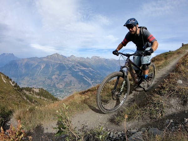
Chestnut Mountain is an absolute gem of a mountain bike ride that rightfully reigns as one of Bozeman's favorite rips.
The route shown here is a shuttle, but with a bit of paved road pedaling, you can connect the ends to form a loop ride. Even with a shuttle, there's a fair bit of climbing required to reach the summit of Chestnut Mountain—FATMAP claims 1,926 feet of climbing along this entire shuttle route, with 2,720 feet of descending.
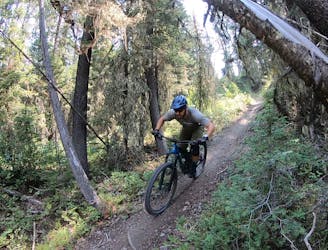
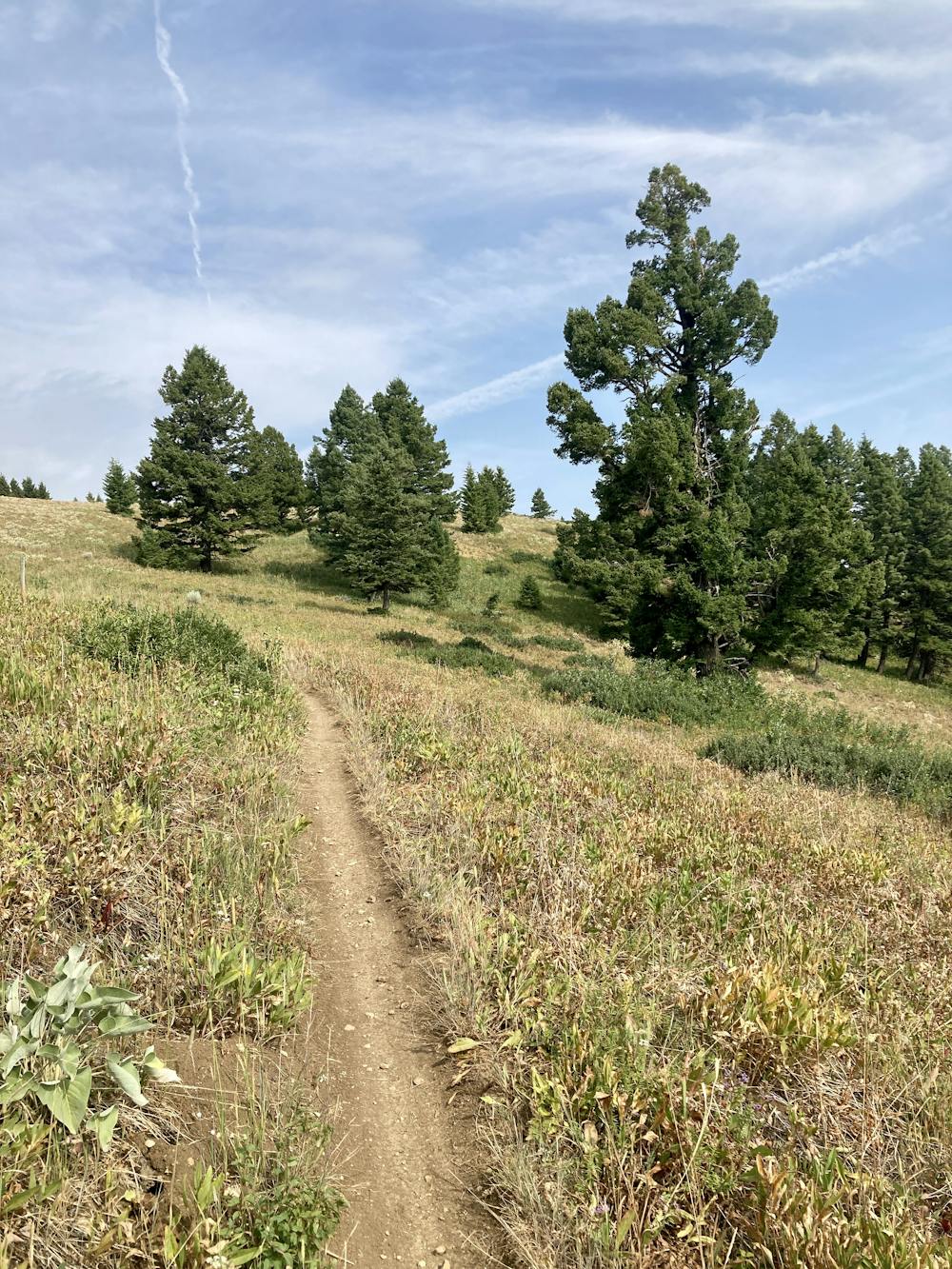
Even though you have to do a fair bit of work to earn the downhill, the singletrack is very climbable. It's well-built and appears to have been rerouted relatively recently to make it more sustainable and more pedalable.
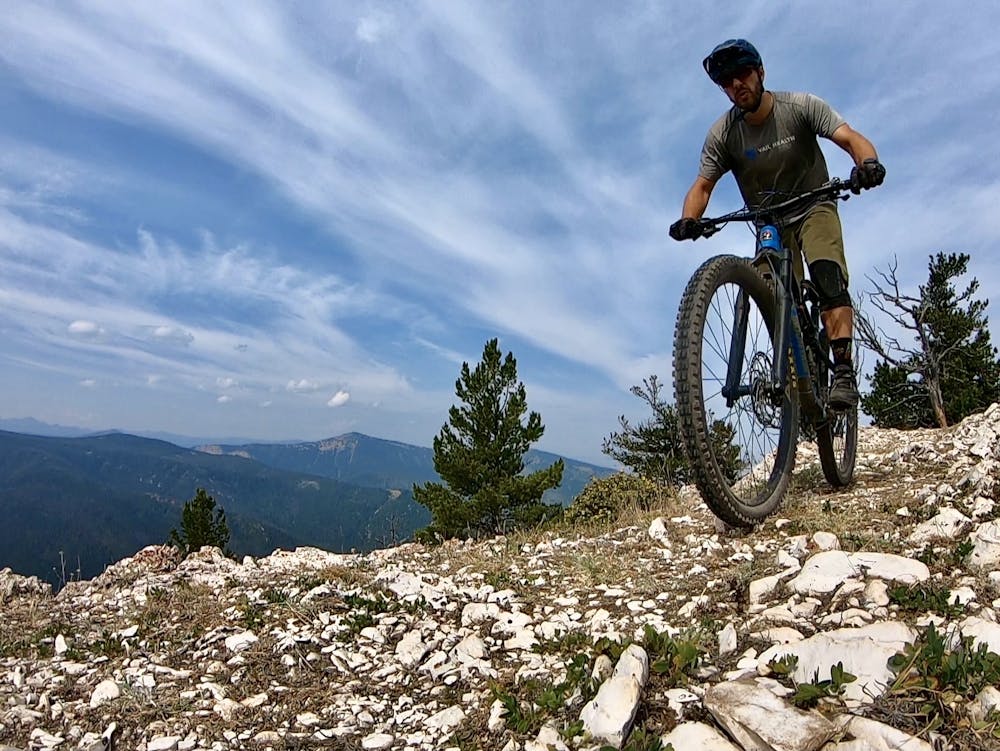
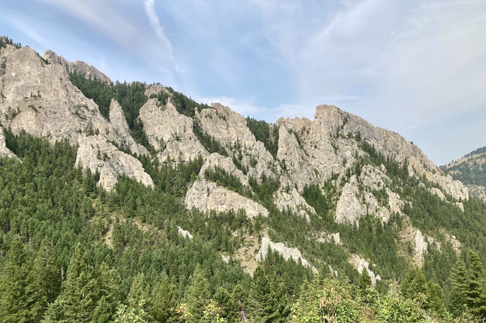
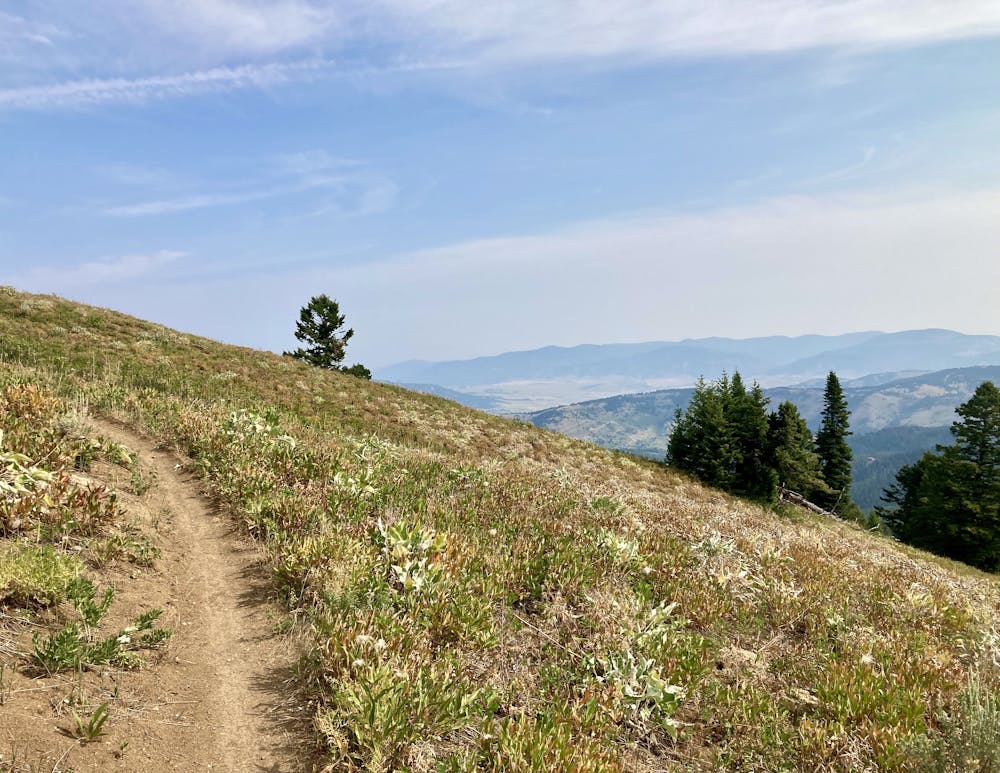
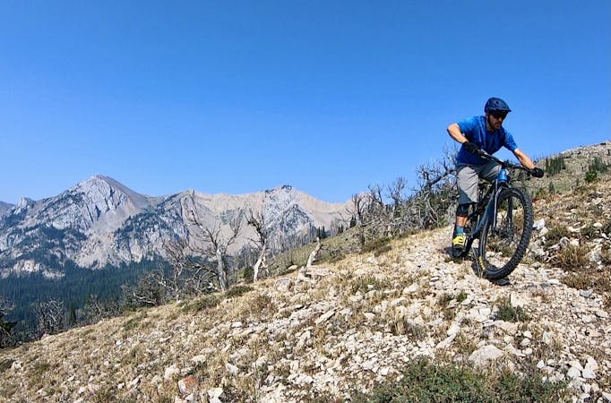
After a few minutes of climbing through the trees, you'll break out into alpine meadows that provide beautiful vistas to enjoy as you continue climbing. When you finally gain the top, you'll enjoy an incredible (almost) 360-degree view of the Gallatin Mountains surrounding you!
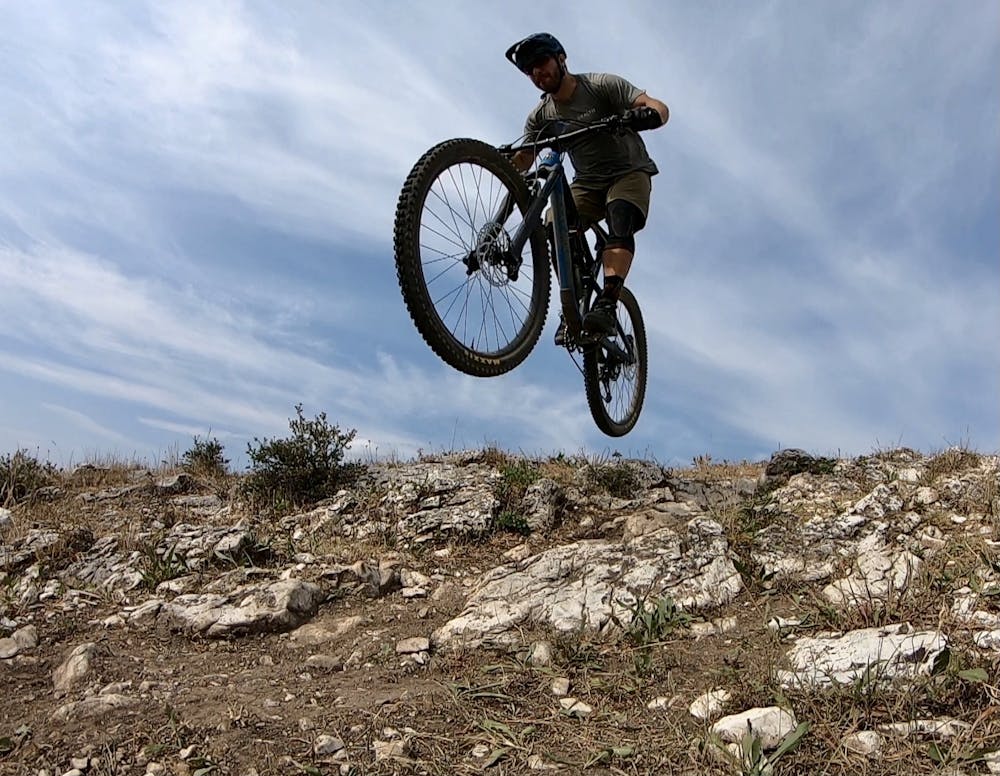
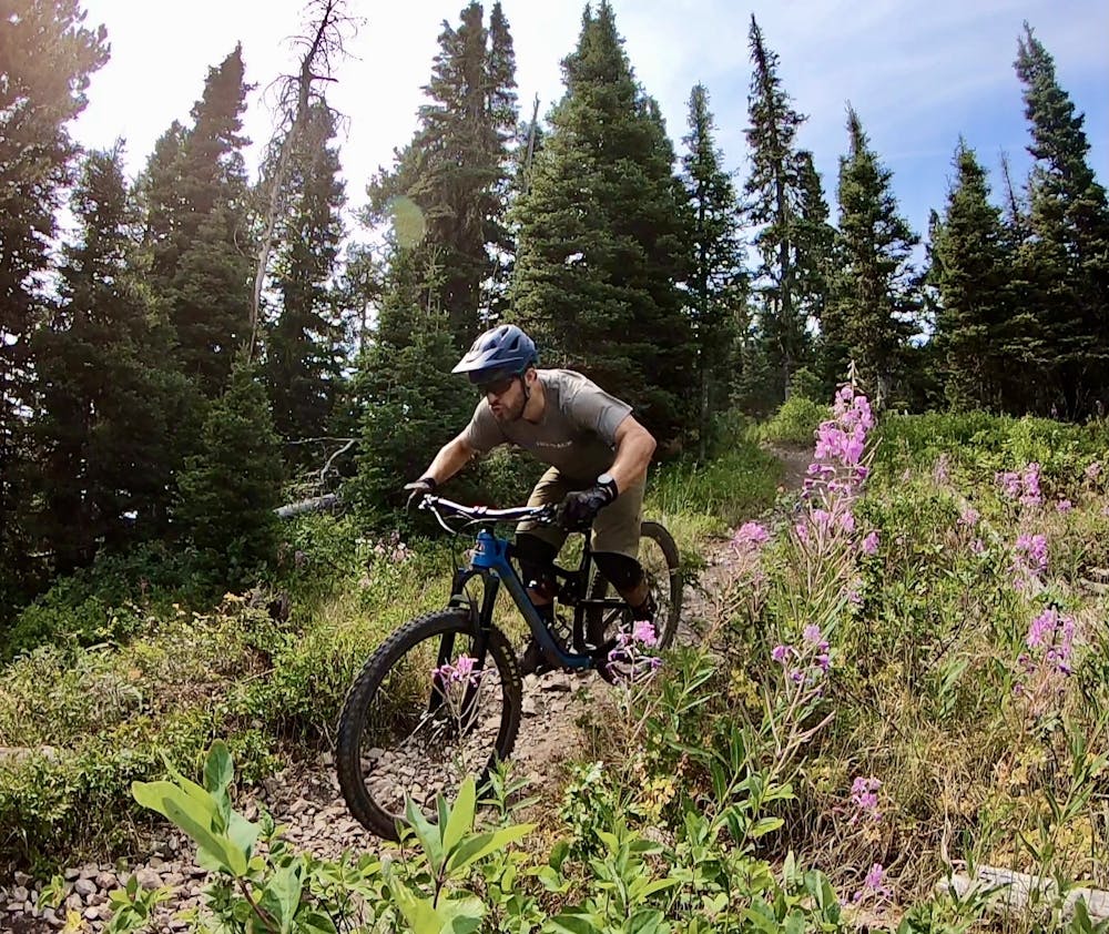
When it's time to descend, this singletrack drops fast and furious! This ripping descent offers wide-open singletrack and sightlines up high as you whip through beautiful meadows of wildflowers and rocket off rock drops. The trail consists of beautiful, narrow singletrack, requiring precise handling.
Lower down, the singletrack gets tighter, with shorter sightlines and switchbacks on the steeper side slope. You'll have to slow down a bit in this section, especially as you negotiate root webs, rock gardens, and exposed corners. A few of the corners are quite exposed over a canyon below, but of course, that exposure provides some fantastic vistas!
This trail is also a popular hike, with most hikers ascending from the lower trailhead near the interstate all the way to the top of Chestnut Mountain. Consequently, even though it's easy to get going fast on this descent, you'll need to ride heads-up and remember to yield to all hikers.
Note:
The Bozeman area is renowned as prime grizzly bear country. Signs at every trailhead warn that bears are highly active in the area. Mountain biking is considered a high-risk activity in grizzly bear country due to the quiet speed of a bicycle and how quickly you can accidentally sneak up on a bear when rounding a blind turn. To mitigate this risk, make plenty of noise while riding, try to ride with a group of people, and consider attaching a bear bell to your handlebars. Also, make certain that you carry bear spray with you every time you ride, in case you do get into an encounter with a grizzly.
Difficult
Mostly stable trail tread with some variability featuring larger and more unavoidable obstacles that may include, but not be limited to: bigger stones, roots, steps, and narrow curves. Compared to lower intermediate, technical difficulty is more advanced and grades of slopes are steeper. Ideal for upper intermediate riders.

Some trail sections have exposed ledges or steep ascents/descents where falling could cause serious injury.

Away from help but easily accessed.
5.3 km away
A fantastic backcountry loop on the Gallatin Front.
Severe Mountain Biking
11 routes · Mountain Biking
10 routes · Mountain Biking