5 routes · Mountain Biking
A popular loop with some very exposed singletrack.
Mountain Biking Difficult

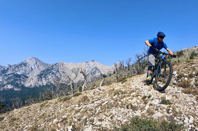
Garnet Mountain is located about halfway between Big Sky and the outskirts of Bozeman, making it one of the most popular backcountry mountain bike rides in the Southern Gallatins. The basic route is an 8-mile loop around the mountain combining dirt road, ATV trail, and fantastic singletrack. About halfway through the loop, you'll have the option to add on some bonus miles to reach the very top of the mountain via an out-and-back segment, as shown on this map. It's easy to skip over the extra additional stem if you're feeling tired or want a shorter ride.
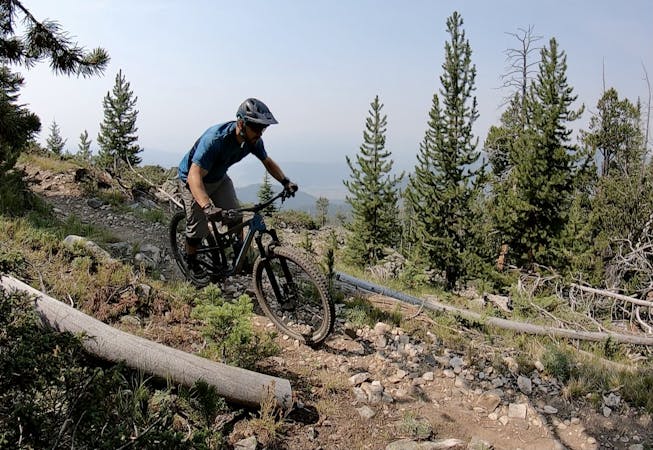
After departing the trailhead, you'll climb steadily up the dirt road, and then turn onto a section of ATV trail and keep climbing. Soon you'll reach fantastic singletrack, and the trail quality will improve dramatically. The views will also open up, with fantastic vistas of the canyon and the surrounding mountains.
If you choose to bike/hike to the summit, you'll discover an old fire lookout tower on top of the mountain. "The tower was built in 1930 and is available to rent for camping through the Montana Recreation Rental Program," according to OutsideBozeman.com.
The descent offers fast, wide-open singletrack that begs you to open it up, but ride cautiously, as some of the corners will tend to sneak up on you. Portions of this section of trail are also ultra-exposed.
"The trail isn’t overly technical, but where this trail earns its SCARY reputation is for its XXX rated exposure," writes Owen House Cycling. "Along several parts of the trail, especially near the top, the tight single track slices across some nearly vertical slopes. Its a 'no fall zone' for sure," they continue.
As long as you negotiate the exposed sections successfully, you'll have a blast on this fast, flowy descent!
Note:
The Big Sky area is renowned as prime grizzly bear country. Signs at every trailhead warn that bears are highly active in the area. Mountain biking is considered a high-risk activity in grizzly bear country due to the quiet speed of a bicycle and how quickly you can accidentally sneak up on a bear when rounding a blind turn. To mitigate this risk, make plenty of noise while riding, try to ride with a group of people, and consider attaching a bear bell to your handlebars. Also, make certain that you carry bear spray with you every time you ride, in case you do get into an encounter with a grizzly.
Sources: https://outsidebozeman.com/trails-tours/biking-trails/garnet-mountain-trail https://www.owenhousecycling.com/trail/garnet-mountain-trail/
Difficult
Mostly stable trail tread with some variability featuring larger and more unavoidable obstacles that may include, but not be limited to: bigger stones, roots, steps, and narrow curves. Compared to lower intermediate, technical difficulty is more advanced and grades of slopes are steeper. Ideal for upper intermediate riders.

Some trail sections are extremely exposed where falling will almost certainly result in serious injury or death.

Little chance of being seen or helped in case of an accident.
5 routes · Mountain Biking
11 routes · Mountain Biking