Daisy Pass Skin Track
Up Track to Daisy Pass
Ski Touring Easy
- Distance
- 7.6 km
- Ascent
- 9 m
- Descent
- 804 m
- Duration
- 1-2 hrs
- Low Point
- 2.3 km
- High Point
- 3.1 km
- Gradient
- 36˚
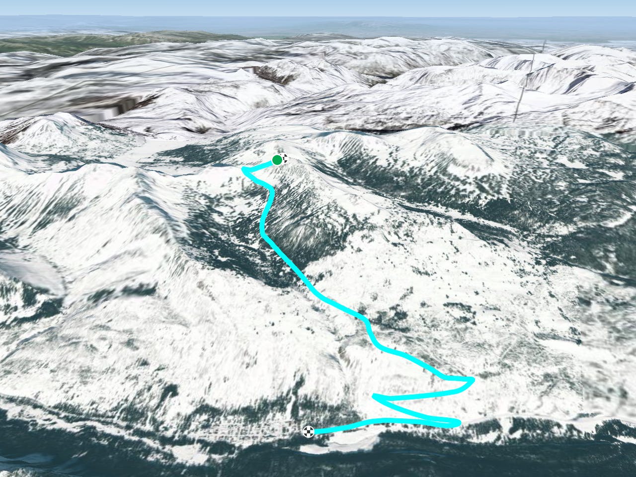
This is a popular ski touring route which is generally considered to be easy. It's remote, it features unknown exposure and is typically done between October and June. From a low point of 2.3 km to the maximum altitude of 3.1 km, the route covers 7.6 km, 9 vertical metres of ascent and 804 vertical metres of descent. It's graded 1.2 and Labande grade 1. You'll need skins to complete it safely.
Description
Skin Track along a road.
Difficulty
Easy
Wide gentle slopes at around 20 degrees or less.
Remoteness

Away from help but easily accessed.
Best time to visit
Features
- Walk Required
Equipment required
- Skins