Dawson Pitamakan Loop
Glacier National Park (USA)
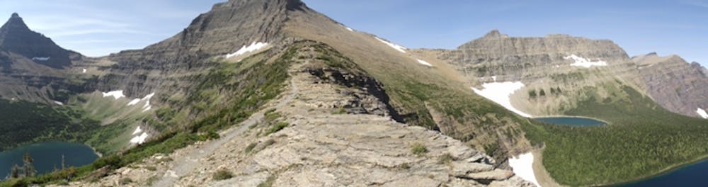
High alpine loop in Glacier National Park
Trail Running Difficult
- Distance
- 31 km
- Ascent
- 1.2 km
- Descent
- 1.2 km
- Duration
- 5-6 hrs
- Low Point
- 1.6 km
- High Point
- 2.5 km
- Gradient
- 10˚

This is a popular trail running route which is generally considered to be difficult. It's remote, it features medium exposure and is typically done between July and September. From a low point of 1.6 km to the maximum altitude of 2.5 km, the route covers 31 km, 1225 vertical metres of ascent and 1221 vertical metres of descent.
Description
The Pitamakan/Dawson loop is a route with over 3,300 feet of elevation gain, with mind-blowing, panoramic views and varied terrain including some exposed ridge lines.
Difficulty
Difficult
Medium Exposure

The trail contains some obstacles such as outcroppings and rock which could cause injury.
Remoteness
Away from help but easily accessed.