3.4 km away
Emerald Lake and Heather Lake
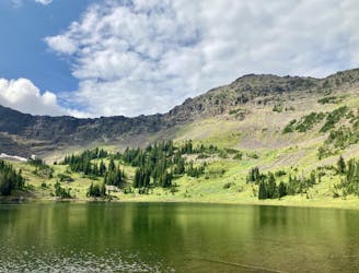
Run to two of the most beautiful lakes above Bozeman.
Difficult Trail Running
- Distance
- 18 km
- Ascent
- 676 m
- Descent
- 676 m
One of the most famous trails near Bozeman, passing numerous waterfalls and leading to a beautiful alpine lake.
Trail Running Difficult

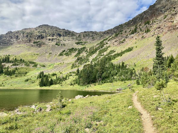
The Hyalite Creek Trail follows the banks of a rushing mountain stream, crossing it multiple times as it works its way up to Hyalite Lake, high in the mountains above. This trail is an absolutely stunning run through a canyon! Along the way, it passes some 11 waterfalls, which are all worth checking out.
The climb up the canyon is consistent, gaining a stiff 2,200 vertical feet in about 5.5 miles. The trail requires some steep climbing as you traverse rock gardens and roots. When the water is high in the springtime, the creek crossings can be deep and fast.
At the 5.5-mile mark, you'll reach Hyalite Lake, tucked in a beautiful alpine cirque. This is a great spot to stop, have lunch, and enjoy the incredible views. It's also the noted turnaround point for this route. While you can continue on to climb Hyalite Peak, the trail leading to the summit gets dramatically steeper and rougher.
After enjoying your time at the lake, turn around and head back down to your car the way you came.
Note 1:
This trail is on a "shared use" schedule, which bans mountain bikes from the trail on Fridays and Saturdays from July 16th until September 4th. If you're looking for a bike-free running experience, aim to hit the trail on Friday or Saturday.
Note 2:
The Bozeman area is renowned as prime grizzly bear country. Signs at every trailhead warn that bears are highly active in the area. To mitigate the risk of bear encounters, make plenty of noise while running, try to travel with a group of people, and consider attaching a bear bell to your backpack. Also, make certain that you carry bear spray with you every time you run, in case you do get into an encounter with a grizzly.
Difficult

The trail contains some obstacles such as outcroppings and rock which could cause injury.

Little chance of being seen or helped in case of an accident.
3.4 km away
Run to two of the most beautiful lakes above Bozeman.
Difficult Trail Running
7 routes · Trail Running