Alpine Lakes Loop
Hike among ancient trees to two tranquil lakes at the foot of Wheeler Peak.
Moderate Hiking
- Distance
- 4.3 km
- Ascent
- 145 m
- Descent
- 145 m
Ponder the passage of time among ancient and enduring trees, and witness an age-old glacier that may be on its way out.
Hiking Moderate

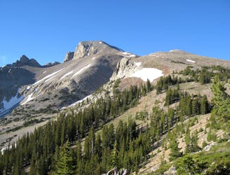
Great Basin National Park is well known for bristlecone pine trees, which are some of the oldest living organisms on the planet. They subsist in rocky alpine soils, expanding minutely in each short growing season, but enduring for thousands of years. Ages of brutal winters contort these trees into improbable shapes, with sprawling roots and twisted trunks that seem carved from the stone they sprout from.
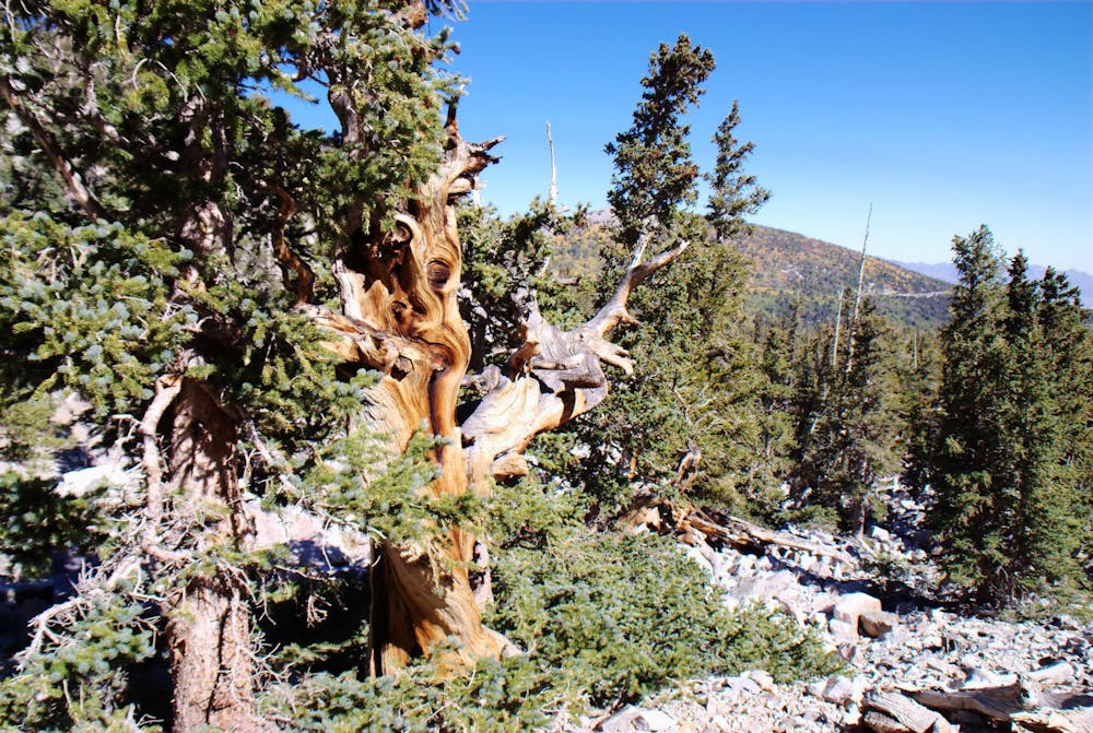
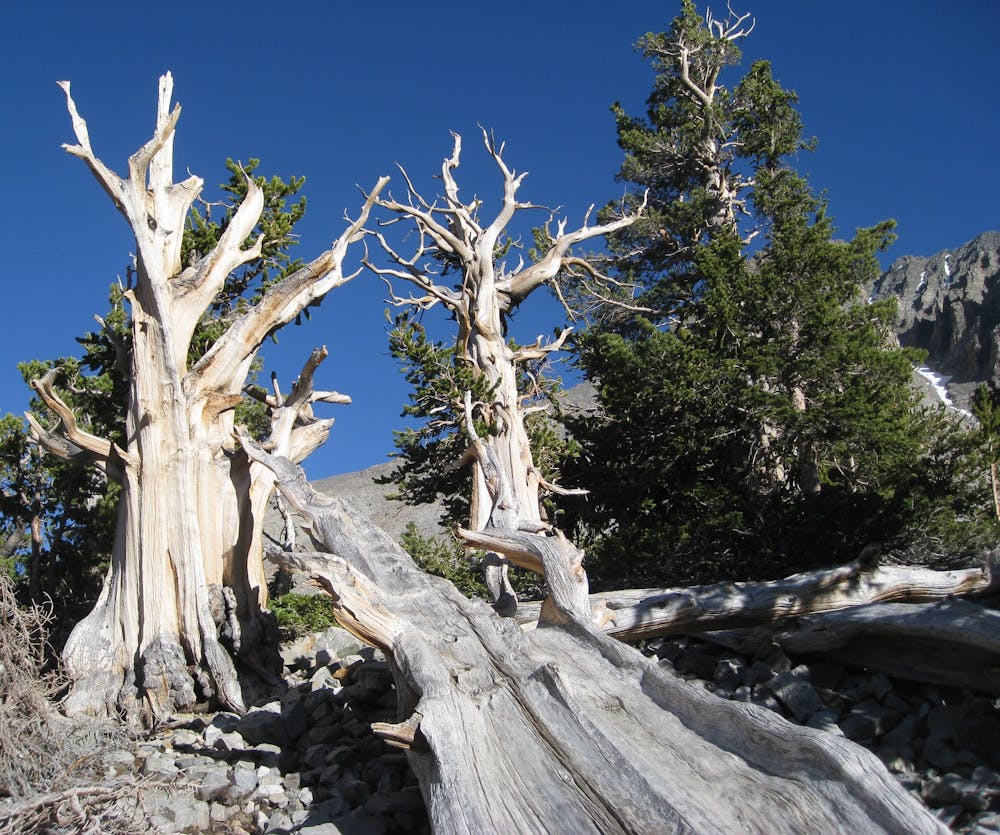
One tree on the slopes of Wheeler Peak was discovered to be 4,900 years old. That one, named Prometheus, was cut down years ago, but you can walk among its long-lived cousins on the Bristlecone Trail. This may be the national park’s most popular hike, and it’s a must-do to see what makes the Great Basin ranges so special. These mountains are one of few remaining strongholds for the ancient trees.
The well-marked trail goes steadily uphill through a forest of various conifers. The bristlecone grove comes after about a mile, and with it comes expansive views among the generously spaced old trees. There’s a short interpretive loop, where signs share facts about the bristlecones, and note historical events that really put their age into perspective.
Note: It's important to stay on designated trails within the grove, to protect the soil and the trees. Foot erosion has already killed some of the bristlecones by exposing their finer roots.
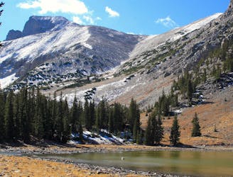
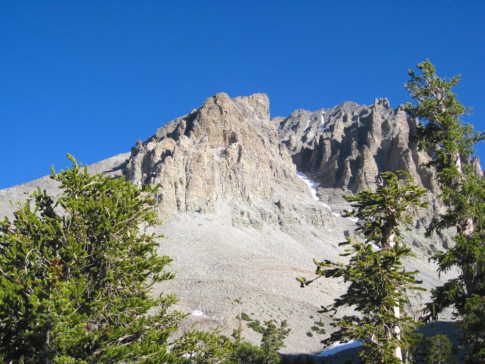
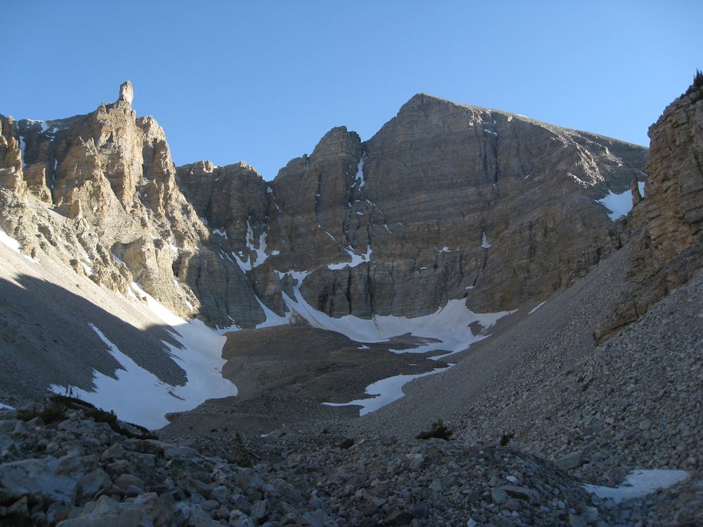
The trail continues beyond the grove, higher into the rock-strewn valley with the cliffs of Wheeler Peak looming ahead. Within this cirque above the timberline is Wheeler Peak Glacier. It's the only glacier left in Nevada, and is now a mere remnant of the force that carved this valley throughout past ice ages. You won’t find the mass of white ice you might expect, however. Instead, this is what’s called a rock glacier, comprised mostly of boulders and mud that are frozen together. It’s all that’s left of a glacier in retreat, which may soon be gone completely. You can tell the outline of the rock glacier by its relief from the surrounding terrain. The trail fades into the talus beneath the toe of the glacier, but you can proceed and walk onto it. Just beware that rocks may be unstable.
Sources: https://www.nps.gov/grba/planyourvisit/identifying-bristlecone-pines.htm https://www.nps.gov/grba/learn/nature/glaciers.htm https://www.jmpeltier.com/great-basin-bristlecone-pine-trail/
Moderate
Hiking along trails with some uneven terrain and small hills. Small rocks and roots may be present.

The trail contains some obstacles such as outcroppings and rock which could cause injury.
Away from help but easily accessed.
Hike among ancient trees to two tranquil lakes at the foot of Wheeler Peak.
Moderate Hiking
842 m away
An alpine hike to the highpoint of Great Basin National Park, and the second-tallest mountain in Nevada.
Difficult Hiking
6.5 km away
Hike through shady timber and over an airy ridge, linking two alpine lakes in the Great Basin backcountry.
Difficult Hiking

5 routes · Hiking

63 routes · Alpine Climbing · Hiking