
58 routes · Hiking
A beautiful segment of the AT, summiting the final 4,000-footers in New Hampshire before heading into Maine.
Also in Maine, United States of America
Hiking Severe

This segment of the Appalachian Trail begins at the Pinkham Notch Visitor Center, due east of the Presidential Range. This large trailhead makes this a popular hub to access the highest peak in the northeast, Mount Washington.
To head north on the AT, cross the road and follow the Lost Pond Trail south towards to the Wildcat Ridge Trail. At the junction, you can access Glen Ellis Falls, a popular destination due to its proximity to the road and ease of access.
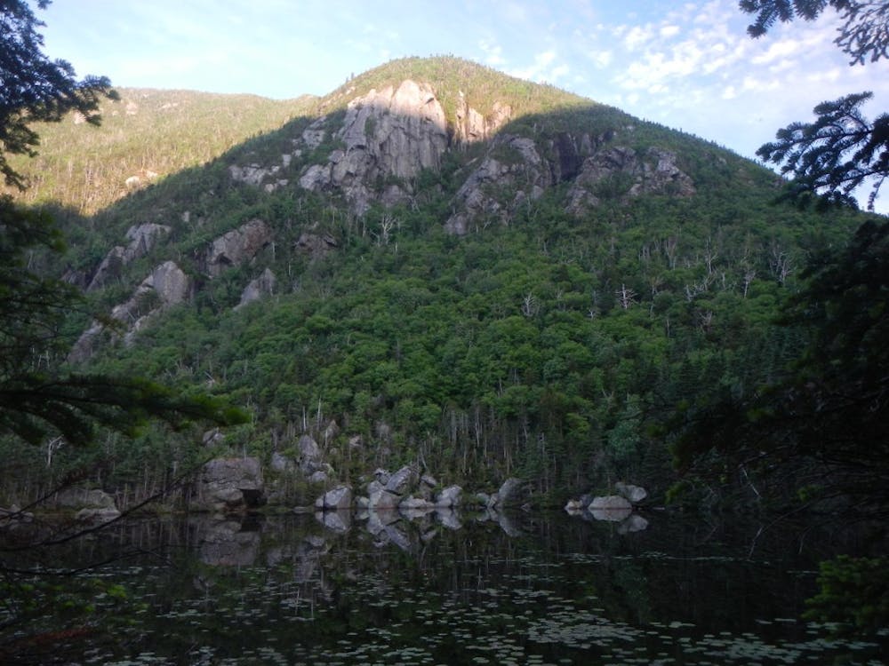
A strenuous climb up Wildcat Ridge leads to a series of summits, labeled A to D. The official summit of Wildcat Mountain is near the "A Peak" and offers phenomenal views of Carter Notch. A brief—but steep—descent lies ahead.
At the bottom, the AT meets two trails near the pond, and a spur leads to the Carter Notch Hut. Open year-round, this hut is just shy of four miles from the trailhead and serves as a popular destination to spend the night. For reservations, amenities, and availability, visit www.outdoors.org.
Ahead, the white-blazed AT heads to Carter Dome and Mount Hight. According to Wikipedia, "the origins of Carter Dome's name is unknown. Local folklore suggests that it was named after a hunter named Carter, while a neighboring peak is named after his hunting partner, Hight."
Though considered a secondary summit to Carter Dome, Mount Hight is renowned for having the best views along this ridge.
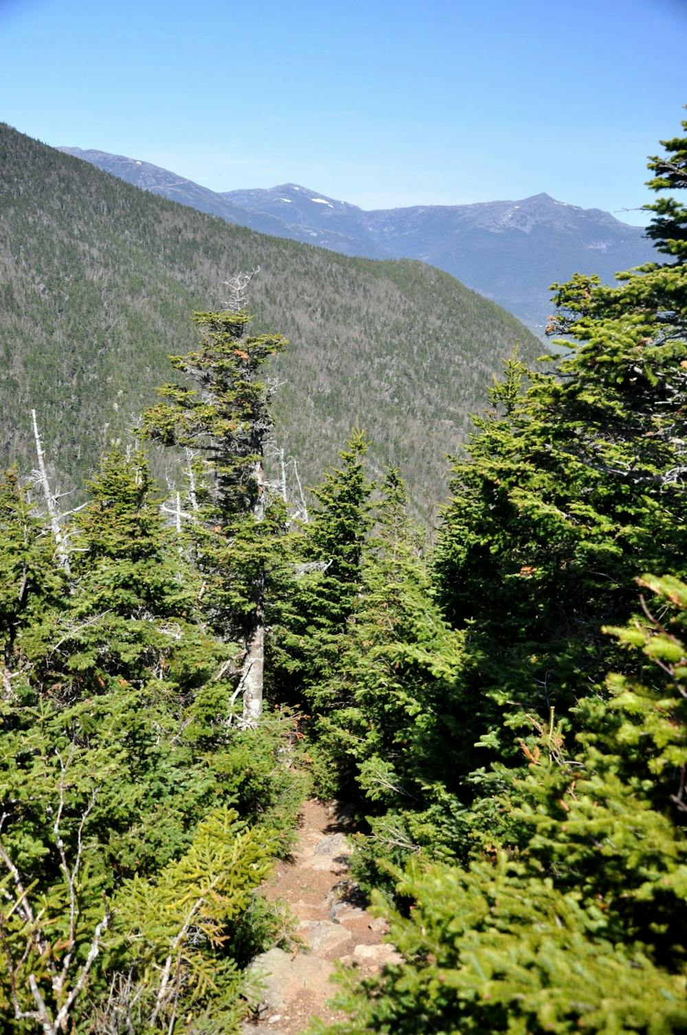
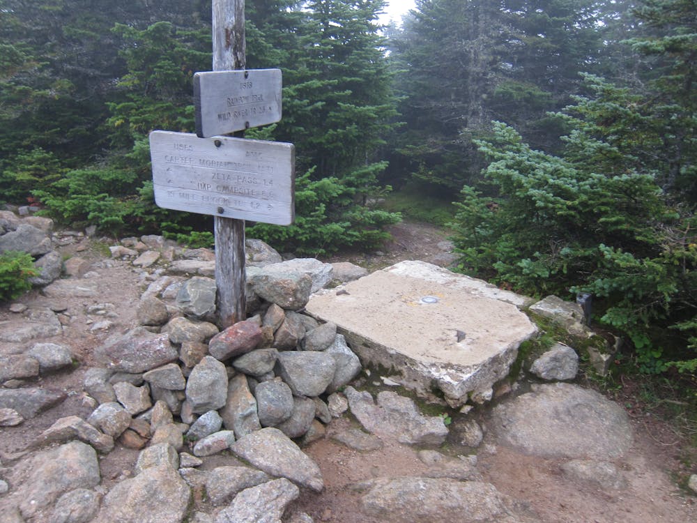
Continuing north, summit Middle Carter and North Carter Mountains on your way to Imp Mountain. A campsite and shelter lie on the northeast side of the mountain.
Mount Moriah, the last 4,000-footer along the ridge, lies ahead and offers a breathtaking view. Take the opportunity to soak in the scenery before descending to US-2 and leaving the boundary of the White Mountain National Forest.
Multiple camping or lodging opportunities lie along the road, and a small trailhead serves as a popular access point for the AT. If necessary, take this opportunity to resupply in town as the next portion of the trail heads into remote backcountry.
Head north along the road across the dam, then turn left onto Hogan road. Look for a white blaze on the right side of the road where the trail spurs off.
Next, the AT spirals atop a ridge, offering an optional summit of Mount Hayes before continuing north to Cascade Mountain. In the area, you'll find some partial views, but none as commanding as the exposed summits in the Whites.
Heading northeast, the trail makes its way to Maine, crossing a few picturesque high points along the way. Soon after crossing the state line, the trail summits Mount Carlo, Goose Eye Mountain, and a couple of smaller peaks as it makes its way to Old Speck Mountain. A short spur trail leads to the official summit, the fourth-highest peak in the state and the highest in the Mahoosuc Range.
Ahead, the trail descends to Grafton Notch and a popular trailhead along the road. For a short hike, pair the AT with the Eyebrow Trail to form a loop from the road.
Sources: https://en.wikipedia.org/wiki/OldSpeckMountain https://en.wikipedia.org/wiki/MountHight https://en.wikipedia.org/wiki/CarterDome https://www.outdoors.org/lodging-camping/huts/carter https://www.backpacker.com/trips/appalachian-trail-pinkham-notch-visitor-center-to-hogan-road https://www.outdoors.org/trip-ideas-tips-resources/plan-your-trip/nh-4000-footers/hiking-wildcat-mountain
Severe
Hiking challenging trails where simple scrambling, with the occasional use of the hands, is a distinct possibility. The trails are often filled with all manner of obstacles both small and large, and the hills are very steep. Obstacles and challenges are often unexpected and can be unpredictable.

Some trail sections have exposed ledges or steep ascents/descents where falling could cause serious injury.
Little chance of being seen or helped in case of an accident.
58 routes · Hiking