9.6 km away
The Presidential Traverse
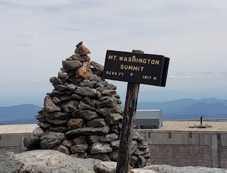
One of the greatest hikes in White Mountains of New Hampshire.
Severe Hiking
- Distance
- 32 km
- Ascent
- 2.8 km
- Descent
- 2.6 km
Traverse of the Moriah Carter and Wildcat Peaks.
Hiking Severe

This is a popular hiking route which is generally considered to be severe. It's remote, it features high exposure and is typically done between May and October. From a low point of 238 m to the maximum altitude of 1.5 km, the route covers 28 km, 2409 vertical metres of ascent and 2032 vertical metres of descent.
A hike that me and my friends did over the course of two nights. Very challenging but totally worth it.
Severe
Hiking challenging trails where simple scrambling, with the occasional use of the hands, is a distinct possibility. The trails are often filled with all manner of obstacles both small and large, and the hills are very steep. Obstacles and challenges are often unexpected and can be unpredictable.

Some trail sections have exposed ledges or steep ascents/descents where falling could cause serious injury.

Away from help but easily accessed.
9.6 km away
One of the greatest hikes in White Mountains of New Hampshire.
Severe Hiking

10 routes · Hiking