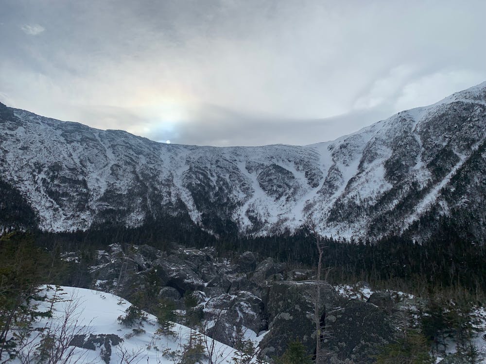
King Ravine (approach)
A dramatic glacial cirque with a difficult approach.
Ski Touring Severe
- Distance
- 5 km
- Ascent
- 798 m
- Descent
- 1 m
- Duration
- 3-4 hrs
- Low Point
- 397 m
- High Point
- 1.2 km
- Gradient
- 26˚

King Ravine is a massive glacial cirque, with multiple couloirs and beautiful scenery. While it makes a great backcountry ski objective, getting there will not come without it's challenges. From the trailhead, take the Valley Way Trail for 0.1 miles to Airline Trail. After 0.4 miles, take a right onto Short Line Trail. From here it is lightly trafficked, so you may need to break trail. Follow short line for 1.6 miles to King Ravine Trail. from here, the trail becomes steep and narrow, so you may need to remove skis. After 0.3 miles, you will reach the boulder field. This provides a scenic view of the whole ravine and a place scope possible ski objectives. Navigating the boulder field will be quite difficult in any season, it is easy to lose the trail in this maze of car sized rocks. Try your best to stick to the lookers left side, then connect with the Great Gully Trail, which will take you into the heart of the ravine. The terrain here is very different than Tuckerman Ravine. It's bigger, steeper and more committing. Some chutes have ice bulges you may not be able to skirt. You will need to be exceptional in your ability to assess the snowpack. On the right day, King Ravine can be an incredible adventure, but it's a dangerous place.
Difficulty
Severe
Steep skiing at 38-45 degrees. This requires very good technique and the risk of falling has serious consequences.
Medium Exposure (E2)

As well as the slope itself, there are some obstacles (such as rock outcrops) which could aggravate injury.
Remoteness

Little chance of being seen or helped in case of an accident.
Best time to visit
Features
- Alpine
- Tree Skiing
- Single Descent
Equipment required
- Skins
- Crampons