0 m away
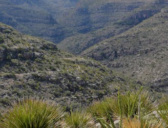
Slaughter Canyon Cave
A rugged, yet short hike with excellent views of Slaughter Canyon.
Difficult Hiking
- Distance
- 1.7 km
- Ascent
- 148 m
- Descent
- 148 m
A rugged backcountry hike for anyone seeking solitude.
Hiking Difficult

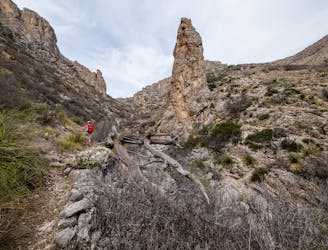
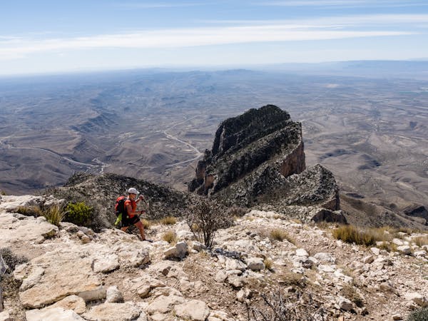
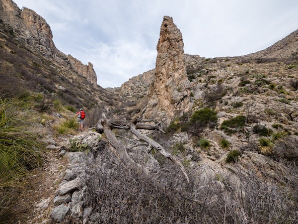
The Slaughter Canyon Trail is a rugged backcountry trail that connects to the Guadalupe Ridge Trail, a 100-mile National Recreation Trail (NRT) that follows the spine of the Guadalupe Mountains into Texas. Though overnight camping is not allowed on Slaughter Canyon, limited camping is available on the Guadalupe Ridge Trail with the appropriate backcountry permits. Along the way, take note of juniper, prickly pear cactus, mesquite, and even green sotol that paint the landscape with dull tan, green, and red hues.
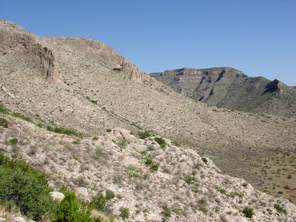
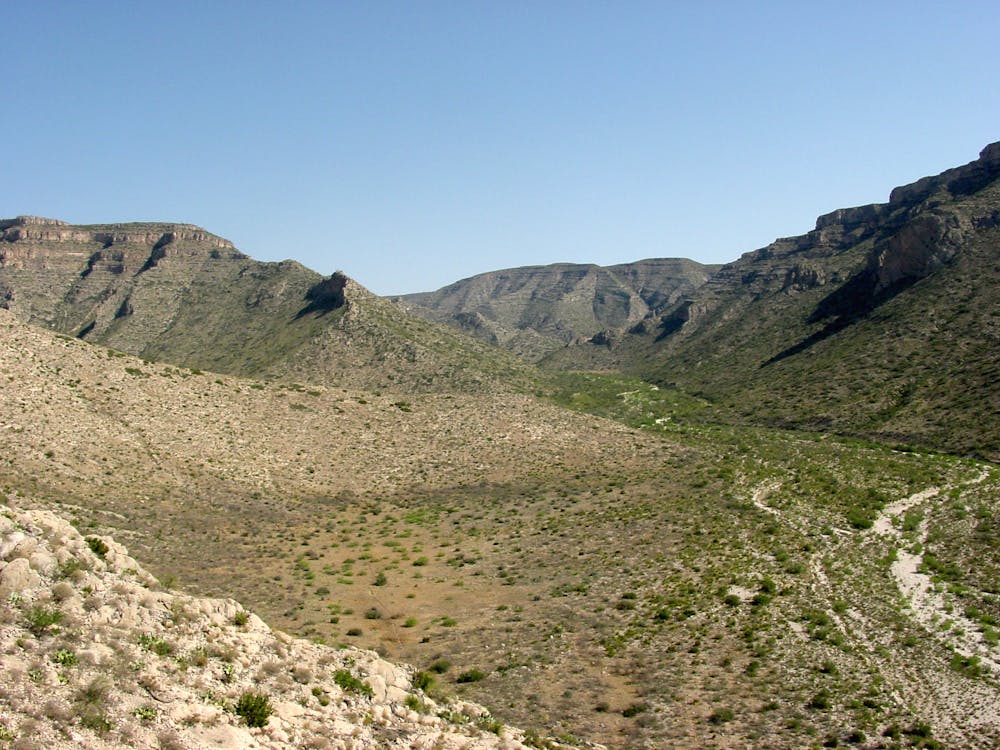
As mapped, this is the most recent iteration of the trail, which is rumored to have changed over time. The trail offers plenty of nice views, but no particular destination other than the Guadalupe Ridge Trail. Hike as little - or as far - as you'd like, but pay close attention to your map to make sure you don't get too far off trail. The route mostly follows the wash through the middle portion of the canyon, but climbs up to the ridge before connecting to the ridge.
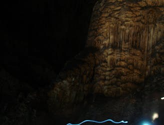
The trailhead, which has vault toilets only, is shared with Slaughter Canyon Cave Trail, a shorter hike leading to an overlook of the cave. Other than this day hike, ranger-guided cave tours are a popular activity. "Highlights of the tour may include the 89-foot high Monarch, one of the world's tallest columns; the Christmas Tree, a sparkling, crystal-decorated column; and the Chinese Wall, a delicate, ankle-high rimstone dam." Those interested can call 877-444-6777 or visit Recreation.gov for reservations. The 5.5-hour tour costs $15 for adults and $7.50 for children.
Sources: https://www.stavislost.com/hikes/trail/middle-slaughter-canyon-trail-to-guadalupe-ridge https://www.nps.gov/cave/planyourvisit/slaughtercanyoncavetour.htm https://www.nps.gov/cave/slaughter-canyon-cave-trail.htm https://www.nps.gov/cave/learn/nature/treesandshrubs.htm
Difficult
Hiking trails where obstacles such as rocks or roots are prevalent. Some obstacles can require care to step over or around. At times, the trail can be worn and eroded. The grade of the trail is generally quite steep, and can often lead to strenuous hiking.

The trail contains some obstacles such as outcroppings and rock which could cause injury.

Little chance of being seen or helped in case of an accident.
0 m away
A rugged, yet short hike with excellent views of Slaughter Canyon.
Difficult Hiking
2.7 km away
A backcountry hike up a narrow canyon.
Moderate Hiking
8.3 km away
A 6-mile backcountry hike off of Desert Loop Road with striking views and diverse plant life.
Moderate Hiking
10 routes · Hiking
7 routes · Hiking

63 routes · Alpine Climbing · Hiking