Truchas Peak: Southern Approach
A lengthy hike to the second-tallest peak in New Mexico.
Hiking Difficult
- Distance
- 36 km
- Ascent
- 1.7 km
- Descent
- 1.7 km
- Duration
- 1 day +
- Low Point
- 2.7 km
- High Point
- 4 km
- Gradient
- 17˚

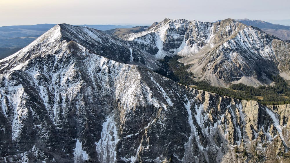
Vaulted Truchas Peak ranks as the second-tallest mountain in New Mexico behind Wheeler Peak. However, the 13,102-foot mountain summit receives almost zero traffic compared to the crowds that descend on Wheeler every day. Naturally, people most often want to hike the state's high point, but the crowds are further limited by the difficulty of reaching Truchas Peak (aka South Truchas).
Description
Routes approach Truchas from the West, the North, and the South. Some reports suggest that the Western route is the most popular, while others recommend the Southern approach. The route mapped here is the Southern approach, which begins from the Jacks Creek Horse Camp trailhead, which is relatively easy to reach by car.
This lengthy hike covers 22 miles round-trip, but it has a relatively mellow gradient for that distance, only climbing and descending about 5,440 vertical feet. Even still, at 22 miles this will be a backpacking trip for most people, and a day hike or trail run for only the hardiest of adventurers.
While this is a long day out, SummitPost.org notes that this approach provides the opportunity to bag Pecos Baldy and East Pecos Baldy on the way up to South Truchas.
Despite the difficulty of the approach, this is indeed a worthy mountain summit! "The Truchas group is truly a beautiful group of mountains," writes Dsnell on SummitPost.org. "Unlike many of the broad, dome-shaped mountains of northern New Mexico, the Truchas mountains are craggy, steep mountains that are more reminiscent of their neighbors to the north in Colorado. The easiest route to the summit is only a class 3 route, but many more difficult routes could be developed in this mountain group."
Difficulty
Difficult
Hiking trails where obstacles such as rocks or roots are prevalent. Some obstacles can require care to step over or around. At times, the trail can be worn and eroded. The grade of the trail is generally quite steep, and can often lead to strenuous hiking.
Medium Exposure

The trail contains some obstacles such as outcroppings and rock which could cause injury.
Remoteness

In the high mountains or remote conditions, all individuals must be completely autonomous in every situation.
Best time to visit
Features
- Alpine