5.5 km away
Alien Run: Short Loop
Hike the most scenic of the Alien Run trails.
Easy Hiking
- Distance
- 11 km
- Ascent
- 134 m
- Descent
- 134 m
Short hike to a UFO crash site!
Hiking Easy

The Alien Run Trail System gets its name from a UFO crash landing that happened at this site in 1948. This short, easy hike leads directly to the UFO crash site, where you're able to experience the mystery for yourself.
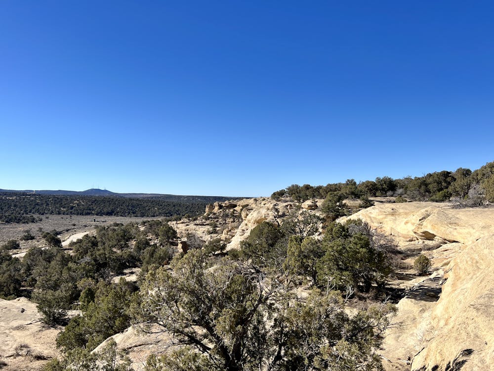
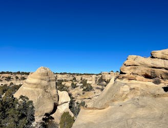
The hike out to the site is mostly-flat, following a beautiful desert singletrack trail. You'll enjoy the opportunity to gain beautiful views off of an elevated sandstone rock rim. The scenery is stunning, and the desert is immersive... just try to ignore the constant hum of oil wells dotting the region.
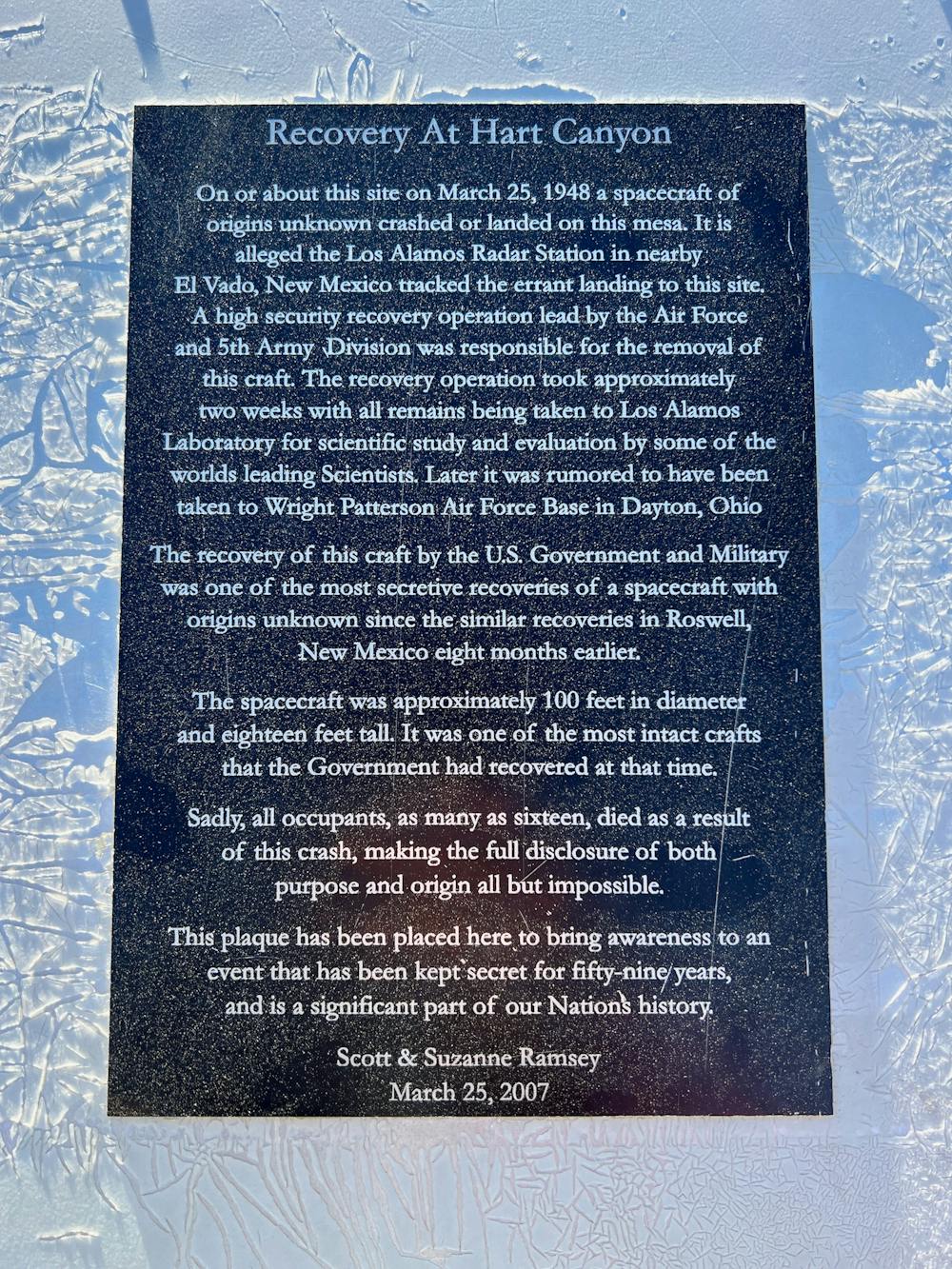
When you reach the UFO crash site, you'll be able to enjoy rock stacks and rock art left by previous visitors, as well as a historical plaque with a brief history of the crash and recovery. The plaque reads:
"Recovery at Hart Canyon
On or about this site on March 25, 1948, a spacecraft of origins unknown crashed or landed on this mesa. It is alleged the Los Alamos Radar Station in nearby El Vado, New Mexico, Tracked the errant landing to this site. A high security recovery operation lead sic by the Air Force and 5th Army Division was responsible for the removal of this craft. The recovery operation took approximately two weeks, with all remains being taken to Los Alamos Laboratory for scientific study and evaluation by some of the worlds sic leading Scientists. sic Later it was rumored to have been taken to Wright Patterson Air Force Base in Dayton, Ohio.
The recovery of this craft by the U.S. Government and Military sic was one of the most secretive recoveries of a spacecraft with origins unknown since the similar recoveries in Roswell, New Mexico, eight months earlier.
The spacecraft was approximately 100 feet in diameter and eighteen feet tall. It was one of the most intact crafts that the Government sic had recovered at that time.
Sadly, all occupants, as many as sixteen, died as a result of this crash, making the full disclosure of both purpose and origin all but impossible.
This plaque has been placed here to bring awareness to an event that has been kept secret for fifty-nine years, and is a significant part of our Nations sic history.
Scott & Suzanne Ramsey March 25, 2007"
The plaque opens up more questions than it answers. How do Scott and Suzanne Ramsey know how large the craft was? How do they know how many occupants it had? How do they know definitively that all the occupants died in the crash?
We may never know...
Easy
Walking along a well-kept trail that’s mostly flat. No obstacles are present.

The path is on completely flat land and potential injury is limited to falling over.

Away from help but easily accessed.
5.5 km away
Hike the most scenic of the Alien Run trails.
Easy Hiking

4 routes · Mountain Biking · Hiking