8.2 km away
Red Mesa

Technical rock slab riding in the desert that can sometimes be tricky to navigate.
Severe Mountain Biking
- Distance
- 5.6 km
- Ascent
- 103 m
- Descent
- 103 m
A serpentine network of rocky outcrops, smooth singletrack, and exotic colors.
Mountain Biking Difficult

Tucked away in rugged and scenic country southwest of the community of San Ysidro, New Mexico, is the White Ridge Bike Trails Area. To the west is the designated Ojito Wilderness.
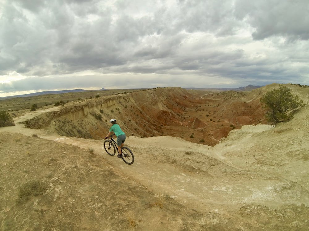
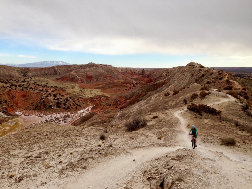
White Mesa/Ridge is one of the most bizarre, lovely, and fun places to ride in New Mexico. The trail is a serpentine network of rocky outcrops, smooth, natural singletrack, and exotic colors. Here, the geology of the land is on full display. Within this unique geological landscape are 15 miles of bike trails designed for both beginner and expert riders.
This route describes the best of the trails offered here, and is more suited to intermediate riders and above. Beginners will find this particular loop difficult, challenging, and may spend some time off the bike. Intermediate riders will absolutely love this route.
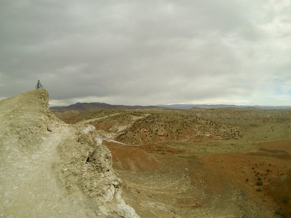
Technically this route can be ridden clockwise or counterclockwise but the route described here, counterclockwise, is preferable. You will be rewarded with incredible 360-degree views of the New Mexico landscape from atop the gypsum trails.
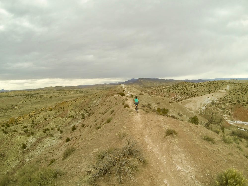
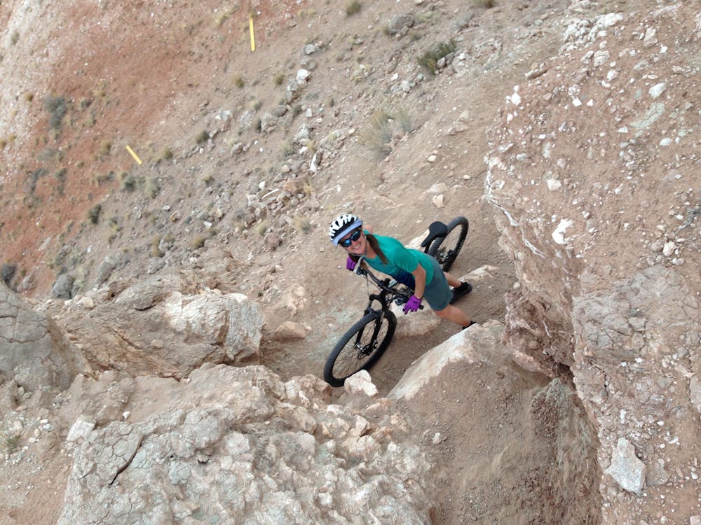
The western leg of the outer loop (the Dragon’s Back), which you will do first, crosses rolling alluvial fill, skirting tilted beds of sandstone and mudstone. Towards the end of Dragon's Back, there is a short section where you will need to hike and carry your bike up loose sandstone, scrambling up about 7m.
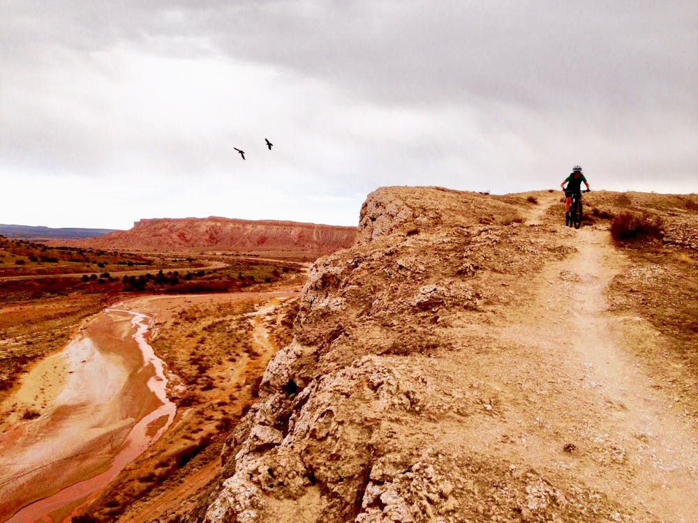
The less extreme (but still challenging) east leg offers a thrilling ride on the high, narrow gypsum mesa ridges of the Tierra Amarilla Anticline. It traverses a central valley composed of red-brown Triassic period rocks and a surrounding rimrock composed of grey-white Jurassic period gypsum.
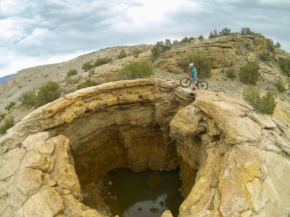
Be sure not to miss the two hot spring pools a third of the way into the east leg. The second is the biggest, with a depth of 7m. It is not advisable to enter the water!
There are several segments of narrow trails with exposed, steep sides falling away from you, drops, gullies, loose shale, and numerous obstacles that provide challenges.
While the loop may take a seasoned rider under an hour to complete, the drive out to this trail system is worth the effort.
It's best ridden in late fall, winter, or spring to avoid excessive heat or lightning.
Difficult
Mostly stable trail tread with some variability featuring larger and more unavoidable obstacles that may include, but not be limited to: bigger stones, roots, steps, and narrow curves. Compared to lower intermediate, technical difficulty is more advanced and grades of slopes are steeper. Ideal for upper intermediate riders.

Some trail sections are extremely exposed where falling will almost certainly result in serious injury or death.
In the high mountains or remote conditions, all individuals must be completely autonomous in every situation.
8.2 km away
Technical rock slab riding in the desert that can sometimes be tricky to navigate.
Severe Mountain Biking

37 routes · Mountain Biking

25 routes · Mountain Biking

22 routes · Mountain Biking · Hiking · Trail Running