
22 routes · Mountain Biking · Hiking · Trail Running
The Winsor Trail is a mostly non-technical downhill romp into Santa Fe.
Mountain Biking Moderate

If you're looking for a screaming fast and mostly non-technical downhill romp, then Santa Fe's Winsor trail is just the ticket. This trail drops over 3,000 vertical feet in just under nine miles, and it does so with little in the way of threat to a less-than-expert rider.
While some hardy souls will loop this with a major pavement climb, or even climb the trail itself for an epic out-and-back, most choose to shuttle it so they can be fresh enough to fully enjoy the absolute screamer of a downhill. Intermediate or expert, your brakes will get a workout, although much of the trail invites carrying some speed, which is part of what makes this route such unadulterated fun. This is a genuine, big grin, bugs-in-teeth kind of ride!
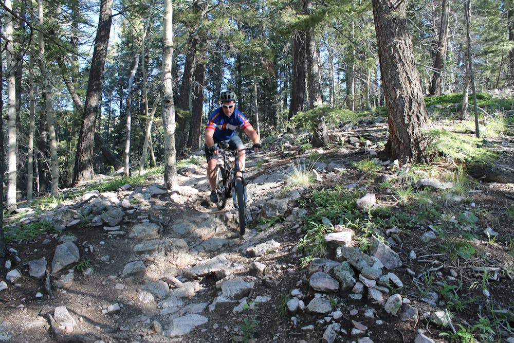
The upper section between the Santa Fe Ski Area trailhead and the Norski cross country ski trailhead does have a couple punchy—but short—climbs, so if you're looking for your downhill romp to be all downhill, simply omit this first mile and start at the Norski trailhead.
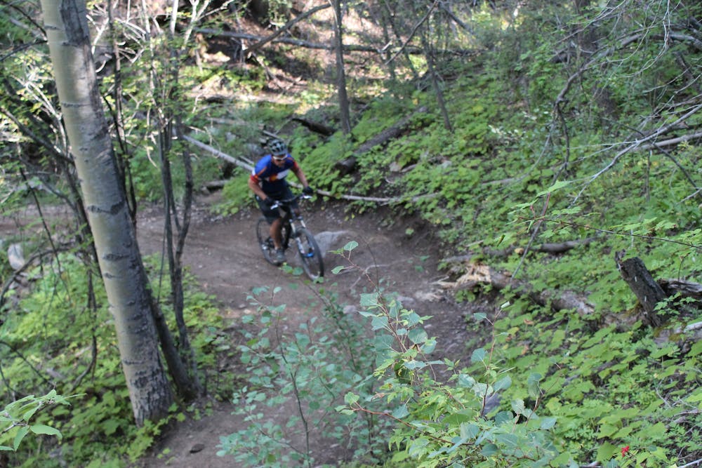
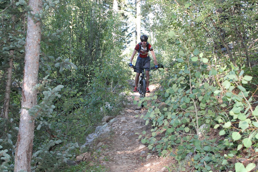
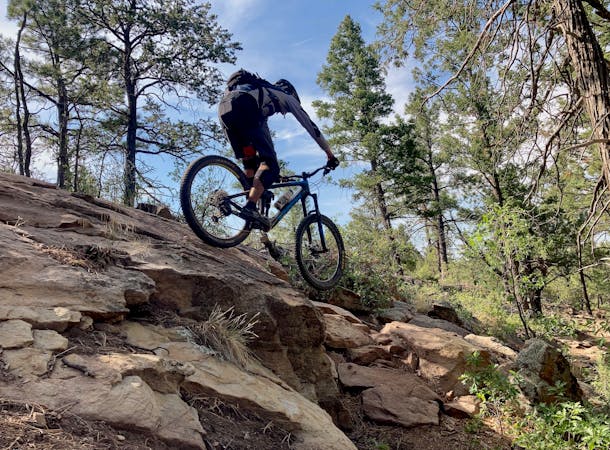
After that, the middle section of the route is positively spectacular, being consistently steep, but never scary-steep, and throwing a mix of super smooth singletrack and mild rock gardens at the rider. Occasionally, the trail utilizes sidehills to create natural berms to maintain flow. Most of the rocks are in the upper part here, with the lower part being smoother and faster. This is where you can let off the brakes and really let your knobbies run free. There is a good line of sight most of the time, but always be on the lookout for hikers and uphill riders—especially when approaching the occasional blind corner.
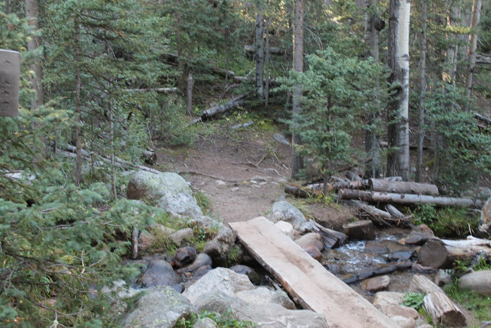
In the bottom third of the trail, the trees and bushes get a little denser, and the singletrack narrower and twistier, so the mach speed period is mostly over. The bottom portion of the trail makes multiple creek crossings, so you will get your feet wet—especially early season when the creek is running high.
Ultimately, the trail dumps you out in the classic little New Mexico village of Tesuque, a few miles north of Santa Fe, where you will have a difficult time wiping that grin off your face... and getting the bugs out of your teeth.
-Written by John Fisch
Moderate
Mostly stable trail tread with some variability, with unavoidable obstacles 8in/20cm tall or less. Other obstacles such as rock gullies and steep sections may exist. Ideal for lower intermediate riders.

The trail contains some obstacles such as outcroppings and rock which could cause injury.
Away from help but easily accessed.
22 routes · Mountain Biking · Hiking · Trail Running
7 routes · Mountain Biking