
8 routes · Hiking
An ~20 mile singletrack route dissecting Long Island, with countless access points.
Hiking Moderate

When you think of hiking in New York, the Catskills and Adirondacks are often the first things to come to mind. Long Island, however, is home to a surprisingly challenging and diverse trail that dissects the island between Cold Spring Harbor and the Massapequa Preserve.


Accessible year-round, the Nassau-Suffolk Greenbelt Trail trail is particularly spectacular in the spring, summer, and fall months. At the northern end of the trail, look for blooming mountain laurel in the summer. On the southern, enjoy the countless species of birds that take seasonal residence in the Massapequa Preserve.
Though the trail is 20 miles in length, there are no listed campsites or shelters along the trail. While a single day traverse is within reach, the trail crosses countless roads and parks along the way, offering a tremendous number of day hiking or trail running opportunities. Expect to find water and bathrooms at most parks that the trail passes through.
Arguably one of the largest and most popular access points, Stillwell Woods Park lies in Woodbury, just south of Cold Spring Harbor. This park also offers a network of mountain biking and hiking trails, as well as plenty of sporting fields.
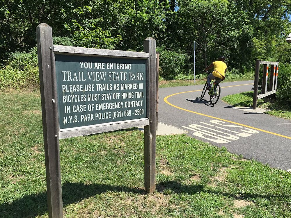
Near where the trail crosses the LIE heading south, it shares the corridor with both a mountain bike trail and paved bike path as it passes through the long and narrow Trailview State Park. At times, trails may merge near roads or other access points.
South of the LIE, the trail skirts along the western edge of Bethpage State Park. A large parking area makes this another popular trailhead with endless opportunities to form a loop.
The southern end of the Nassau-Suffolk Greenbelt Trail passes through the Massapequa Preserve. Here, you'll be welcomed by several picturesque ponds and a wide array of wildlife. Know that this area is at the lowest elevation and takes time to drain after a rain.
Sources: https://www.dot.ny.gov/portal/pls/portal/MEXISAPP.DYNBIKETRAILDETAILMAIN.show?pargnames=ptrailid&pargvalues=221 https://en.wikipedia.org/wiki/TrailViewStatePark
Moderate
Hiking along trails with some uneven terrain and small hills. Small rocks and roots may be present.

The trail contains some obstacles such as outcroppings and rock which could cause injury.

Close to help in case of emergency.
8 routes · Hiking