5.6 km away
Cattail Mine Loop
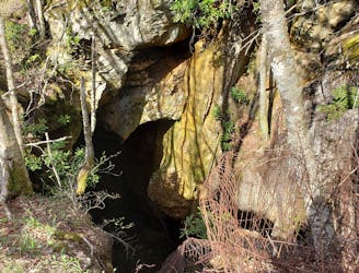
A wild loop with waterfalls, sweeping views, and a trek past an abandoned mica mine.
Difficult Hiking
- Distance
- 18 km
- Ascent
- 603 m
- Descent
- 603 m
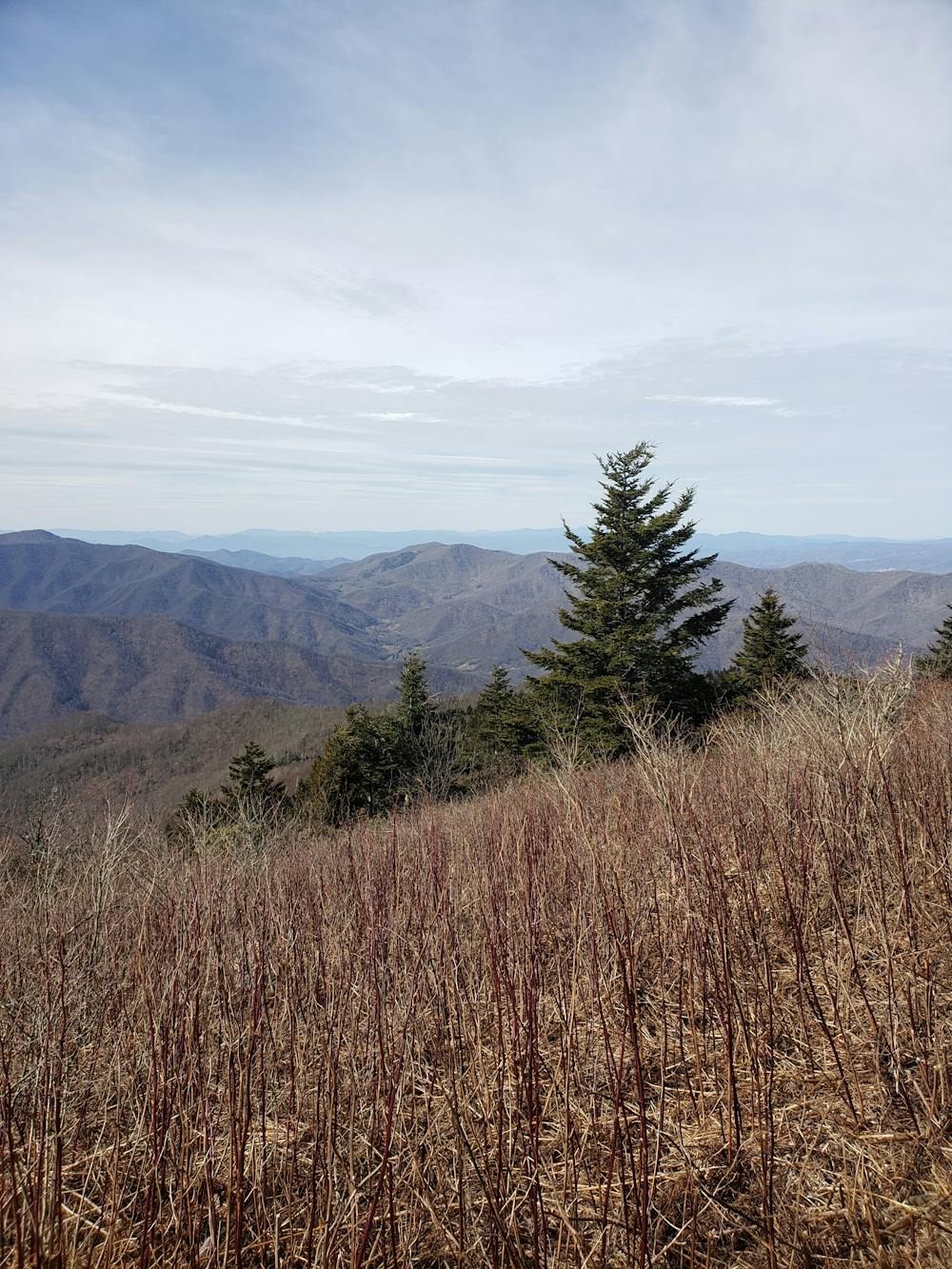
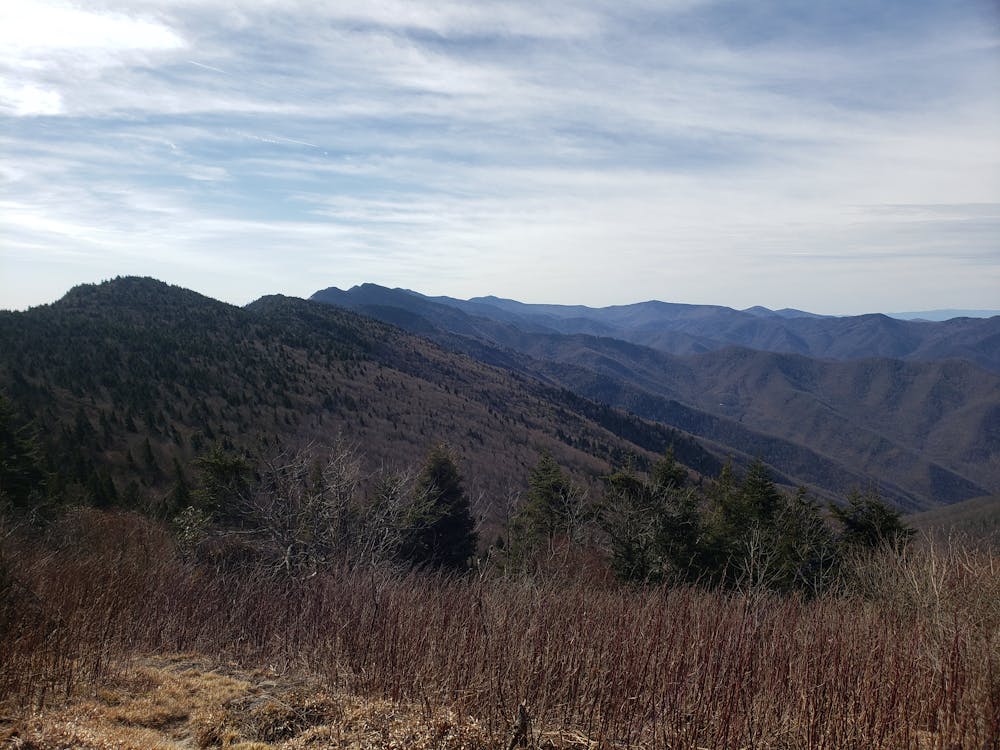
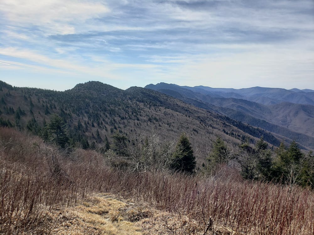
The single most epic ridgeline traverse in the Appalachian Mountains.
Hiking Severe

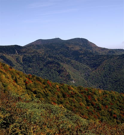
The Black Mountain Crest Trail is a rite of passage for hikers and trail runners in Western North Carolina. This epic route climbs quickly out of a valley to reveal an epic ridgetop traverse like no other. The path is incredibly challenging, steep at times, and crosses several 6,000-foot peaks along the way.
The northern trailhead lies along Watershed Road just off of Bolens Creek Road. The turn is easy to miss, and there is only parking for two vehicles. If you are in a high-clearance 4x4 vehicle, you can drive past the gate for more options. Most hikers opt to get dropped off here and leave a vehicle at Mount Mitchell.
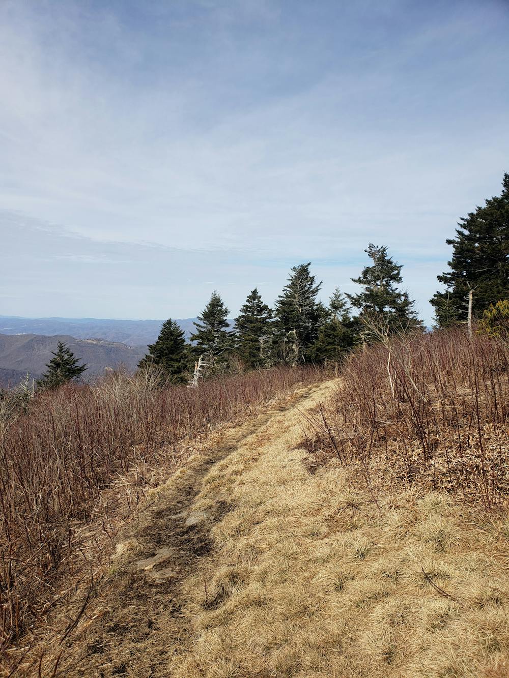
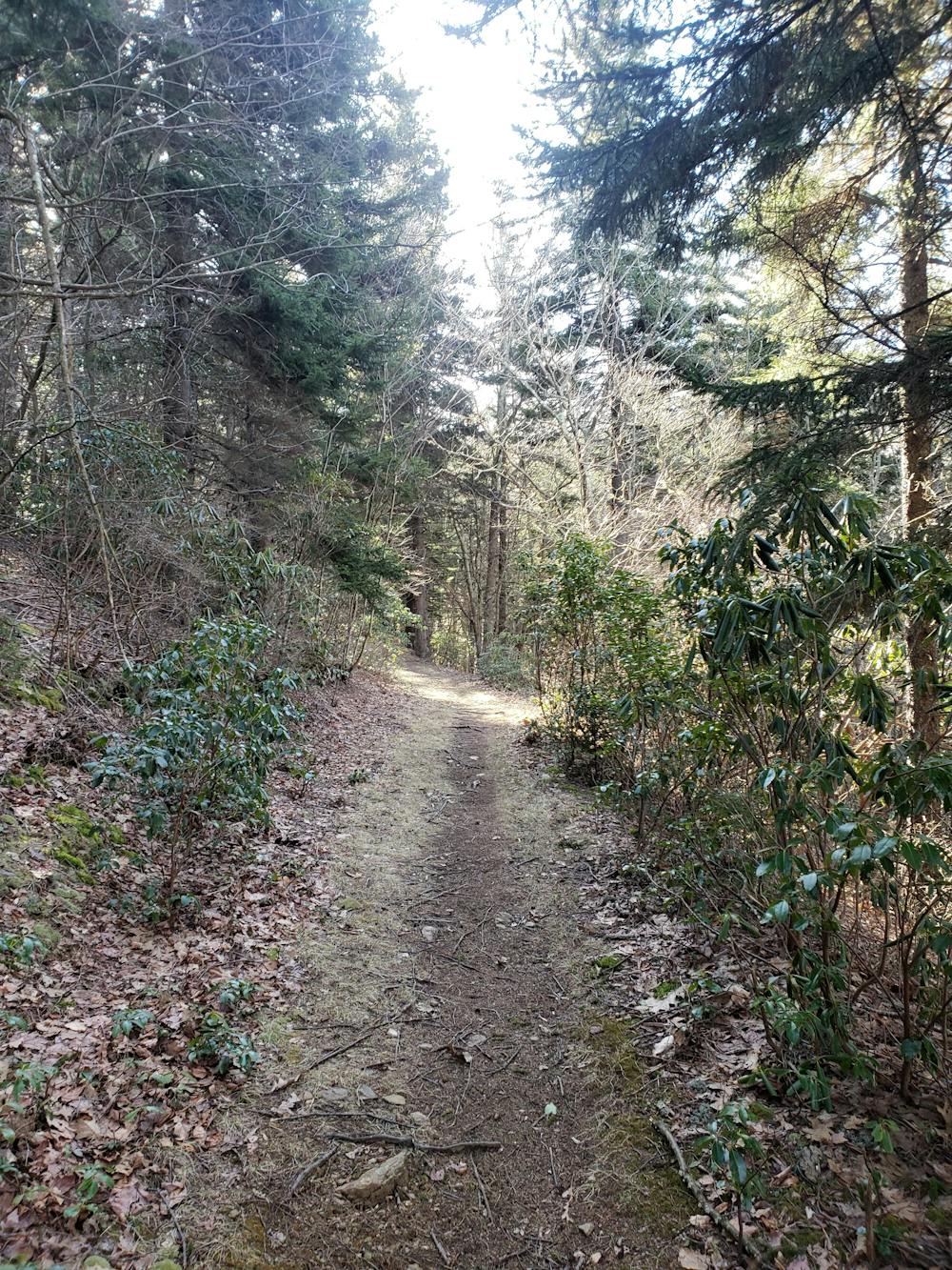
The first few miles are demanding and relentless. Labeled as Trail #179, the route follows old forest service roads as it climbs its way to a ridge. Along the way, enjoy the flora as it transitions into beautiful spruce-fir forest typically confined to the northern latitudes.
As you approach the ridge, the steady two-track gives way to rugged singletrack. A clearing near Horse Rock Bald provides some views to the southwest and your ultimate destination, Mount Mitchell. Ahead, you're welcomed with even more incredible views as the trail treks across countless peaks and high points.
Know that water is limited as you traverse the ridge. Stock up when you can, and if you intend to make this an overnight trip, camping is possible near Deep Gap.
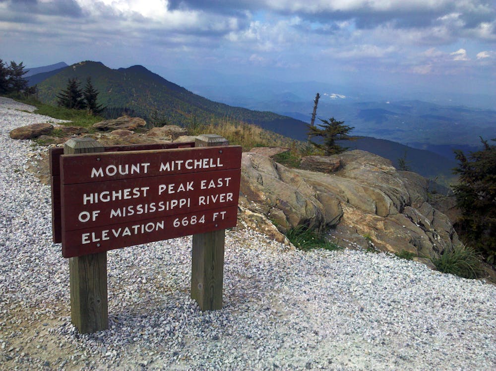
Once the Black Mountain Crest Trail reaches its southern terminus at the parking lot, take the short hike to the official summit and observation deck atop Mount Mitchell. Nearly 6,700 feet, the peak is the highest point east of the Mississippi River and an excellent finish to the epic hike.
Sources: https://www.fs.usda.gov/recarea/nfsnc/recarea/?recid=48518
Severe
Hiking challenging trails where simple scrambling, with the occasional use of the hands, is a distinct possibility. The trails are often filled with all manner of obstacles both small and large, and the hills are very steep. Obstacles and challenges are often unexpected and can be unpredictable.

Some trail sections have exposed ledges or steep ascents/descents where falling could cause serious injury.

In the high mountains or remote conditions, all individuals must be completely autonomous in every situation.
5.6 km away
A wild loop with waterfalls, sweeping views, and a trek past an abandoned mica mine.
Difficult Hiking
7 routes · Hiking

16 routes · Hiking

10 routes · Hiking