1 m away
Badlands Rock -> Flatiron Rock Loop
Tag two of the most impressive rock formations in the Oregon Badlands Wilderness.
Easy Hiking
- Distance
- 14 km
- Ascent
- 119 m
- Descent
- 119 m
A flat hike leads to incredible views from an upthrust volcanic rock.
Hiking Easy

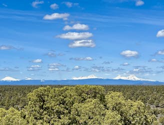
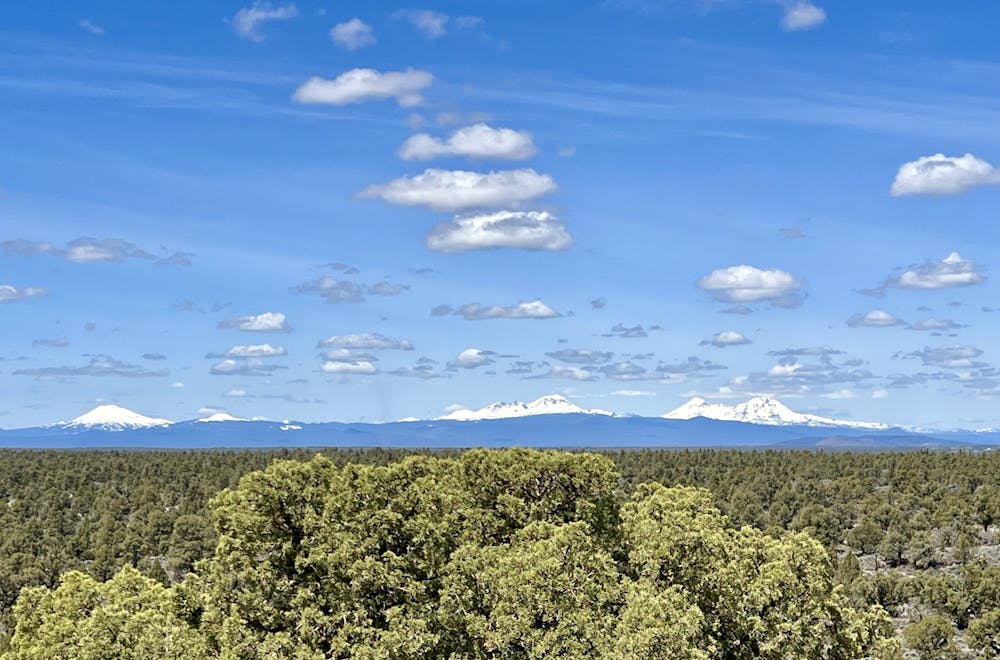
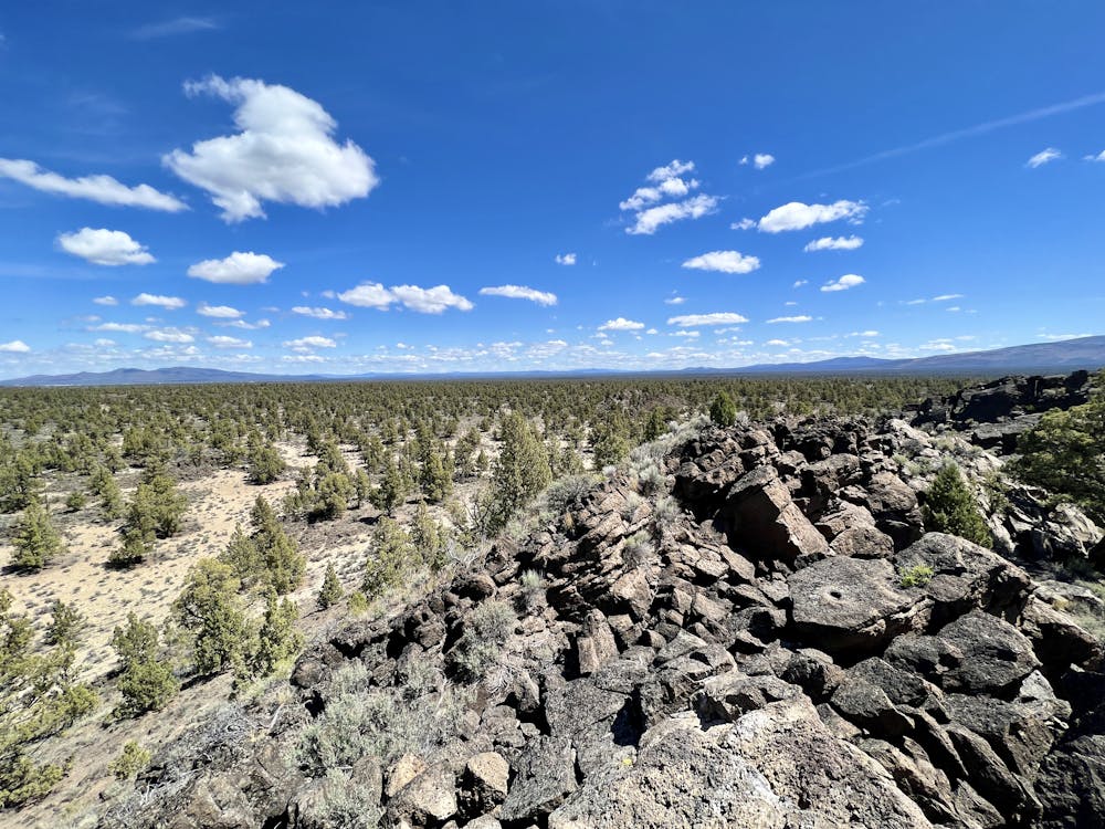
Badlands Rock is a large outcropping of volcanic rock surrounded by the Oregon Badlands Wilderness. From the top, you'll enjoy 360-degree views of this remote desert landscape, as well as long-range views of the Cascade volcanoes in the distance.
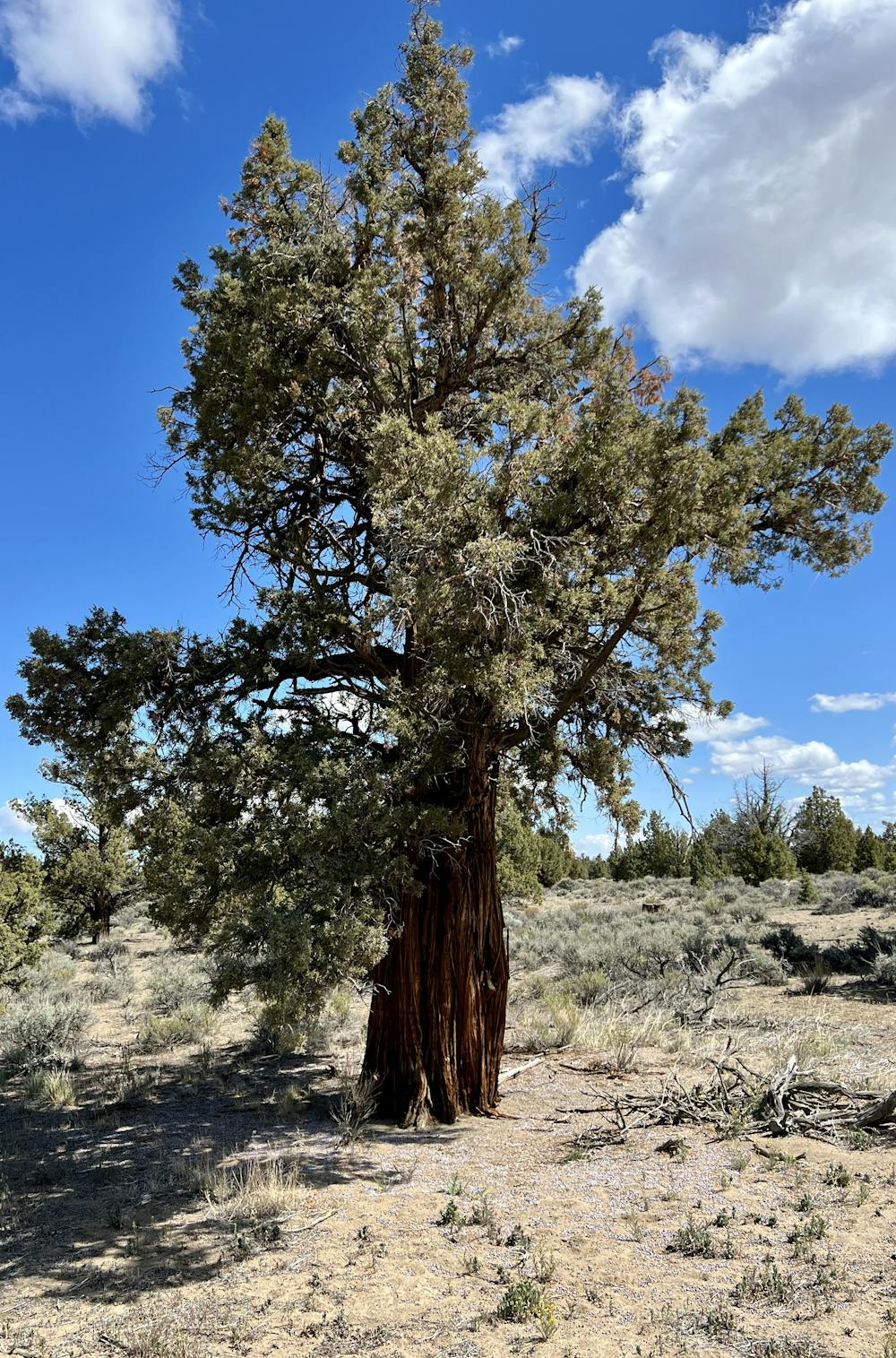
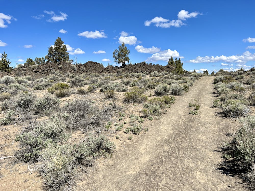
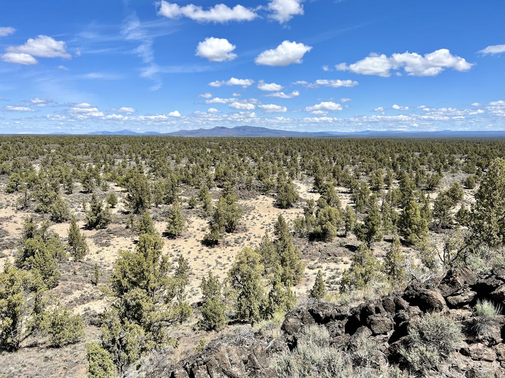
The hike to Badlands Rock follows a wide, sandy, non-technical path that leads almost directly to the rock with very little twisting or turning. This sandy trail passes through the unique ecosystem of the Oregon Badlands. Juniper trees thrive in this arid climate. It's relatively rare to find juniper trees that are this tall and majestic, but they're everywhere in the Oregon Badlands! Oftentimes, you'll spot them growing right on top of a ledge of volcanic rock.
The hike out to Badlands Rock is easy and absolutely nontechnical, and it's almost entirely flat. While sometimes the soft sand can slow you down, it's difficult to imagine an easier 6-mile hike in a Wilderness area than this one! Consequently, this hike has received an "Easy" FATMAP difficulty rating.
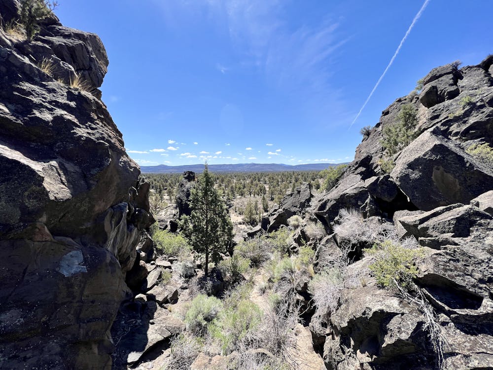
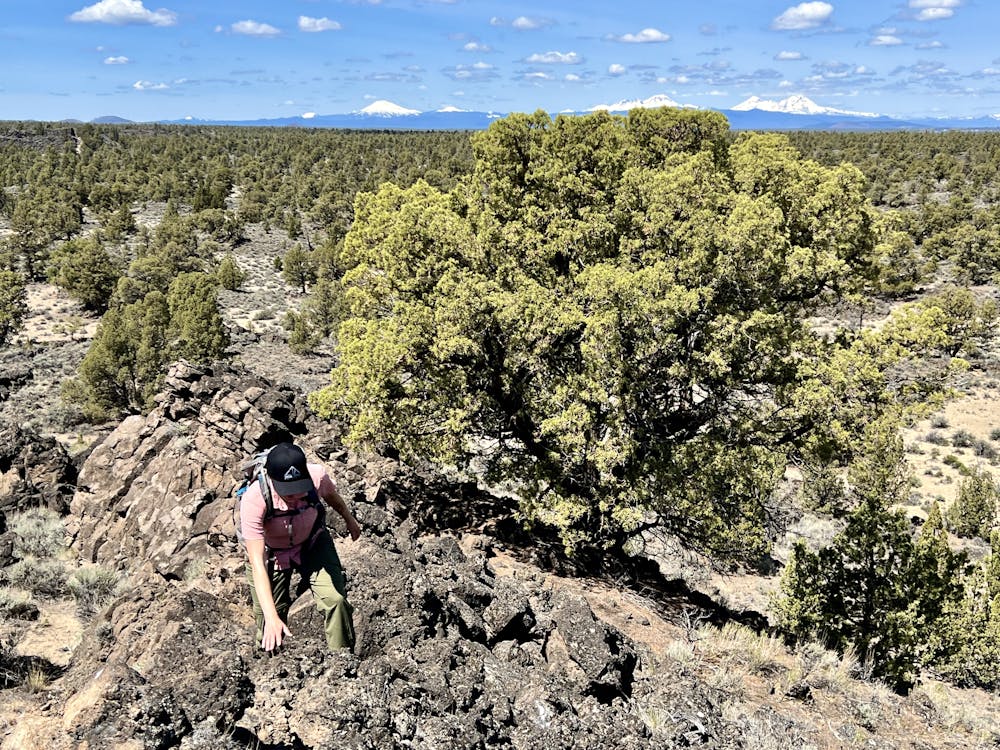
When you reach the rock, most hikers will feel the urge to scramble to the top of it. This optional climb to the top is much more technical than the hike out, and can approach a FATMAP "Severe" rating. The climb to the top isn't factored into the difficulty rating that's been assigned to this hike.
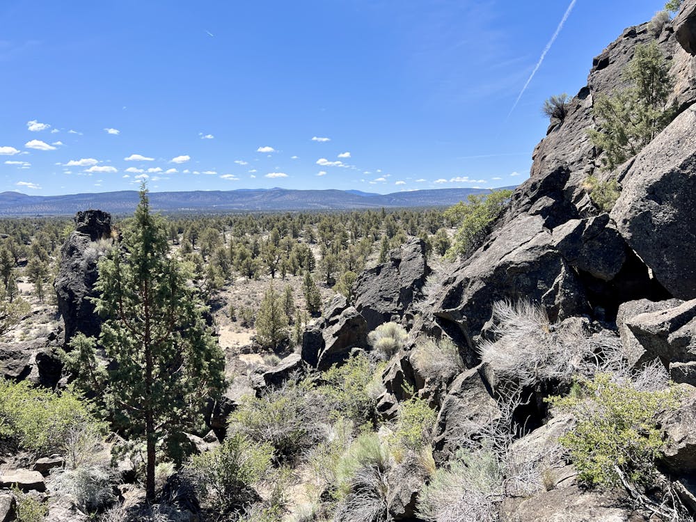
To reach the top, look for a sign for the Badlands Rock trail. This points to a small trail that scrambles up a cleft in the rock to a middle landing that's surrounded by lava rock on all sides. From the middle landing, you can scramble up to reach a view from the top of the lava rock cliffs via a myriad of options. However, these scrambles will require the use of hands and do pose some fall danger. Exercise caution, but enjoy the views!
Once done, you can either return to the trailhead the same way that you came, or you can choose to create a loop with the Castle Trail (7.7 miles) or the Tumulus Trail (12.3 miles)
Easy
Walking along a well-kept trail that’s mostly flat. No obstacles are present.

The path is on completely flat land and potential injury is limited to falling over.

Away from help but easily accessed.
1 m away
Tag two of the most impressive rock formations in the Oregon Badlands Wilderness.
Easy Hiking
9 routes · Hiking