5.1 km away
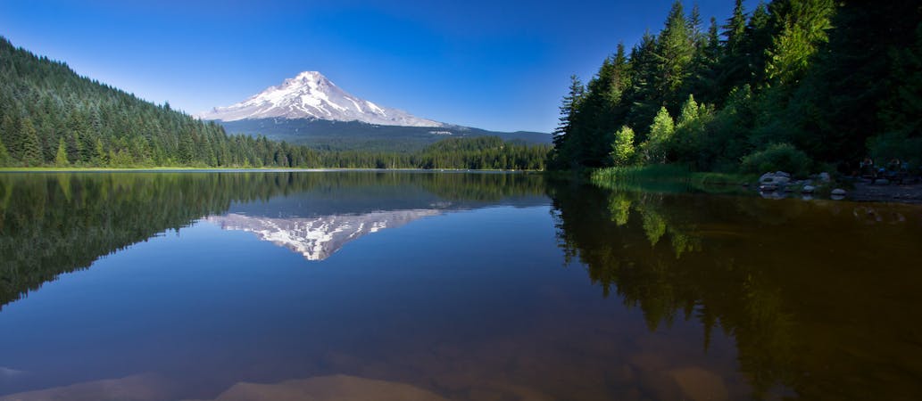
Trillium Lake Loop
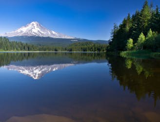
The classic easy lake hike for reflective views of Mount Hood.
Easy Hiking
- Distance
- 3 km
- Ascent
- 17 m
- Descent
- 17 m
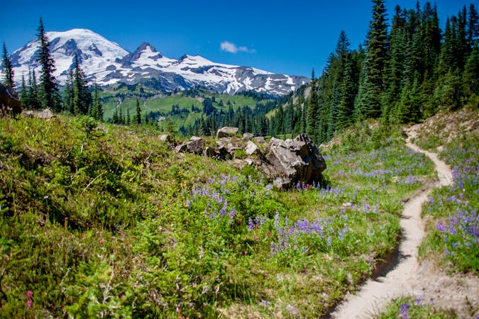
Miles 2091.7-2114.2 of the northbound PCT: Climbing on the flanks of Mount Hood, to sweeping views over Oregon and up to the mountain’s icy crown.
Hiking Difficult

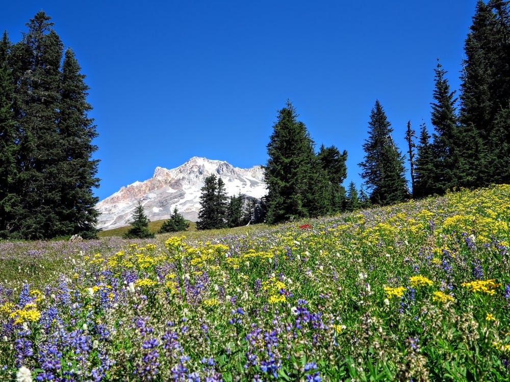
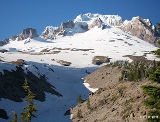
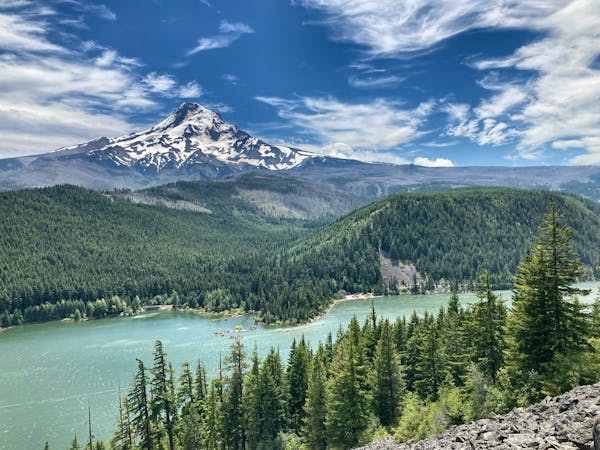
Mount Hood is undoubtedly a highlight of the PCT in Oregon, and even among the trail’s 2650 total miles, this mountain shines as one of the most memorable. A truly regal peak, crowned in cliffs and robed in glaciers, Mount Hood presides as the tallest of Oregon’s Cascades, and treats PCT hikers some of the best views in the state. As the trail traverses the mountain’s west flank, it strolls through alpine meadows and forest, dips through eroded ravines, and fords rushing glacial streams. The variety and challenge make Mount Hood one of the trail’s best sections by far.

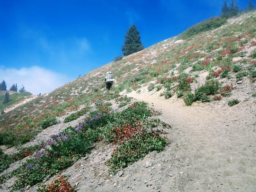
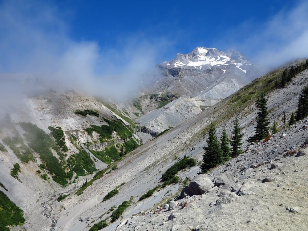
This is the beginning of Section G northbound, which ends eventually at the Washington border. From the road at Barlow Pass (NB mile 2091.7) the trail ascends relentlessly through lush forest. For a few miles, conifers mask the surroundings, and it feels like this could be any ridge climb along the Cascade Crest. But eventually, the trail reaches the limit of the trees, on bald slopes that reveal the mountain’s true scale. On all sides, denuded canyons and pine-flecked ridgelines crane upward, converging at the snow-capped highpoint of Oregon overhead.
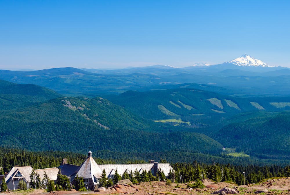
The trail climbs yet higher, then begins to contour through wildflower meadows and rocky gullies. The surface is rather sandy, but the huge views are more than enough to distract from sore legs. Once at the ski resort (NB mile 2086.9), Timberline Lodge is a short detour down a side trail. The lodge is famous for its history and architecture but best known to PCTers for the breakfast and lunch buffet. There’s not much for resupply shopping, but the lodge can accept packages, and a road goes from there to the town of Government Camp.
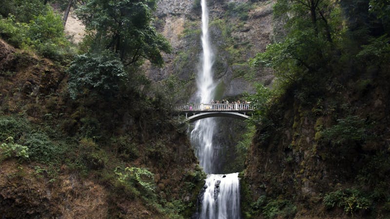
Past the lodge, the trail trends downward, but the terrain becomes steadily more complex. At first, it’s a gentle traverse across the ski runs, through patches of trees and flowery clearings. Then the path dips through a series of ravines, including the sizable Little Zig Zag Canyon. Some pitches are steep enough to be dangerous if covered with snow early season. After a stint of thicker forest, the trail emerges on the rim of Zig Zag Canyon––a massive gash in the mountainside. Switchbacks lead into the yawning chasm, and at the bottom is the Zig Zag River (NB mile 2100.3), which is a good water source and generally an easy crossing.
On the other side is a climb just as steep as the previous descent. Once out of the canyon, the trail continues to work its way around the mountain, on comparatively gentle terrain, and finds some campsites near Rushing Water Creek (NB mile 2106.3). Then it tips downard once more, making a meandering descent into the canyon of the Sandy River. This glacial stream flows swift and opaque with sediment, making a treacherous crossing if the volume is high. Meltwater tends to swell in the afternoon, so safer flows can be found in the morning.
Shortly after leaving the riverbed, the PCT meets a junction with the Timberline Trail (NB mile 2106.9), which makes an alternate to Ramona Falls. It’s an easy detour with similar mileage, to a pretty waterfall with a footbridge beneath it. The alternate reconnects at Muddy Fork (NB mile 2108.9), another silty stream that can sometimes be tricky to cross. Good campsites are nearby.
From Muddy Fork, the trail climbs up and over a thickly forested ridge, with a few possible campsites but no reliable water. The descent on the other side leads to Lolo Pass, where there’s a narrow paved road, trailhead, and campsite with a picnic table. This would be a logical endpoint for section hiking Mount Hood, but the remote location does not offer much for distance hikers. The end of Section G, and a town at the Oregon border, is just another couple of days northward.
Permits: This segment is on Mt. Hood National Forest, and largely within designated wilderness. The wilderness requires permits for entry, but these are self-issued for free at trailheads. Parking at trailheads may also require a day-use fee or the Northwest Forest Pass.
Sources: https://www.fs.usda.gov/recarea/mthood/recarea/?recid=79439 https://pctmap.net/trail-notes/ https://pctwater.com/
Difficult
Hiking trails where obstacles such as rocks or roots are prevalent. Some obstacles can require care to step over or around. At times, the trail can be worn and eroded. The grade of the trail is generally quite steep, and can often lead to strenuous hiking.

Some trail sections have exposed ledges or steep ascents/descents where falling could cause serious injury.
Little chance of being seen or helped in case of an accident.
5.1 km away
The classic easy lake hike for reflective views of Mount Hood.
Easy Hiking
5.6 km away
One of the finest backpacking routes in the Pacific Northwest!
Difficult Hiking
7.8 km away

A popular hike to gain incredible views of Mount Hood.
Moderate Hiking
10 routes · Hiking · Trail Running
3 routes · Hiking
5 routes · Hiking

72 routes · Hiking
10 routes · Hiking