Chief Joseph Mountain
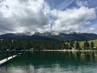
Adventurous peak climb to a prominent mountain looming over Wallowa Lake.
Extreme Hiking
- Distance
- 21 km
- Ascent
- 2.1 km
- Descent
- 2.1 km
Bag two summits over 9,000 feet in the Eagle Cap Wilderness.
Hiking Extreme

Sacajawea Peak boasts the highest elevation in the Wallowa Mountains, at 9,838 feet above sea level. Nearby Matterhorn Peak was once thought to be higher, but it has since been remeasured at 9,826 feet. Regardless, you can bag both of these peaks in one big climb deep in the Eagle Cap Wilderness!
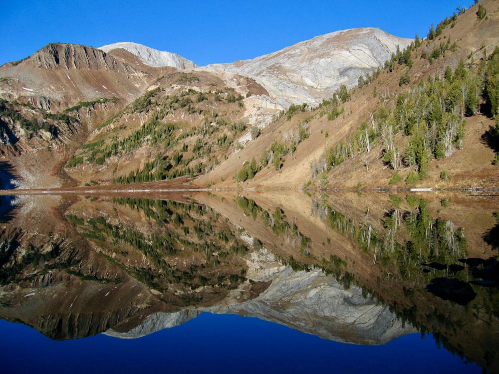
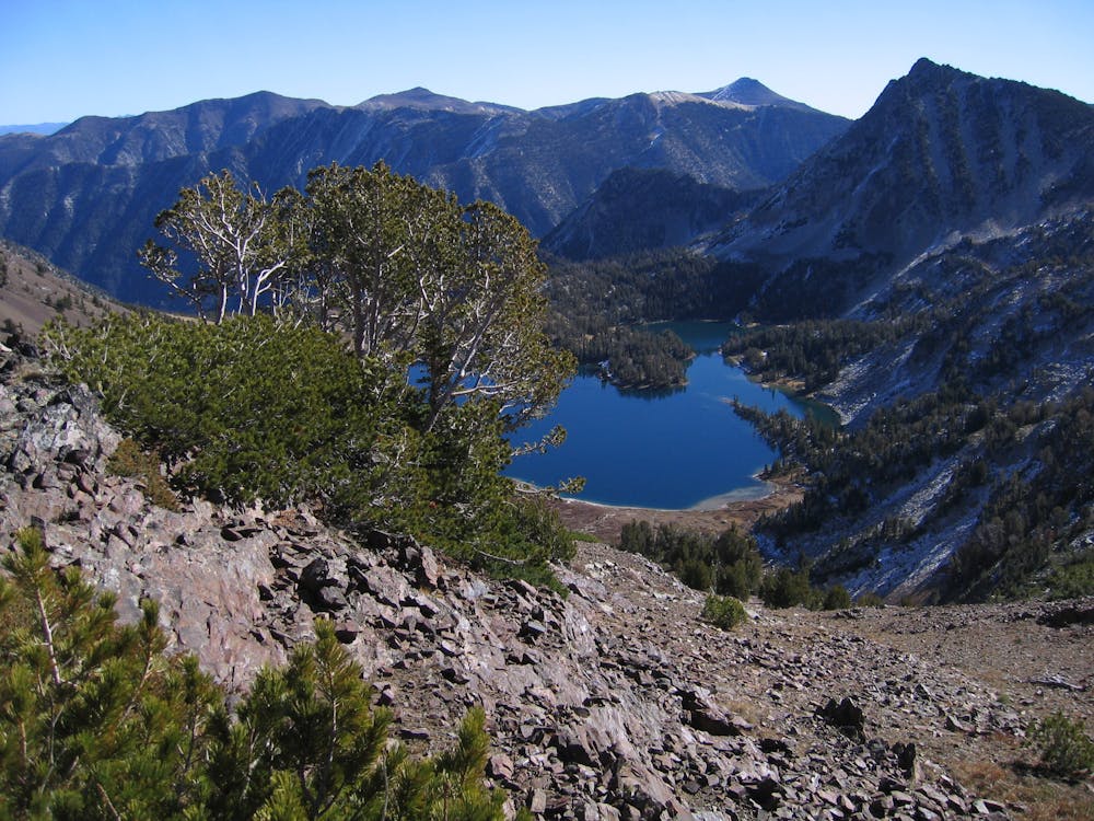
Like most of the major peaks in the Wallowas, these summits are hidden deep within the wilderness, requiring either a big day in the mountains to reach their summits or a multi-day backpacking excursion. The entire route mapped here demands 20.2 miles of hiking/climbing and a substantial 6,500 feet of elevation gain. With a whopping 6,377 feet of topographical prominence, Sacajawea Peak is the 111th most prominent peak on the continent.
The adventure begins by climbing slowly up a mountain valley from the popular Wallowa Lake Trailhead on the West Fork Trail. Turn right on the Ice Lake trail to begin climbing in earnest, gaining elevation rapidly on a switchbacked trail.
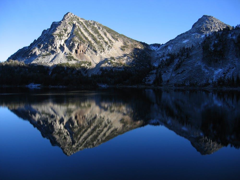
Ice Lake offers a respite from the steep climbing, and a logical spot for camping if you opt to turn this into a multi-day backpacking trip. It would make for a great basecamp for an early morning summit push.
From Ice Lake, “a mountaineer's track leads most of the way to the summit” of Matterhorn, according to Bob Bolton on SummitPost.org.
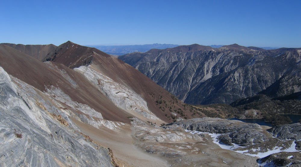
Once on the summit of Matterhorn, follow the ridge to the north to reach the summit of Sacajawea Peak. You’ll have to climb and descend one false summit before you finally reach the highest point in the Wallowa Mountains. This traverse is the most technical way to reach Sacajawea Peak, but it only maxes out at Class 3 and allows you to bag both peaks in one push.
The easiest approach to Sacajawea Peak is via "Hurricane Creek Trail to Thorp Creek Trail and up the east ridge non-technically,” according to Brian Jenkins on SummitPost.Org. It’s also "possible to come directly from Ice Lake across a saddle in the Hurwal Divide and up lots of red scree on the southeast side,” according to Jenkins. If you feel confident in either of these routes for an alternate descent or loop option, feel free to utilize them. Otherwise, the route as mapped here returns to Matterhorn before descending back to Ice Lake and, subsequently, the trailhead.
Sources: https://www.summitpost.org/sacajawea-peak/151103 https://www.summitpost.org/matterhorn-oregon/150682
Extreme
Scrambling up mountains and along technical trails with moderate fall exposure. Handholds are necessary to navigate the trail in its entirety, although they are not necessary at all times. Some obstacles can be very large and difficult to navigate, and the grades can often be near-vertical. The challenge of the trail and the steepness of the grade results in very strenuous hiking. Hikes of this difficulty blur the lines between "hiking" and "climbing".

Some trail sections have exposed ledges or steep ascents/descents where falling could cause serious injury.

In the high mountains or remote conditions, all individuals must be completely autonomous in every situation.
Adventurous peak climb to a prominent mountain looming over Wallowa Lake.
Extreme Hiking