3 m away
Syncline Trails: Big Loop
A respectable hike that makes the most of the best trails in the Syncline network.
Difficult Hiking
- Distance
- 11 km
- Ascent
- 551 m
- Descent
- 551 m
A short, popular loop hitting the best goods in the Syncline area.
Hiking Difficult

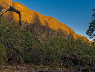
When all the other trails are too wet and snowy to hike, the locals head to the Syncline area. This exposed, south facing mountainside catches sunlight all year round, melting snow fast and drying the dirt quickly after a rain. In fact, if you’re coming to the Hood River area in hopes of finding deep, dark Pacific Northwest forests to hike in and you choose to visit the Syncline area, you may be shocked at how dry, rocky, and barren the terrain actually is. But of course, dry and rocky can make for fantastic hiking!
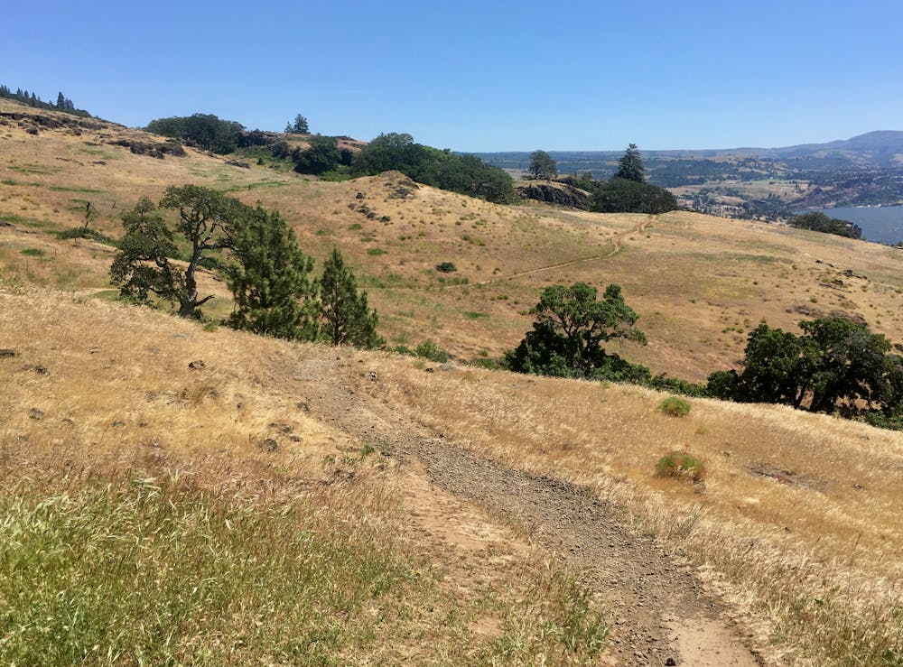

The loop mapped here is a short but popular option that ascends the Little Maui trail and descends the Little Moab trail. Little Maui offers a moderate, enjoyable climb up a smooth dirt singletrack trail that meanders up the mountainside, switching back and forth as it climbs.
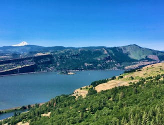
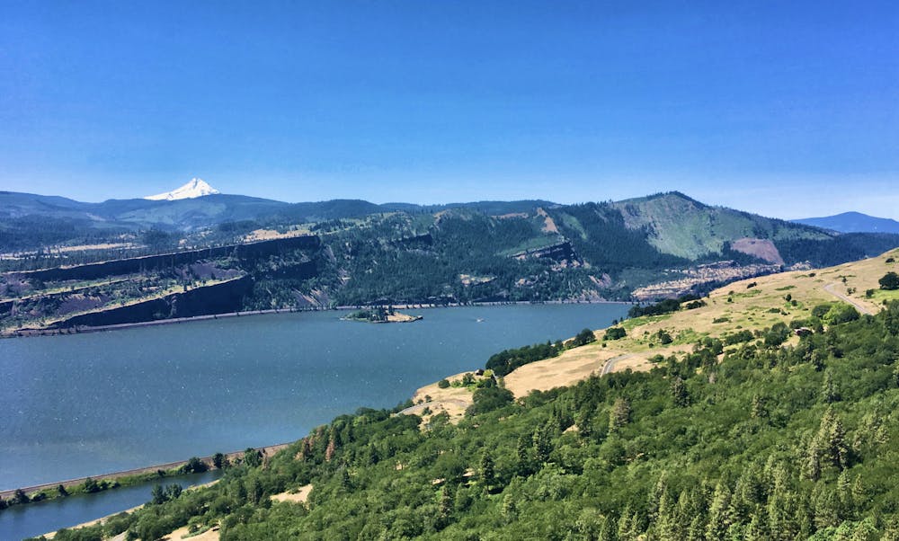
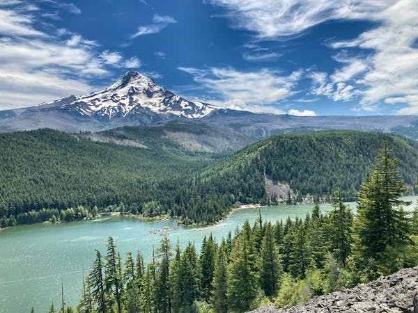
Along the way, you’ll enjoy stunning views of the Columbia River Gorge spread out below you. The largest river in the Pacific Northwest, the scope of this waterway is a stunning sight. The Columbia runs for 1,243 miles, is “the fourth-largest river in the United States by volume, and. . .has the greatest flow of any North American river entering the Pacific,” according to Wikipedia.
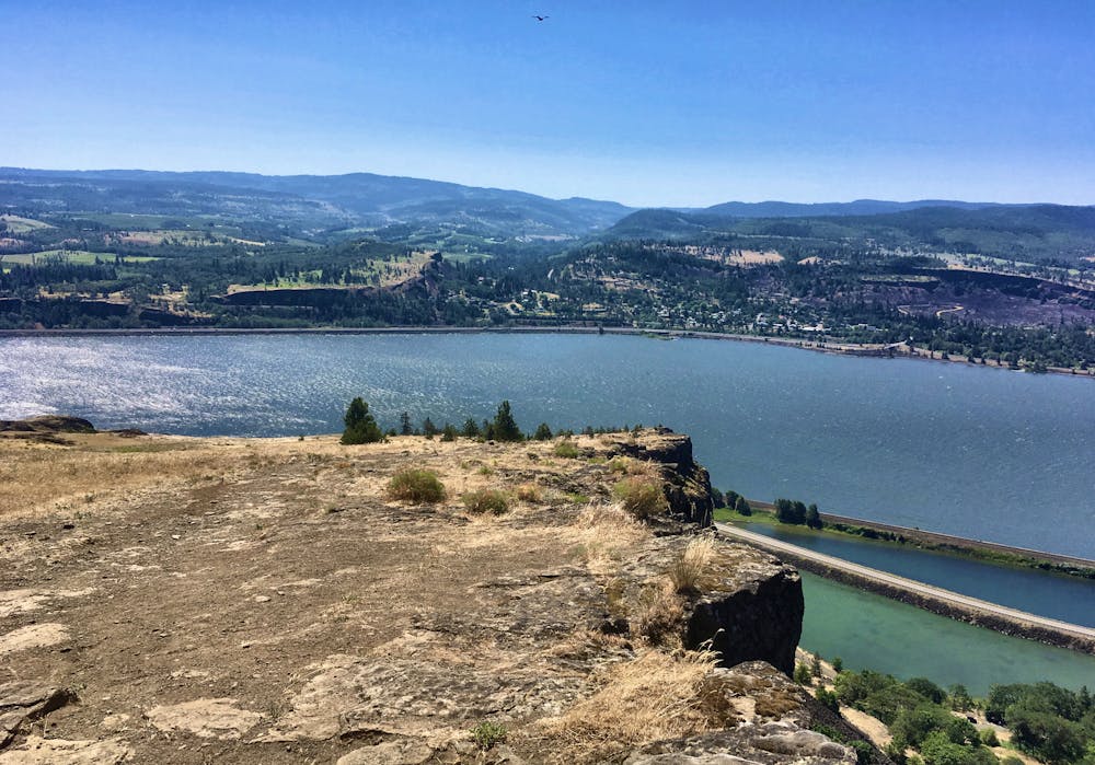
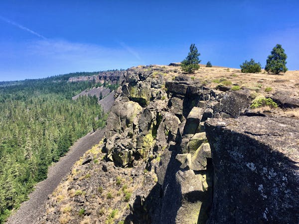
The descending trail, known as “Little Moab,” runs downhill along the rim of a giant rock wall that rock climbers ascend from the bottom. The resemblance to the Porcupine Rim trail in Moab is striking! The trail tread itself bears a resemblance to Porcupine Rim, too. The meat of the trail features a cascading series of ledges and rock gardens. Without a single defined trail line through the mess, you’ll have to constantly be scanning ahead, looking for exactly which line you’d like to take through the sea of rocks. A few obvious lines appear from the rubble, leading you ever downhill, and back to your car.
Difficult
Hiking trails where obstacles such as rocks or roots are prevalent. Some obstacles can require care to step over or around. At times, the trail can be worn and eroded. The grade of the trail is generally quite steep, and can often lead to strenuous hiking.

Some trail sections are extremely exposed where falling will almost certainly result in serious injury or death.

Away from help but easily accessed.
3 m away
A respectable hike that makes the most of the best trails in the Syncline network.
Difficult Hiking
3.2 km away
Arches are rare in this area of the nation, making Catherine Creek Arch a highly attractive destination.
Easy Hiking
4 routes · Mountain Biking · Hiking
10 routes · Hiking