10 routes · Hiking · Trail Running
One of the top hikes in the Pacific Northwest!
Hiking Moderate

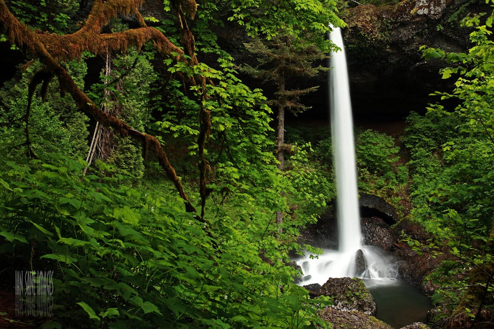
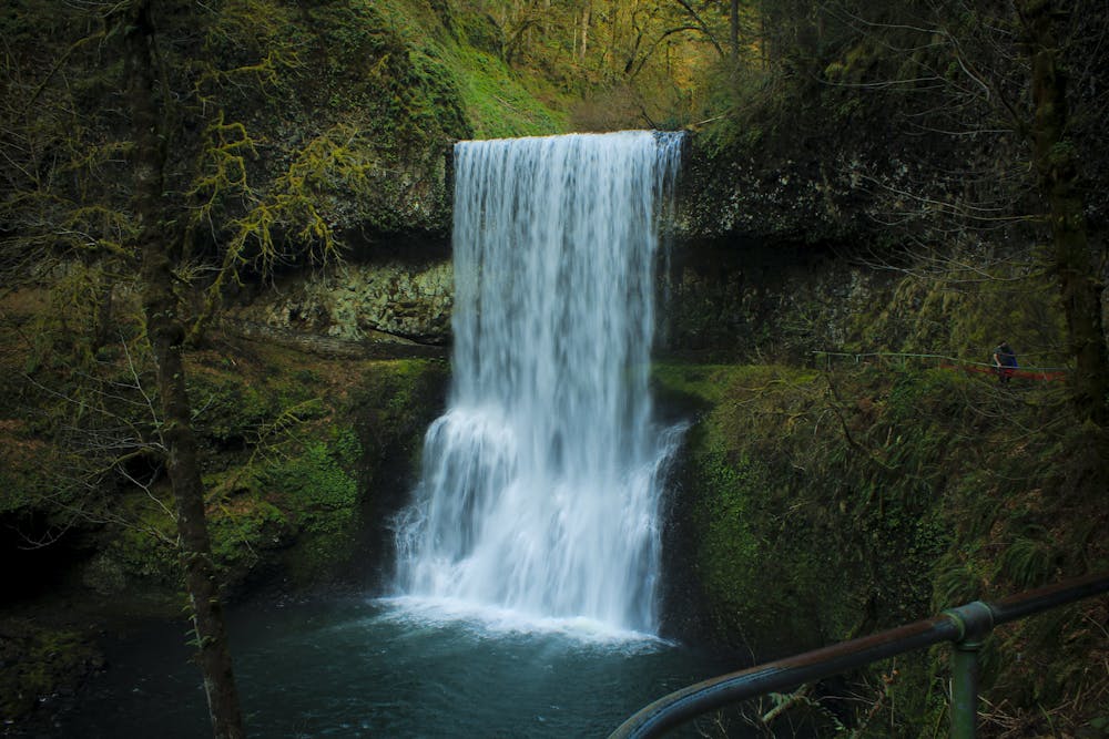
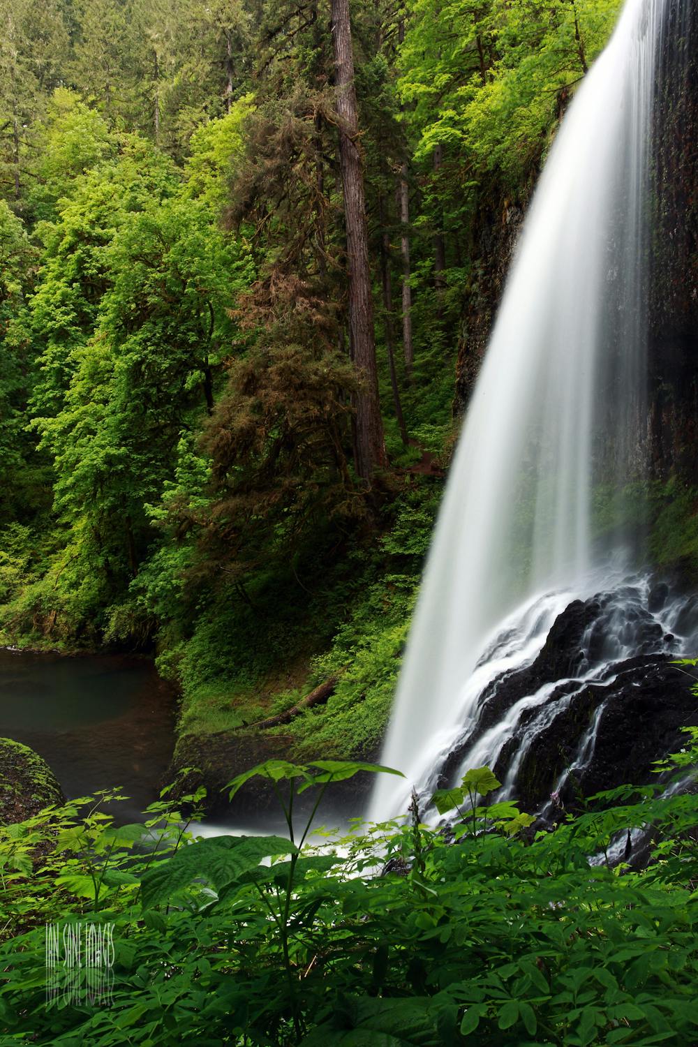
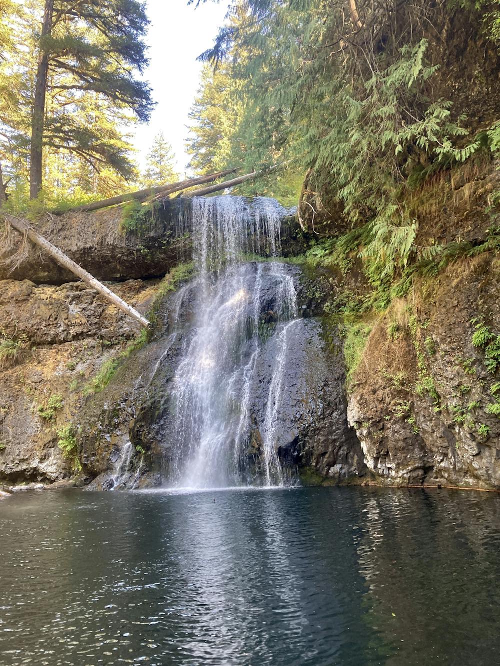
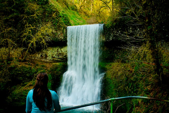
The Trail of Ten Falls is arguably one of the finest hikes in the Pacific Northwest! This 7.6-mile route visits 10 different waterfalls, "and most of them are flat-out gorgeous," according to OregonHikers.org. OregonHikers also calls Silver Falls State Park, where the hike is located, "the crown jewel of the Oregon State Parks system," in part because it's the largest at 9,000 acres, and in part because it contains this hike.

With only 1,444 feet of vertical gain along this route, this hike isn't particularly challenging, making for an approachable and popular day in the woods. Most sources describe it as a 2-3 hour hike.
While you'll have to take a few spurs off of the main loop to spot some of the waterfalls, the trails are generally well-marked and easy to navigate. And of course, you have this map to aid you!
The route of the trail is well-designed, and it will even take you "behind four of the waterfalls as they pour over basalt cliffs," according to HikesPeak.com. The trail itself is quite well-built and non-technical overall, although the wet climate can make the roots and rocks slippery in places. In many spots, steps and staircases have been built to help you negotiate the short but steep climbs and descents. Despite some of the manmade features, this hike is still a truly spectacular natural experience!
Moderate
Hiking along trails with some uneven terrain and small hills. Small rocks and roots may be present.

The path is on completely flat land and potential injury is limited to falling over.

Away from help but easily accessed.
10 routes · Hiking · Trail Running
7 routes · Hiking

10 routes · Hiking