7 routes · Hiking
Gain stunning views above Southern Oregon from the site of an old fire lookout.
Hiking Severe

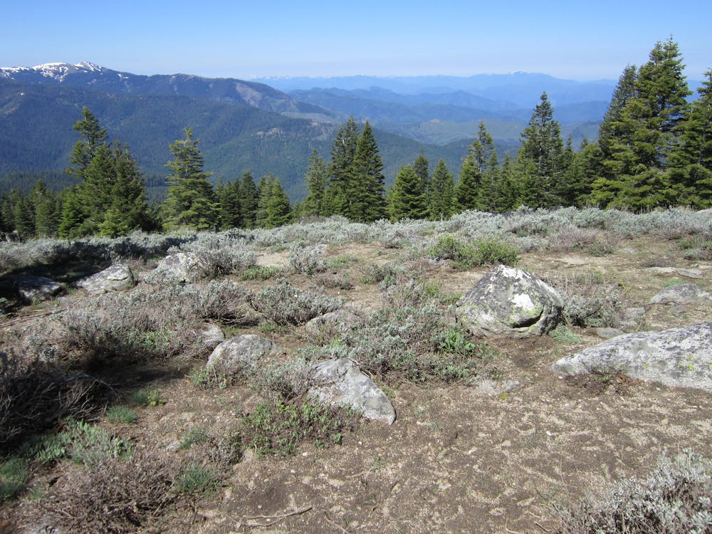
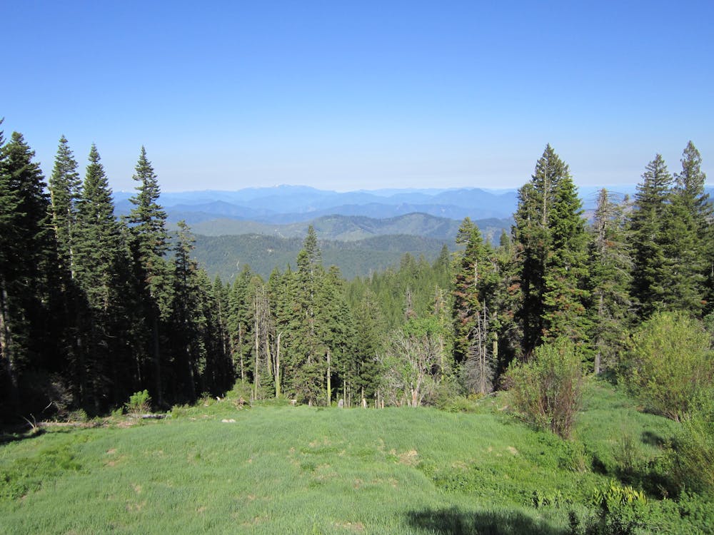
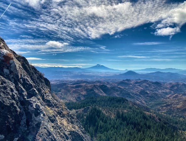
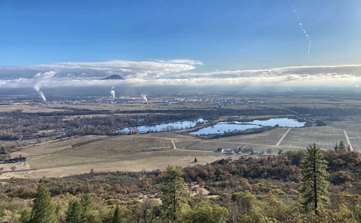
This steep hike up Wagner Butte leads to the site of an old fire lookout, which was originally built in 1920, upgraded in the 60s, and then removed in 1972. Even though the lookout is gone, from the top of the rocky ridge you'll gain stunning views of Southern Oregon and Northern California, including "the Rogue and Little Applegate Valleys and surrounding mountain peaks," according to OregonHikers.org. Nearby peaks that you can see include Mt. Ashland, Mt. Shasta, Mt. McLoughlin, Pilot Rock, Mt. Scott, Mt. Thielsen, and more.
The hike to the summit is steep and strenuous, but the navigation is very straight forward. While some sections of the hike pass through old slide paths and muddy creeks, most of the trail is well-built and easy to follow. At the higher elevations, you may encounter snow patches in the spring and even through much of June, depending on the previous winter.
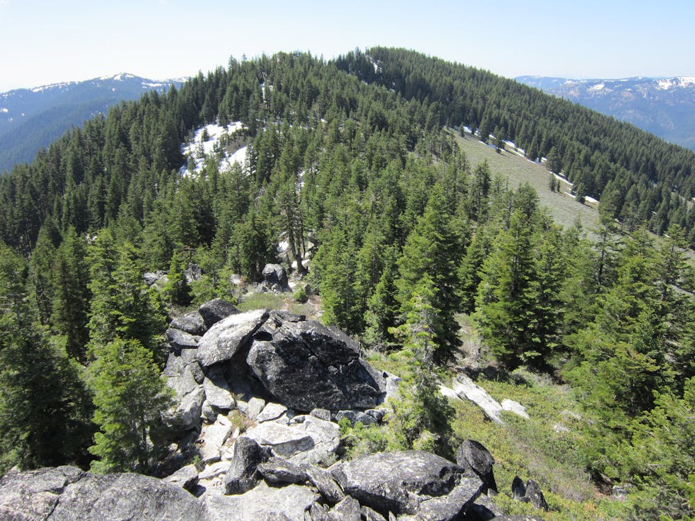
While the climb to the ridgeline all follows a well-built trail, the very top of the ridge is home to a small boulder field. You'll have to do a little moderate boulder scrambling to reach the very end of the ridge and the lookout point, but none of the moves are highly-technical or exceedingly demanding.
This hike ends at the fire lookout point, which is actually about 115 feet lower than the top of Wagner Butte itself. While you could tag both the fire lookout and the top of Wagner Butte, that would turn this hike into an arduous endeavor.
Once you've had your fill of ridgetop views and boulder scrambling, drop back down the trail the way you climbed up to return to your car.
Sources: https://www.summitpost.org/wagner-butte/199829 https://www.summitpost.org/wagner-butte-trail/199830 https://www.oregonhikers.org/fieldguide/WagnerButteHike
Severe
Hiking challenging trails where simple scrambling, with the occasional use of the hands, is a distinct possibility. The trails are often filled with all manner of obstacles both small and large, and the hills are very steep. Obstacles and challenges are often unexpected and can be unpredictable.

The trail contains some obstacles such as outcroppings and rock which could cause injury.

Little chance of being seen or helped in case of an accident.
7 routes · Hiking
11 routes · Hiking