4.4 km away
Jedi Trail Shuttle

A flowy singletrack deep in the wild mountains of southern Oregon.
Moderate Mountain Biking
- Distance
- 6.7 km
- Ascent
- 178 m
- Descent
- 333 m
A flowy singletrack deep in the mountains of southern Oregon.
Mountain Biking Moderate

The Jedi Trail was once renowned as one of the flowiest mountain bike trails in Southern Oregon. This backcountry classic appears to have fallen out of popularity. This is due in part to the long drive deep into the mountains required to reach it and in part due to new trail construction across the region. Even so, this fantastic flowy singletrack will richly reward the intrepid mountain biker willing to drive a few miles to reach it.
The route shown here is a fantastic loop ride heading up the mountain ridge from the southerly aspect. However, you're most likely to approach this trail in your car from the north, where most of the nearby population centers are. Consequently, it's also very easy to shuttle the Jedi Trail if you'd prefer.
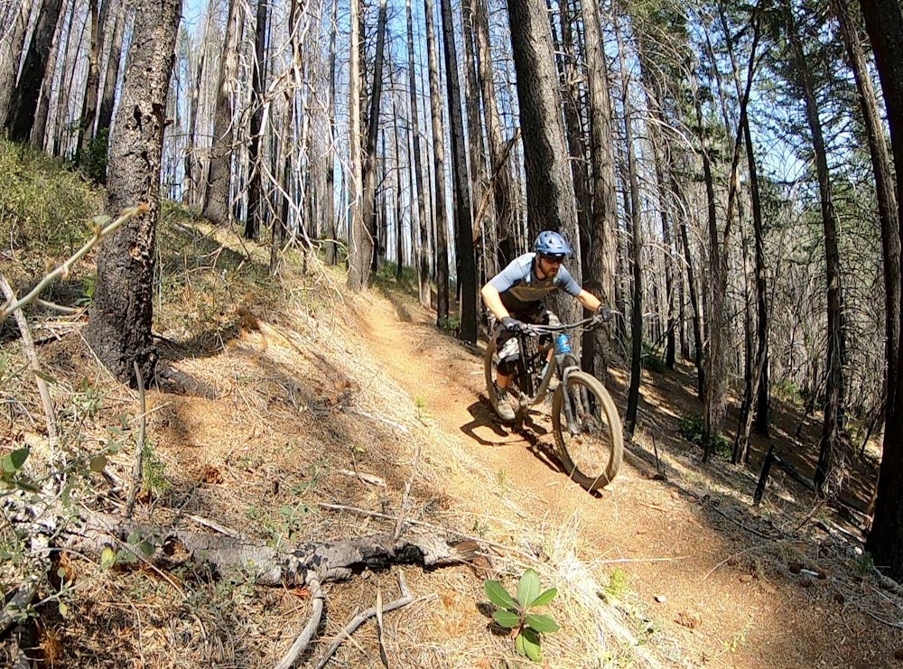
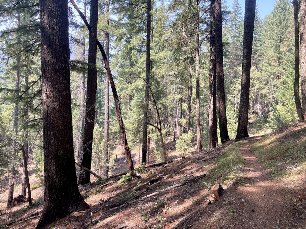
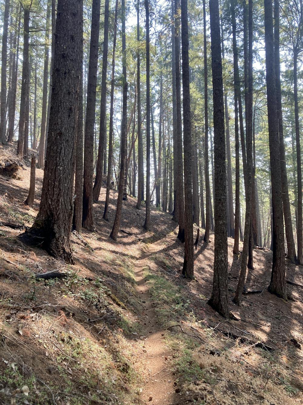
The Jedi Trail is hidden away beneath the boughs of a towering Oregon forest, with majestic trees soaring high above your head. The forest here has visibly survived the ravages of a recent forest fire. Despite being secreted away so deep in the Southern Oregon mountains, the trail tread on Jedi is unbelievably smooth and flowy. Only a few roots punctuate the trail tread, and along with a few somewhat steep grades, account for the "Moderate" difficulty rating. Even so, many beginners will definitely enjoy this trail!
Once it's time to go down, the flow hits fast and furious, with the sinuous singletrack swooping along the side of a beautiful mountain ridge. The fantastic downhill flow will put you in the zone instantaneously, instinct taking over as you whip high up the turns carved into the mountainside and skirt along the benchcut edge at top speed. Unfortunately, the descent is over all too quickly. Jedi will leave you thirsting for more!
Moderate
Mostly stable trail tread with some variability, with unavoidable obstacles 8in/20cm tall or less. Other obstacles such as rock gullies and steep sections may exist. Ideal for lower intermediate riders.

The trail contains some obstacles such as outcroppings and rock which could cause injury.

Little chance of being seen or helped in case of an accident.
4.4 km away
A flowy singletrack deep in the wild mountains of southern Oregon.
Moderate Mountain Biking