1 m away
Mountain of the Rogue: Pay Dirt Loop
Beautifully-designed mountain bike-specific singletrack.
Moderate Mountain Biking
- Distance
- 4.8 km
- Ascent
- 170 m
- Descent
- 170 m
Beautifully-designed mountain bike-specific singletrack.
Mountain Biking Difficult

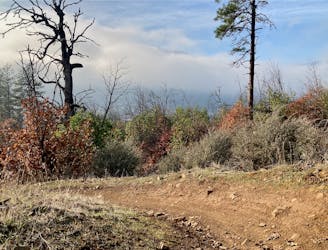
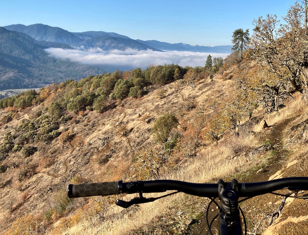
Riders will find a compact, beautifully-built mountain bike-specific trail system basking in the sun on the flanks of the Mountain of the Rogue. With a little something for everyone, this stacked loop trail system has been artfully designed to appeal to a broad swath of mountain bikers.
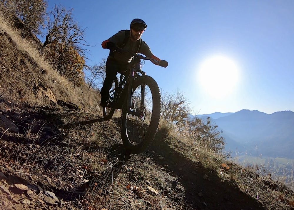
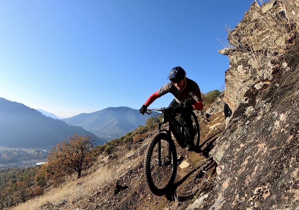
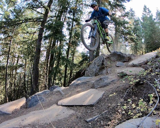
Stacked loop trail systems feature easy trails lower down the mountain and closer to the trailhead, with the more difficult trails further removed from the parking area. That's exactly what you'll find at Mountain of the Rogue. After pedaling up a well-built climbing trail, you'll reach the top of the mountain and drop into one of several black diamond or double black descents. The route mapped here drops into the single-black Arm Bar, which provides narrow benchcut singletrack dropping through chunky rock gardens, down small rock rolls, and the occasional ledge drop opportunity.
In mid-mountain, the trails get noticeably smoother, eventually transitioning to machine-built flow trails. The higher flow trails offer up the biggest hits, with some substantial tabletop and gap jumps. The berms are bigger and the speeds are faster on these burly jump lines.
Around mid mountain, the trails mellow out even more, although you'll find even more options to choose from. Pay Dirt offers a beautiful beginner-friendly flow trail, while other lines like Freewheel (mapped here) provide bigger hits.
The flow trails on this mountain have been beautifully designed, allowing riders to carry plenty of speed and hit the lips with confidence. Mountain of the Rogue is probably home to the best flow trails in Southern Oregon.
Was the descent over too quickly? Pedal back up and try a different trail on for size!
Difficult
Mostly stable trail tread with some variability featuring larger and more unavoidable obstacles that may include, but not be limited to: bigger stones, roots, steps, and narrow curves. Compared to lower intermediate, technical difficulty is more advanced and grades of slopes are steeper. Ideal for upper intermediate riders.

Some trail sections have exposed ledges or steep ascents/descents where falling could cause serious injury.

Away from help but easily accessed.
1 m away
Beautifully-designed mountain bike-specific singletrack.
Moderate Mountain Biking
13 routes · Mountain Biking

52 routes · Mountain Biking · Freeride Skiing · Gravel Biking · Hiking · Road Biking