8.9 km away
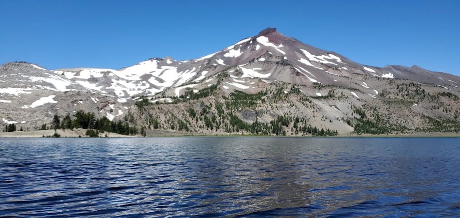
Broken Top Loop
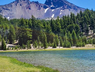
A stunning backcountry trail running loop.
Difficult Trail Running
- Distance
- 36 km
- Ascent
- 1.2 km
- Descent
- 1.2 km
Run past the tourist stop at Tumalo Falls for a longer adventure on one of Bend's most beautiful trails.
Trail Running Moderate

Tumalo Falls ranks among the most popular sightseeing stops near Bend, Oregon. Here, Tumalo Creek flies off a precipice, dropping 97 feet straight down to thunder on the rocks in the bottom of a canyon far, far below. Even in the heat of summer and the cold of winter, the constant flow of water provides a stunning spectacle that draws thousands of hikers and photographers to the edge of the canyon every year.
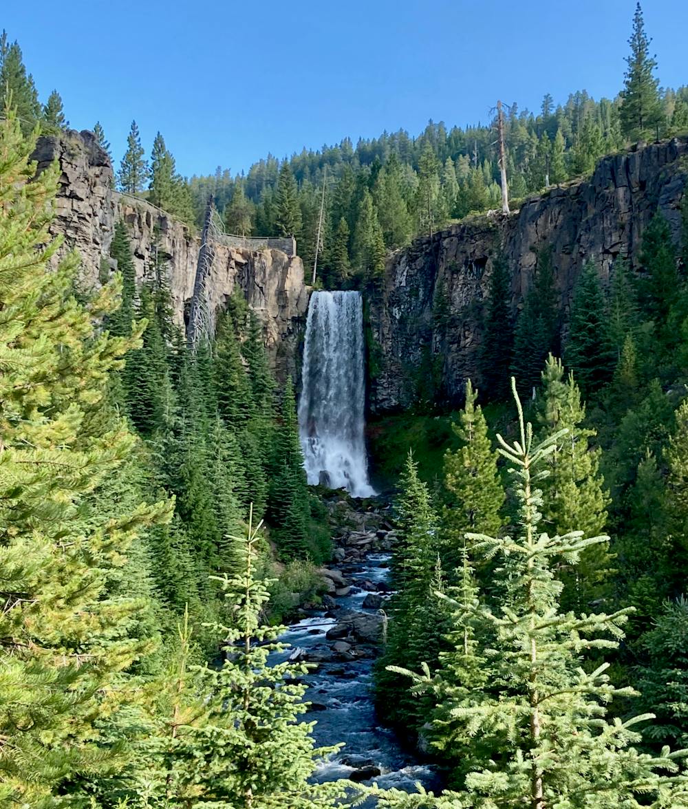
With such a stunning waterfall that’s so easily accessible, the trailhead for Tumalo Falls is constantly filled to overflowing, forcing you to park further down the road and hike more miles than are shown here. That said, a round-trip walk from the standard trailhead to the top of the falls and back down is less than a mile, so if you want to add a little more adventure to your life, consider continuing past the falls on the North Fork trail.
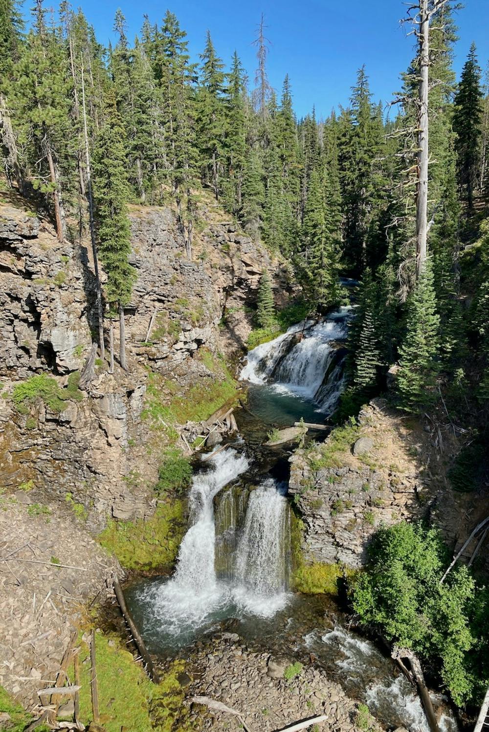
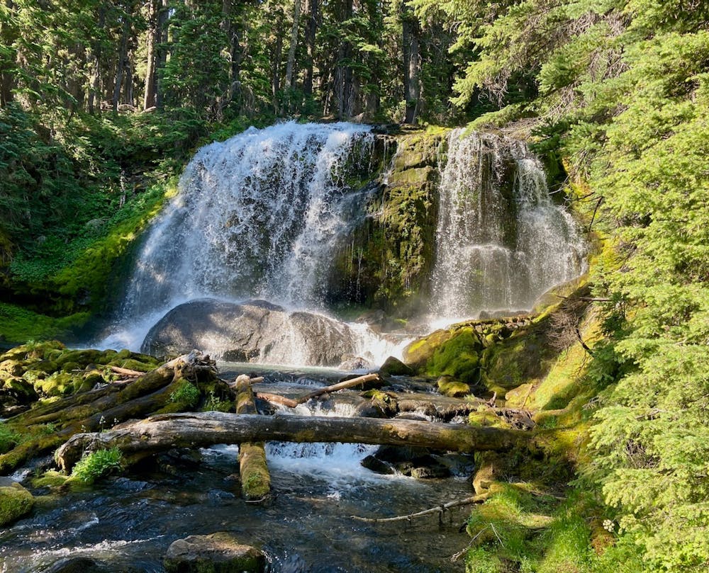
As you continue to run uphill, North Fork rewards your effort with stunning views of thundering cascades in a narrow gorge, vistas of the rushing stream, and an endless parade of waterfalls. While the lower Tumalo Falls is the tallest and grandest of the falls in this narrow valley, the scenery arguably gets even more beautiful as you climb. Even the final falls before the North Fork trail leaves the bank of Tumalo Creek is an absolute stunner, forcing you to sit and soak in the grandeur of nature around you.
Best of all? After you pass the main falls, the crowds thin considerably. And once you’ve gone a mile or two up the mountainside, you might even have the trail to yourself on a weekday.
For a longer loop route instead of an out-and-back, consider turning right on Mrazek and descending the Farewell trail. See this mountain bike route for more information.
Moderate

The trail contains some obstacles such as outcroppings and rock which could cause injury.

Close to help in case of emergency.
8.9 km away
A stunning backcountry trail running loop.
Difficult Trail Running
7 routes · Trail Running