Path of the Flood Trail: Out-and-Back
Travel the path of a catastrophic flood in 1889 on a historical rails-to-trails route.
Hiking Easy
- Distance
- 21 km
- Ascent
- 351 m
- Descent
- 351 m
- Duration
- 4-5 hrs
- Low Point
- 411 m
- High Point
- 484 m
- Gradient
- 9˚

The Path of the Flood Trail is a historic and scenic hike in Pennsylvania that follows the route of the devastating Johnstown Flood of 1889, which killed more than 2,200 people and destroyed much of the city. The trail traces the path of the Little Conemaugh River, where a massive wall of water broke through a dam and swept away everything in its way. The trail offers a number of activity options, such as hiking, biking, and running, and is suitable for all skill levels.
Description
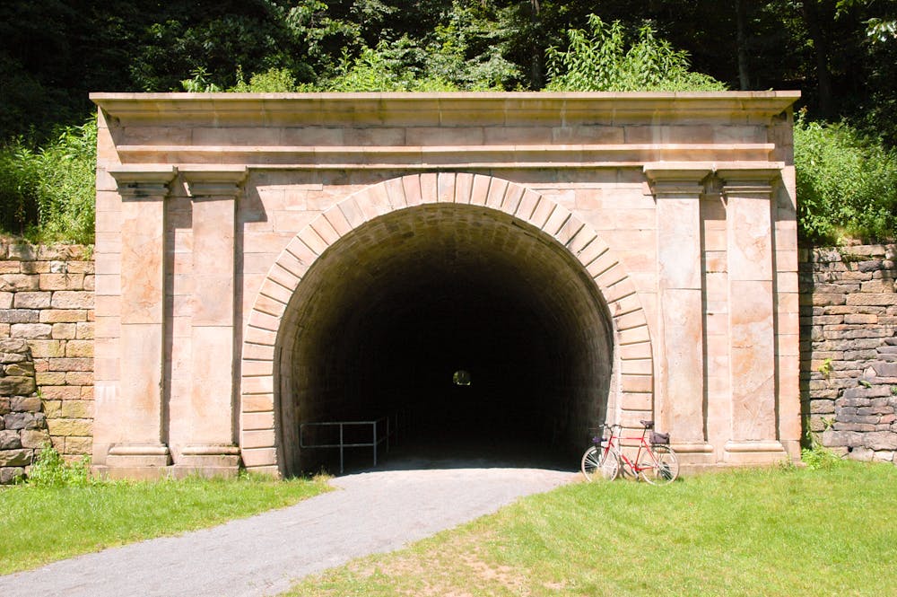
The trail starts from the Staple Bend Tunnel, which is believed to be America's oldest railroad tunnel and was used by the first locomotives in the 1830s. The tunnel is 900 feet long and has two stone arches at each end. After leaving the tunnel, you will follow a dirt road for about two miles until you reach a wooded hillside, where the trail becomes a ballast trail. Along the way, you will see several memorials and markers that tell the story of the flood and its victims. You will also encounter some interesting rock formations and wildlife. The trail offers views of an active rail line and a lush green valley.
The trail ends at the Franklin Ball Field in South Fork, where a replica of the South Fork Dam that failed and caused the flood is located.
Source: Path of the Flood Trail - PA.Gov. https://trails.dcnr.pa.gov/trails/trail/trailview?trailkey=159. Path of the Flood Trail, Carnegie, Pennsylvania - The Outbound. https://www.theoutbound.com/pennsylvania/hiking/path-of-the-flood-trail. Path of the Flood Trail - Cambria County Conservation & Recreation .... https://www.cambriaconservationrecreation.com/path-of-the-flood-trail/. Path of the Flood Trail/Staple Bend Tunnel Trail | Pennsylvania Trails .... https://www.traillink.com/trail/path-of-the-flood-trailstaple-bend-tunnel-trail/. Conversation with Bing Chat
Difficulty
Easy
Walking along a well-kept trail that’s mostly flat. No obstacles are present.
Low Exposure

The path is on completely flat land and potential injury is limited to falling over.
Remoteness
Close to help in case of emergency.
Best time to visit
Features
- Historical
- Water features
- Family friendly