Rhododendron Loop
Mellow loop through a stunning forest filled with rhododendron in Clear Creek State Park
Hiking Moderate
- Distance
- 7.6 km
- Ascent
- 235 m
- Descent
- 235 m
- Duration
- 1-2 hrs
- Low Point
- 365 m
- High Point
- 480 m
- Gradient
- 4˚
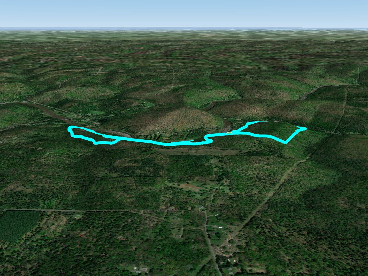
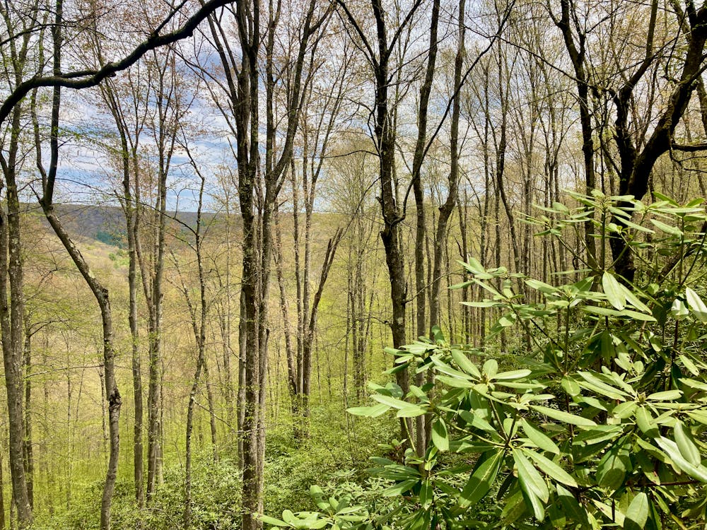
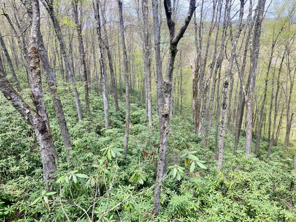
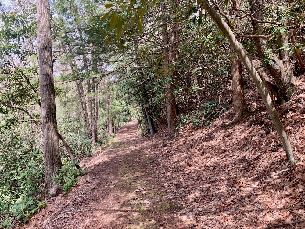
The so-called "Rhododendron Loop" in western Pennsylvania's Clear Creek State Park is so named because it's one of the best routes for experiencing the stunning beauty of the rhododendron forests hidden along the banks of the Clarion River. Throughout this entire hike, you'll be surrounded by rhododendron on all sides, with many sections of the trail running through deep, dark rhodo tunnels. From the top of the ridge, you'll enjoy expansive views of the rhododendron, with views stretching all the way down to the river below.
- •
- •
- •
Description
In the late spring/early summer, the rhododendron will blossom and be adorned by stunning purple flowers! By far the best time to hike this loop is during the bloom, which happens sometime in early June. Unfortunately, timing it perfectly can be tricky. If you do happen to hit this loop at the perfect time, prepare for a sensory overload of color spread all throughout the forest!
The hike begins by traversing along the river on the Tobecco Trail. Tobecco is mostly an old forest road that has narrowed down to doubletrack, but once you take the turn onto Tadler Run, the trail narrows to singletrack and gets even more picturesque.
The first stretch of Tadler Run requires the most climbing along this loop, although it's still a very reasonable stretch of ascending. Indeed, this entire 4.7-mile loop climbs just 771 vertical feet along its length (according to FATMAP), making it quite a mellow hike overall. The climb on Tadler Run parallels a stream, with the rushing of water providing a melodic backdrop to your panting breath.
Once on top of the ridge, the views begin to open up, and it's well-worth taking the mapped dog leg to a rocky outcrop. From the small cliffs you'll gain impressive views of the rhododendron forest! Through the trees, you can just make out the Clarion River below you. This lookout is by far the highlight of the loop.
The rest of the hike along the ridge continues to afford pretty views through the trees, and then you'll simply drop back down a slow, mellow descent to return to the river bottom. Connect the loop with a short stretch of road walking, and you're back to your car.
Difficulty
Moderate
Hiking along trails with some uneven terrain and small hills. Small rocks and roots may be present.
Low Exposure

The path is on completely flat land and potential injury is limited to falling over.
Remoteness

Away from help but easily accessed.
Best time to visit
Features
- Picturesque
- Dog friendly
- Wild flowers
- Forestry or heavy vegetation