
8 routes · Hiking
A family-friendly hike circling the Outer Loop to the main Lookout Tower in Arbor Hills.
Hiking Moderate

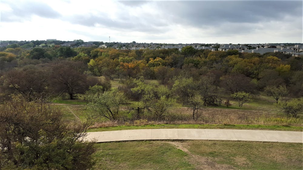
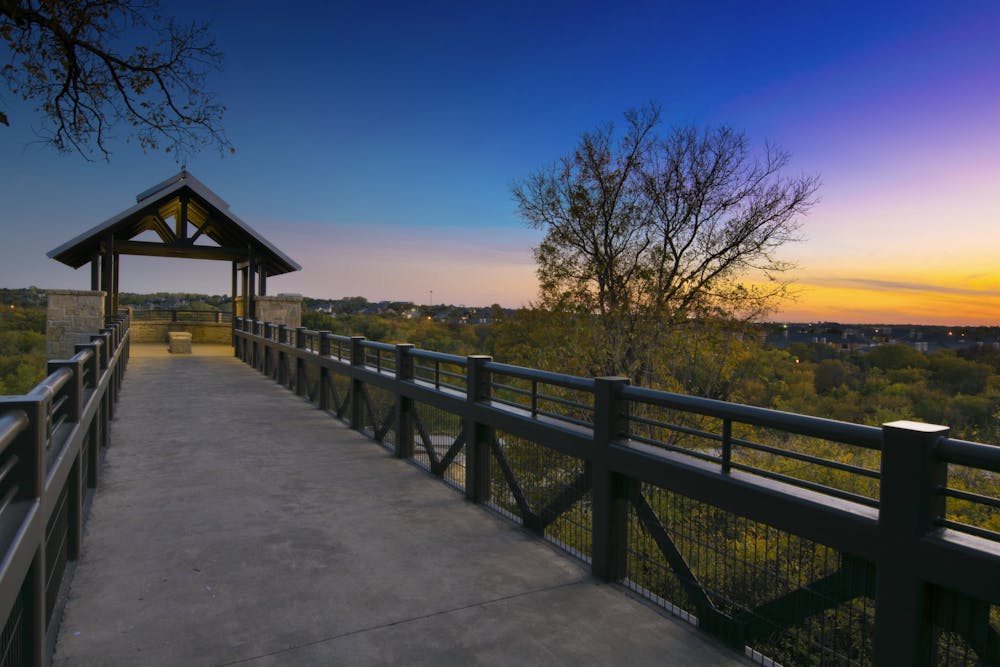
Arbor Hills is arguably the most popular area to go for a hike, run, or mountain bike ride in the northern suburbs of Dallas. With a dedicated mountain biking trail, paved pathways, hiking-only trails, and an observation tower, it's not hard to see why it's a staple amongst locals. This hike explores the more remote outer loop, then circles back to the observation tower with views overlooking most of west Plano. It's a great place to see the sunrise or sunset and a diverse park with picnic pavilions, restrooms, running water, and other family-friendly amenities.
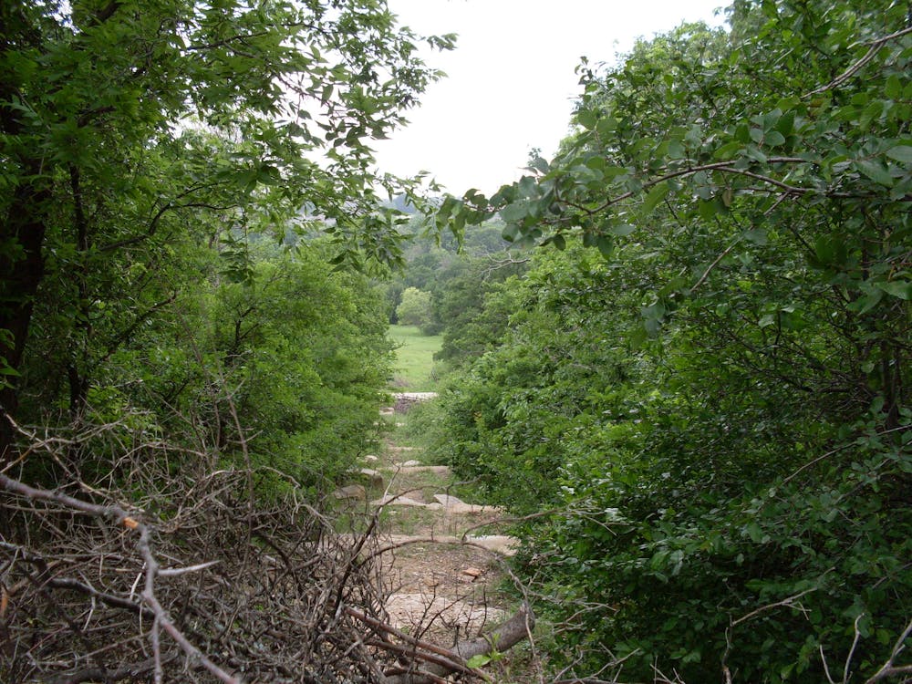
This hike begins at the main trailhead, then follows the paved pathway away from the DORBA Bike Trails, bound for the Outer Loop. Lesser trafficked than any other trail in the park, you'll wander in and out of woodlands and meadows before reaching the park's western boundary along a train track. The wildflowers can be stunning depending on the time of year, though the steady climb ahead may prove difficult to newer hikers.
Topping out this hike, the Tower Trail offers spectacular view of the area, and doubles as a great sunrise or sunset spot. With even more trails in the northeast corner of the park, it's easy to extend your hike, though this route follows a paved trail back to where you began. With so many trails packed into such a small green space, it's easy to come back time after time and enjoy a new hike each visit. Even better, you're rarely more than a mile from the trailhead, making it easy to sneak out for a quick hike or walk no matter what you're into.
Arbor Hills is located on West Parker Road just west of the Dallas North Tollway. Highway 121 to the north also offers easy access for those who live in northern suburbs, especially Lewisville and The Colony. Just be mindful that most of the surrounding highways are toll roads. Restrooms, drinking water, picnic areas, and a large parking area are available at the trailhead, but plan to get an earlier start on the weekends since the park can get quite busy. For information on the park's hours, visit the City of Plano's website, here.
Moderate
Hiking along trails with some uneven terrain and small hills. Small rocks and roots may be present.

The trail contains some obstacles such as outcroppings and rock which could cause injury.
Away from help but easily accessed.
8 routes · Hiking