1 m away
Seminole Canyon State Park Loop
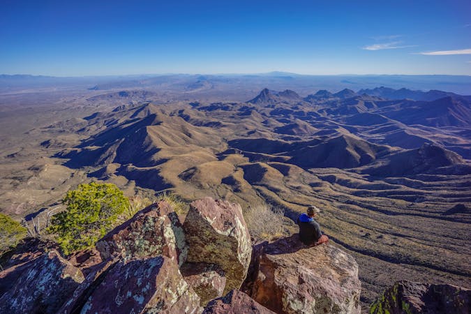
Hike along a scenic rock rim and then reach the US/Mexico border!
Difficult Hiking
- Distance
- 12 km
- Ascent
- 121 m
- Descent
- 121 m
A rewarding out-and-back hike to an overlook of a canyon confluence.
Hiking Moderate

Seminole Canyon State Park is a hidden gem in the massive Texas State Parks system. Seminole Canyon is situated directly on the banks Rio Grande, which forms the US/Mexico border. While this isolated park might be small, it boasts incredible beauty and history.
Seminole Canyon was primarily designated as a state park to protect pictographs left by early canyon dwellers. There are over 200 different pictograph sites in the park! While you can only hike down into the canyon and see the pictographs up close if you sign up for one of the guided tours, several trails along the top of the canyon provide access to the park's natural beauty and long-range views of pictographs on the far canyon walls.
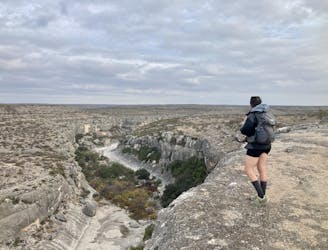
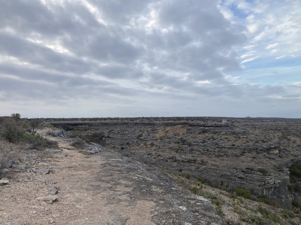
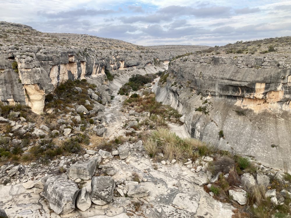
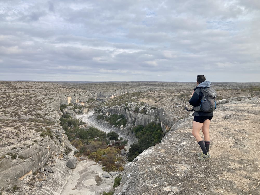
The hike mapped here is a mellow out-and-back hike to the Presa Overlook. This overlook is located at the confluence of two smaller canyons that then form the main Seminole Canyon, which in just a couple of miles connects to the Rio Grande itself. This viewpoint is impressive. Take the time to absorb the immensity of the landscape and the erosive forces that created these stunningly-beautiful canyons.
The hike itself begins on smooth, sandy singletrack, which soon reaches the rougher, exposed slabs of rock that form the canyon rim. While hiking along the rim, the views slowly unfurl as you approach the Presa Overlook, culminating in this incredible scenic view.
Even along the rock rim, the hiking is quite easy, and even though the rim is impressive, the rock slab is wide enough that falling off is unlikely. Still, be sure to exercise caution if you approach the rim.
Moderate
Hiking along trails with some uneven terrain and small hills. Small rocks and roots may be present.

Some trail sections have exposed ledges or steep ascents/descents where falling could cause serious injury.

Away from help but easily accessed.
1 m away
Hike along a scenic rock rim and then reach the US/Mexico border!
Difficult Hiking
14 routes · Hiking