6.5 km away
Paradise Rim
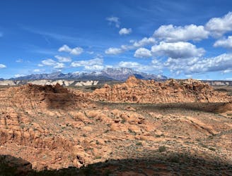
A high-value hike with a stunning overlook above St. George.
Difficult Hiking
- Distance
- 6.6 km
- Ascent
- 149 m
- Descent
- 149 m
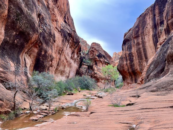
Enjoy a bike-free hike in the Santa Clara Preserve.
Hiking Moderate

The Santa Clara Preserve is home to several scenic singletrack trails located on a ridge above the town of Santa Clara. Most of the trails here are multi-use and are open to both hikers and mountain bikers, but the Black Brush Trail, mapped here, is only open to hikers and horseback riders.
Black Brush forms a 4.3-mile lollipop hike with about 530 feet of elevation gain and loss along the way. Along the entire hike, you'll enjoy beautiful views from the elevated ridgeline.
"Near the center of the loop are signs indicating unique rock formation and even some rock art," writes HikeStGeorge.com. "The rock art is not too clear, but a few petroglyphs can be seen on the cliffside across the gulch," they continue.
If you finish this trail but still haven't had enough hiking yet, try out the Cove Wash Trail, which begins from the same trailhead.
Sources: https://hikestgeorge.com/hiking-trails/black-brush-santa-clara-river-reserve/
Moderate
Hiking along trails with some uneven terrain and small hills. Small rocks and roots may be present.

The trail contains some obstacles such as outcroppings and rock which could cause injury.
Away from help but easily accessed.
6.5 km away
A high-value hike with a stunning overlook above St. George.
Difficult Hiking
7.9 km away
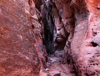
An easy-to-reach slot canyon.
Easy Hiking
9 routes · Hiking