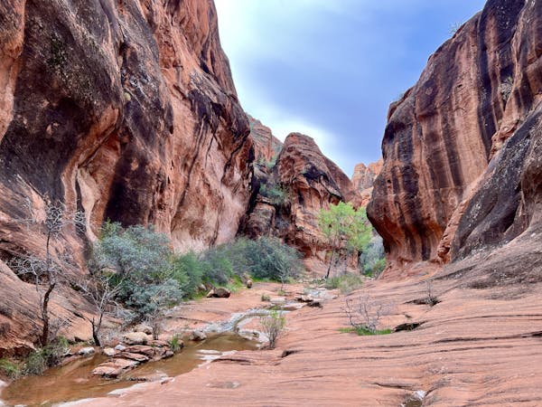
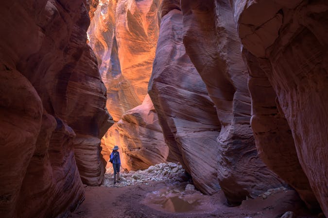
6.3 km away
Red Reef Canyon
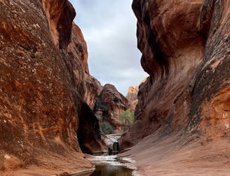
An absolutely stunning slot canyon hike!
Moderate Hiking
- Distance
- 1.9 km
- Ascent
- 44 m
- Descent
- 44 m
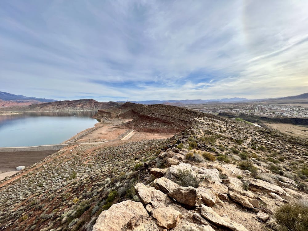
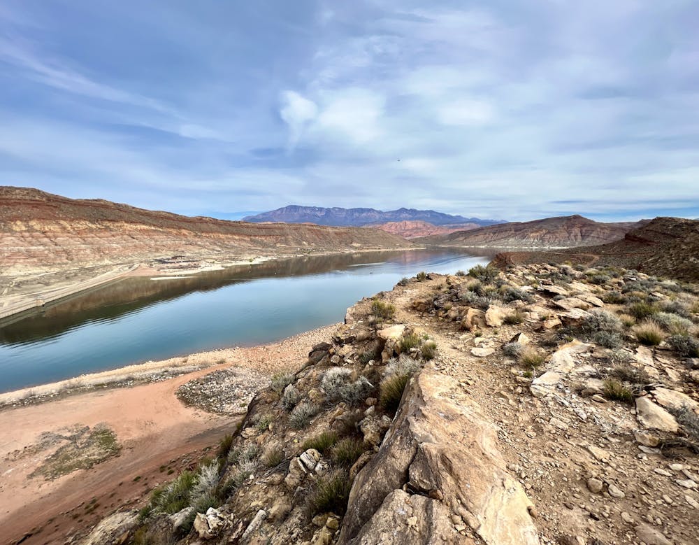
Hike along two scenic mesas to an overlook of Quail Creek Reservoir.
Hiking Difficult

While Hurricane is located in a desert environment, at 3,250 feet above sea level, it does still sometimes receive snow during the winter... albeit infrequently. When it does snow in Hurricane, the first trails to dry out are the rocky, rugged Boy Scout trails just down the road.
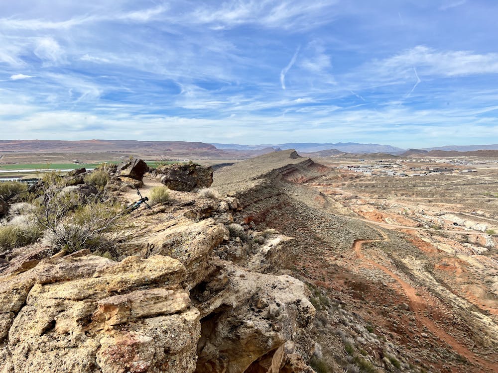
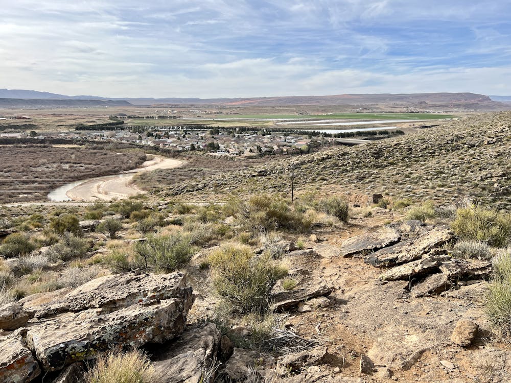
On a small upthrust mesa above the local Boy Scout camp, you'll find a tightly-wound trail system of short interconnecting trail segments. Around the base of mesa wind a few easier trails, but the top of the mesa? The top of the mesa is all rock!
The route mapped here is a ridge top loop covering all of the upper trails in the network. These rocky, rugged trails demand focus as you hike. You'll need to practice careful foot placement in the shifting rocks and take care as you hike along the highly exposed rim.
However, when you can lift your eyes from your feet, you'll enjoy expansive views of the Quail Creek Reservoir below you, flanked by red rock cliffs in the foreground and the Pine Mountains in the distance. Getting to hike rocky desert trails with such a pristine background formed by a body of water is a surreal experience!
Your eventual destination is a viewpoint on the far end of the second mesa, which provides the most excellent views of the reservoir and the verdant Hurricane valley. The end of the second mesa is the perfect spot to enjoy a lunch and spend some time soaking in the incredible views—you've earned it!
Once done with your lunch, you'll continue looping around and back down the two mesas. This rewarding loop route only doubles back on one small portion of singletrack. Otherwise, the trail is unique in both directions—a relative rarity on such hikes.
Difficult
Hiking trails where obstacles such as rocks or roots are prevalent. Some obstacles can require care to step over or around. At times, the trail can be worn and eroded. The grade of the trail is generally quite steep, and can often lead to strenuous hiking.

The trail contains some obstacles such as outcroppings and rock which could cause injury.

Close to help in case of emergency.
6.3 km away
An absolutely stunning slot canyon hike!
Moderate Hiking
9 routes · Hiking
9 routes · Hiking