
14 routes · Hiking
Cross the range land of the Arizona Strip to return to canyon country in Zion National Park, and the western terminus of the Hayduke Trail.
Also in Arizona, United States of America
Hiking Severe

The Arizona Strip is the wide-open, mostly flat high desert between the Grand Canyon and the Vermillion Cliffs, south of Zion. After living in the depths of the canyon, re-emerging to big skies, dirt roads, and cattle country may be an unwelcome shock. The mundane crossing is relatively brief, however, and more canyons await on the other side.
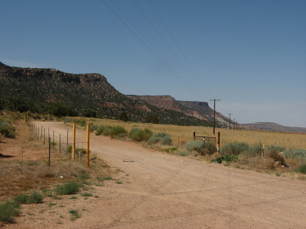
The Strip has one notable challenge, however, and that’s finding clean water. Stock tanks are common, but most are very uninviting. Your best bet is a pumped well in the hillside near the location of Yellowstone Spring. After many miles walking dusty two-tracks, you’ll follow roads through the tiny farming community of Cane Beds. Limited provisions are available there, but for a proper resupply you’ll need to take an alternate route through Colorado City and Short Creek Canyon.
If you stick with Cane Beds, you’ll enter the backdrop of red cliffs via a dirt road through Rosy Canyon, which climbs steadily onto a pinyon and juniper-forested plateau crowned by the yellow sandstone wall of Elephant Butte. An unimproved dirt road continues all the way to the rim of the East Fork Virgin River Canyon, and a switchbacking footpath drops down from there.
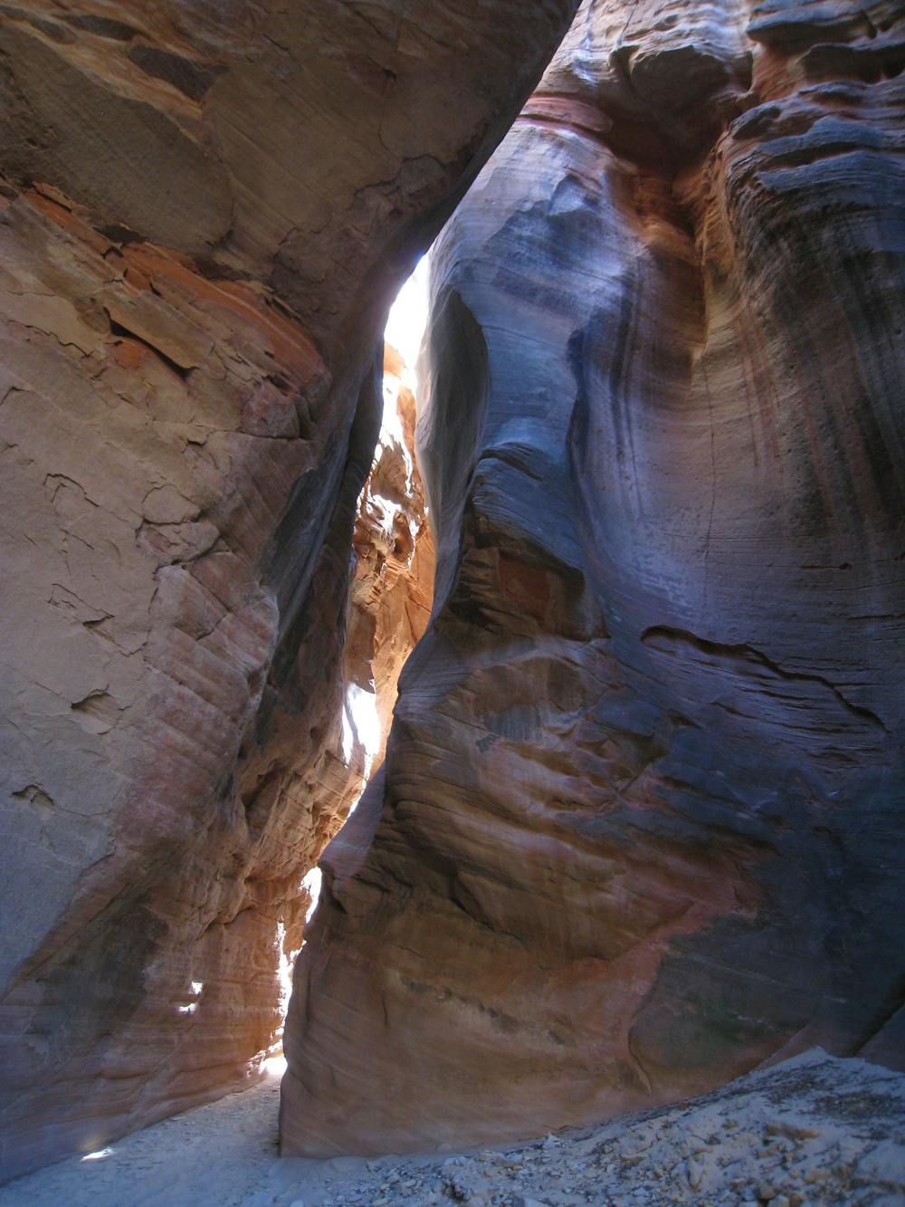
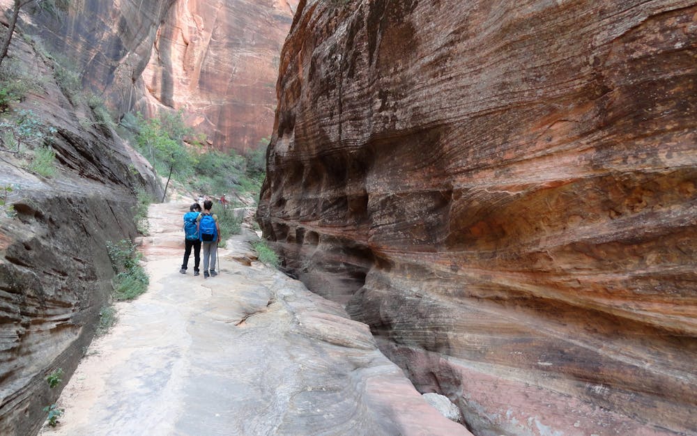
In the bottom, you will once again meet flowing water enclosed between red walls. This is the last substantial section of slot canyon on the Hayduke, so it’s worth taking your time among the pleasant shade and plentiful water. Enjoy the twists and turns of the narrowing corridor as you venture downstream. Several serene side canyons make worthwhile detours. One obstacle is a log and boulder jam that requires some downclimbing and wading through a pool. The only other challenge is the steep scramble to exit this canyon: up a gully and slickrock slope that leads to a trail above.
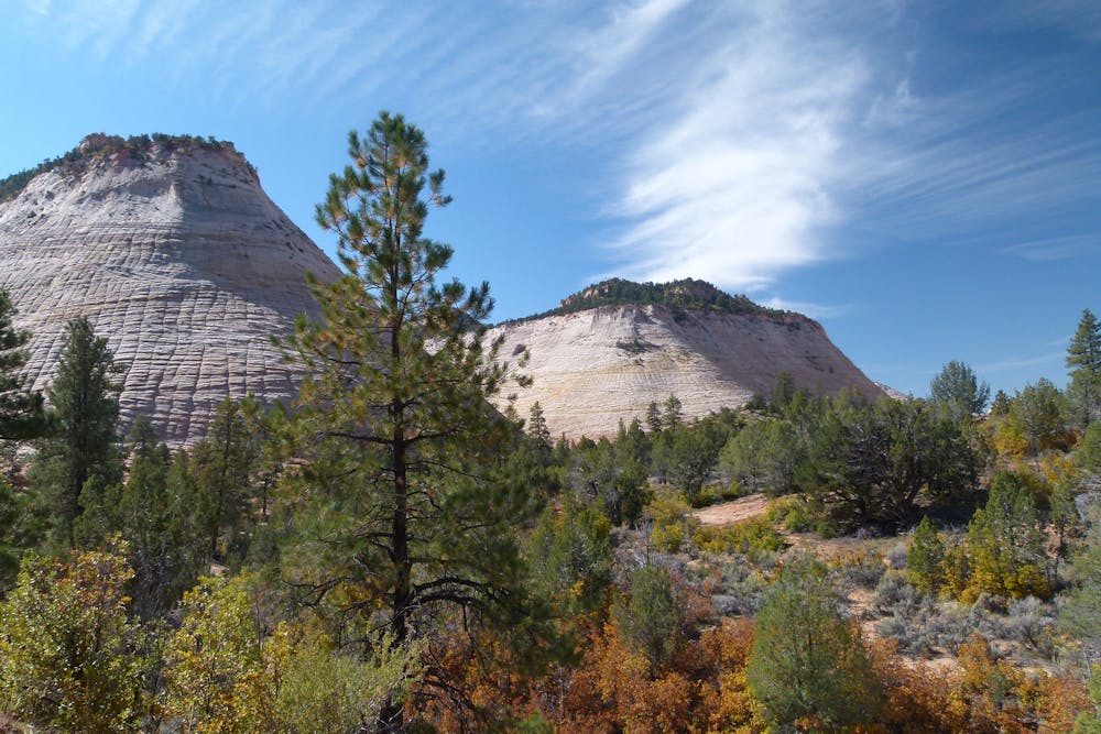
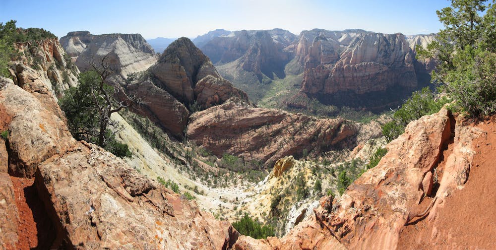
This trail enters Zion National Park, passing beneath soaring white walls in a canyon below Checkerboard Mesa. After emerging at the busy park road, cross it and enter a wash that barely dips below the traffic noise. This leads to the park’s east entrance and the start of the East Rim Trail. This somewhat popular park trail winds its way among more white cliffs, reaching the pine-forested uplands above Zion Canyon’s rim. Find water at Stave Spring just before hitting the rim and beginning the descent. The final steps of the westbound Hayduke are through the narrows of Echo Canyon, then down sweeping switchbacks into the main canyon, joining the crowds at the Weeping Rock shuttle stop.
Sources: http://www.hayduketrail.org/TheRoute.html http://www.hayduketrail.org/Updates.html https://www.little-package.com/blog/2017/11/hayduke-trail-tips https://marmotsadventures.com/2017/05/23/kale-and-kombucha-in-colorado-city/ http://www.acrossutah.com/wordpress/hike-guide-the-barracks/ https://caltopo.com/m/5J0S https://caltopo.com/m/HVQD
Severe
Hiking challenging trails where simple scrambling, with the occasional use of the hands, is a distinct possibility. The trails are often filled with all manner of obstacles both small and large, and the hills are very steep. Obstacles and challenges are often unexpected and can be unpredictable.

Some trail sections have exposed ledges or steep ascents/descents where falling could cause serious injury.
Little chance of being seen or helped in case of an accident.
14 routes · Hiking